Good Saturday, everyone. A few showers and storms are rolling across the state today, signifying a change in the pattern. It’s a pattern that will find rounds of storms rolling in from the north and northwest over the next several days.
Temps out there today range from the upper 70s to middle 80s as humidity levels start to increase. A few showers and storms will be with us, but this isn’t very widespread and many areas won’t see much rain, if any.
Heat is building to our west and makes a run toward Western Kentucky Sunday and Monday. Some big time clusters of storms will be developing on the eastern edge of this and that’s where we are. The future radar through Monday night shows this well…
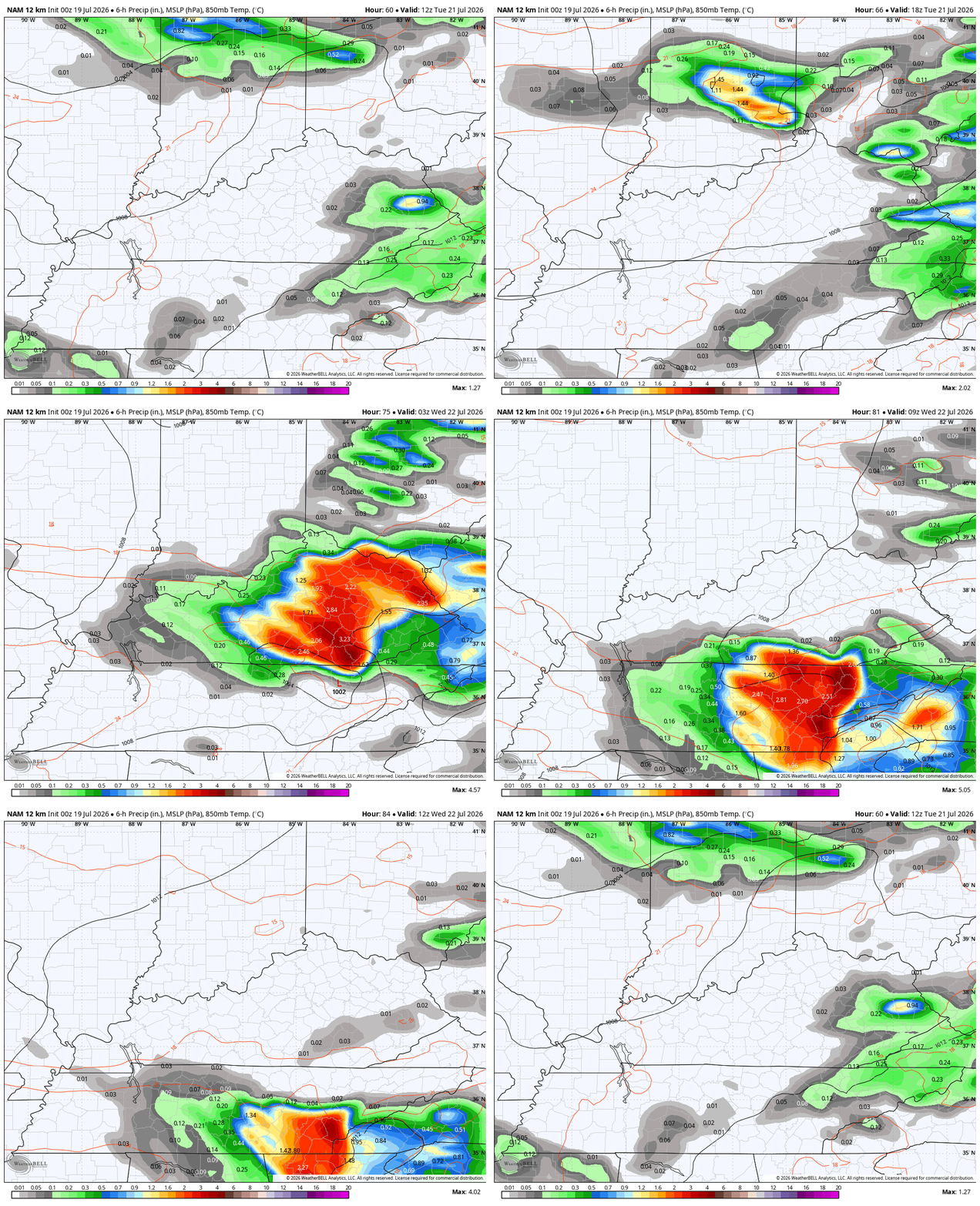
These storms may pack damaging winds, a ton of lightning and torrential rains.
The Storm Prediction Center has been playing catch up with this potential across the Ohio Valley. Here’s a look at what they’re expecting with the Sunday Severe Weather Outlook…
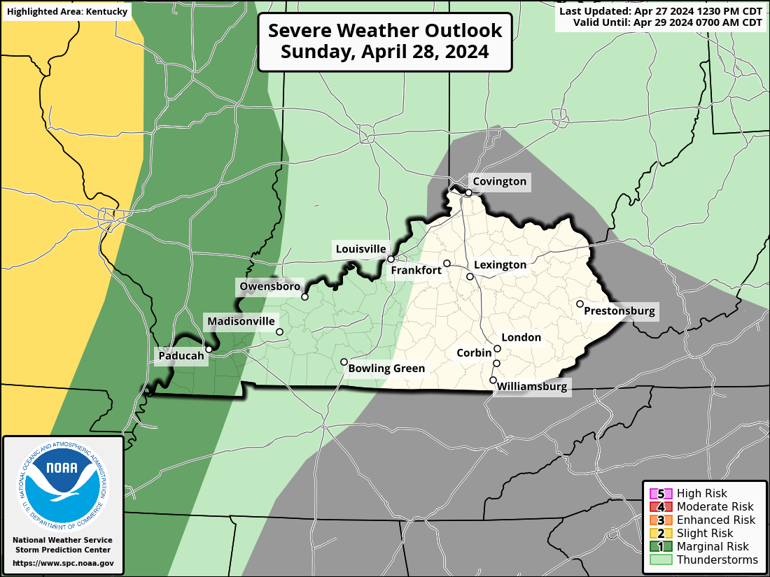
And the outlook for Monday looks like this…

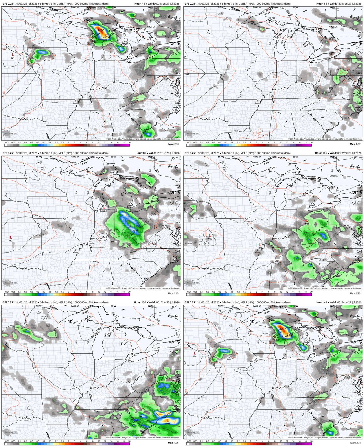
Additional rounds of showers and storms then really rumble through Tuesday and Wednesday as another strong cold front drops in from the northwest. This animation from the GFS starts Sunday evening and runs through Thursday morning…
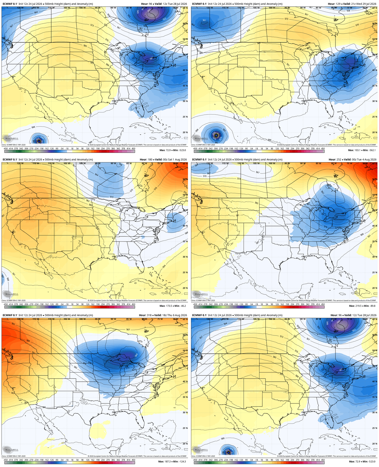
This is part of a setup featuring deep troughs diving into the eastern half of the country into the first week of August…
As always, I leave you with your daily storm tracking toys…




Current watches

Possible Watch Areas

Make it a sensational Saturday and take care.

Bring on the upper 90s
Bring on the troughs.
Nope. Wait until winter.