Good Sunday to one and all. We are watching a setup that can throw a few booming thunderstorm complexes into the region over the next few days. That action gets started later tonight with a better shot on Monday and Tuesday. Some of the storms may be strong or severe.
I’m also diving into a little bit of winter talk for you guys.
Let’s start with the current pattern as things are a wee bit stormy as we get set to close out July.
A heat ridge is dominating areas west of the Mississippi River, meaning we are on the outside looking in from the east. This is the area primed for these big complexes of strong to severe storms that drop in from the north and northwest…
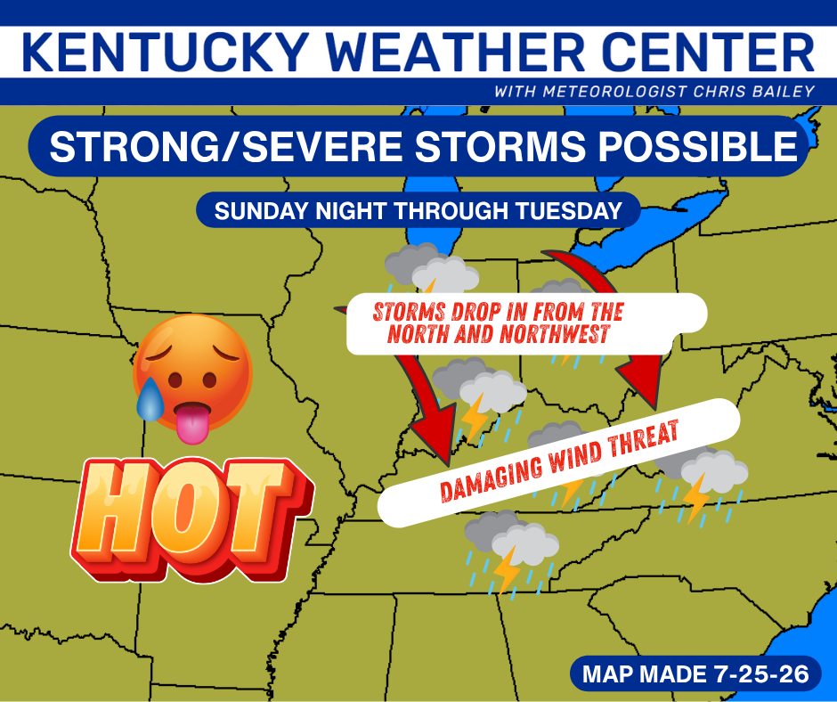
Damaging wind is the primary player with any storm cluster that moves through.
Today’s best chance is to our north and northwest and this is where the Storm Prediction Center has outlined in the Today’s Severe Weather Outlook…

The threat will really expand late tonight into Monday and includes the entire region. Here’s Monday’s Severe Weather Outlook from the Storm Prediction Center…
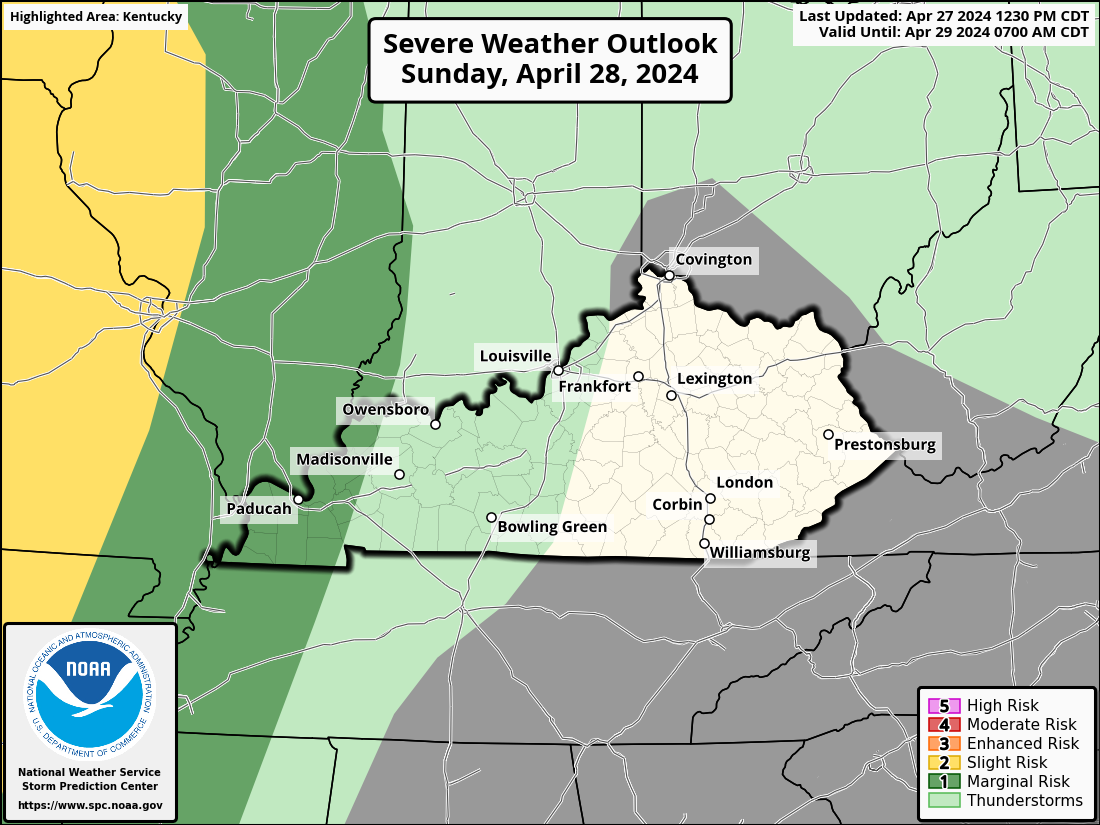
The tornado risk from these storms is on the low end…

The potential for damaging wind is, without question, the greatest threat for our part of the world…

The large hail threat is fairly low…

The potential for a few strong to severe storms will be with us again on Tuesday, especially in the east. Here’s the Tuesday Severe Weather Outlook from the SPC…

Temps come way down behind all this for the second half of the week with another cold front arriving as we begin August.
As you know by now, we have a developing Super El Nino out in the Pacific Ocean. The well above normal ocean waters near the Equator are very evident…
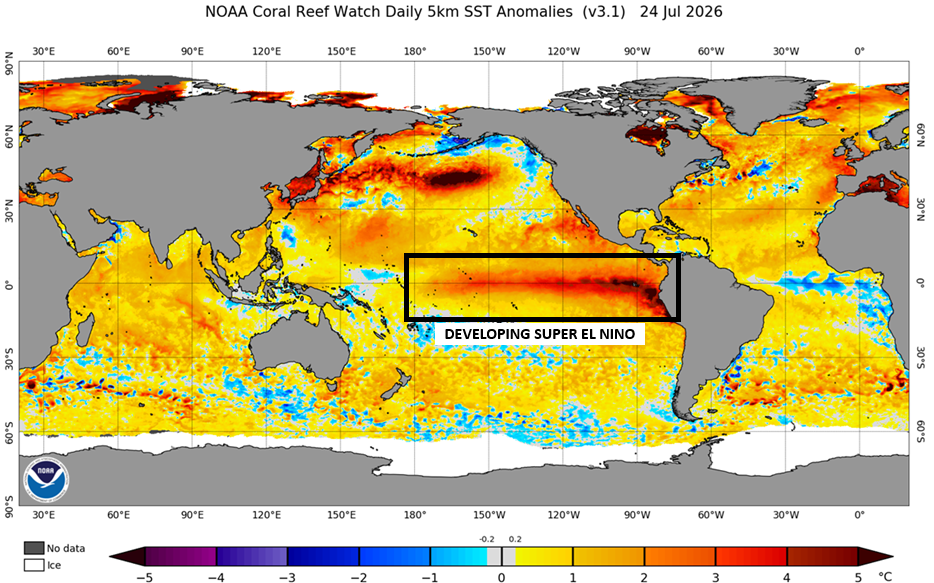
This is may very well become the strongest El Nino on record before all is said and done. That’s just one of the wild cards with this particular event. If it goes above and beyond the previous supers, how does that correspond to the actual weather pattern across the globe?
For me, the bigger wild card for this Super is the base state of the world’s oceans being much warmer than during any previous Super. I have little doubt this has to be factored in, but we really have very little idea as to what extent or what the end result will be on the apparent weather across the Northern Hemisphere, let alone here in the USA.
This developing Super is already behaving differently than the last 3 super El Ninos. Take a look at the temp anomalies so far this month…
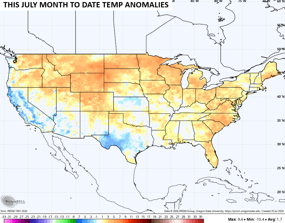
The prior 3 Supers occurred in 2015, 1997 and 1982 and all had similar looks to one another through this same time in July. Notice how all 3 had much cooler than normal July’s for much of the country…
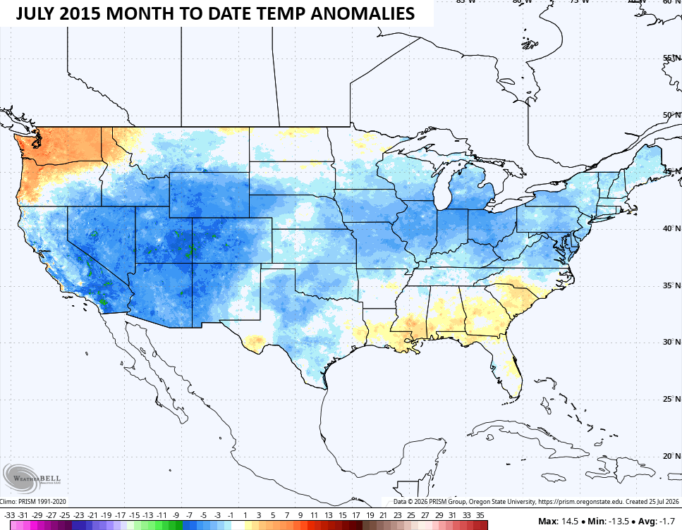
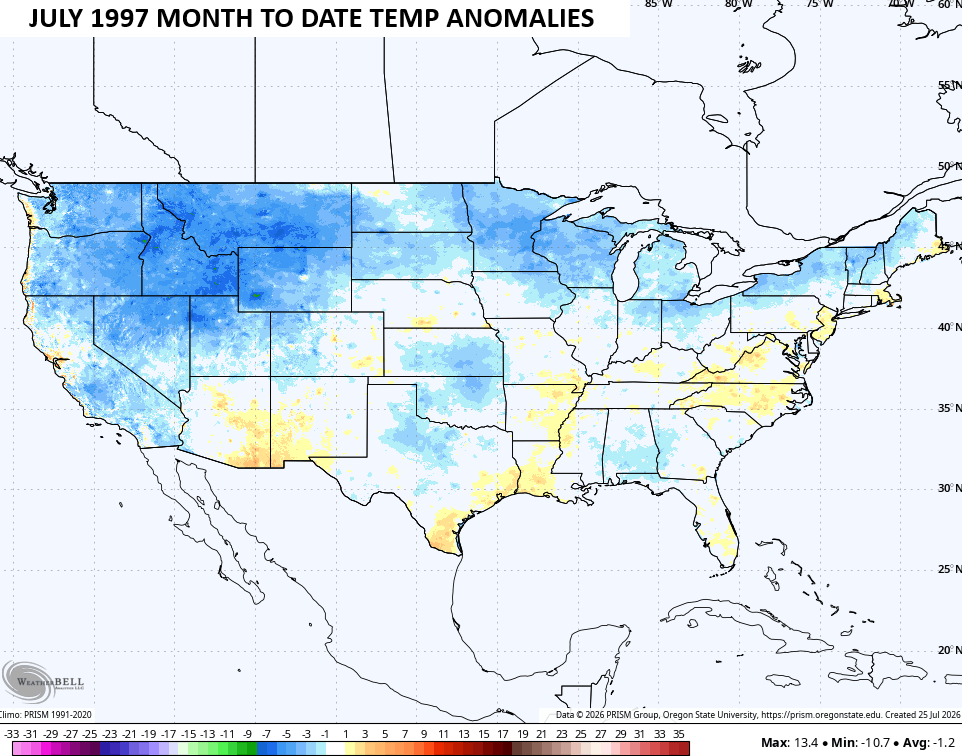
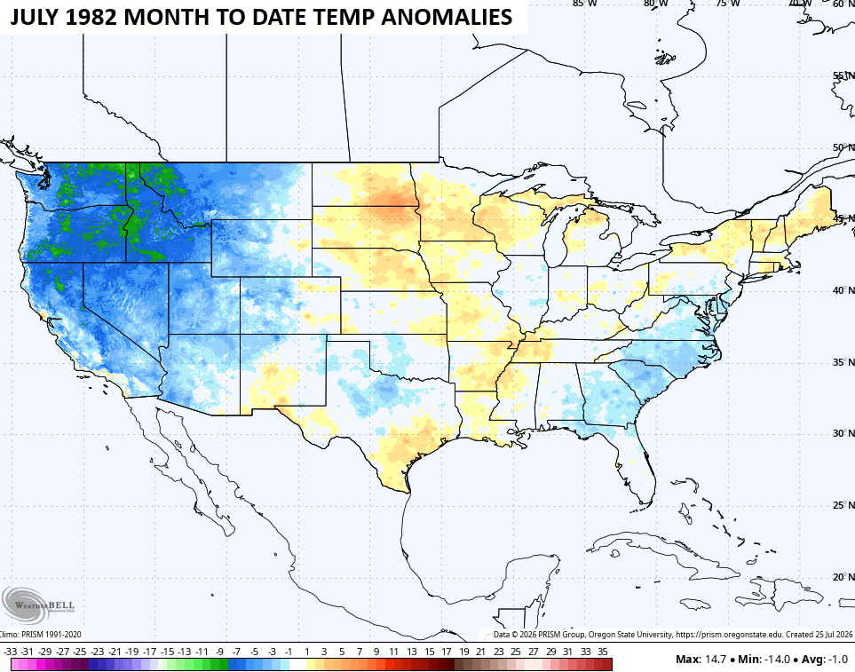
As you can see, the weather this July doesn’t really match up with what we should be getting in a developing Super. If this trend should continue throughout the rest of summer and into fall, it would most certainly have implications with the upcomiung winter.
Here’s a look at what the average temp anomalies look like from the winters of 2015/16, 1997/98 and 1982/83…
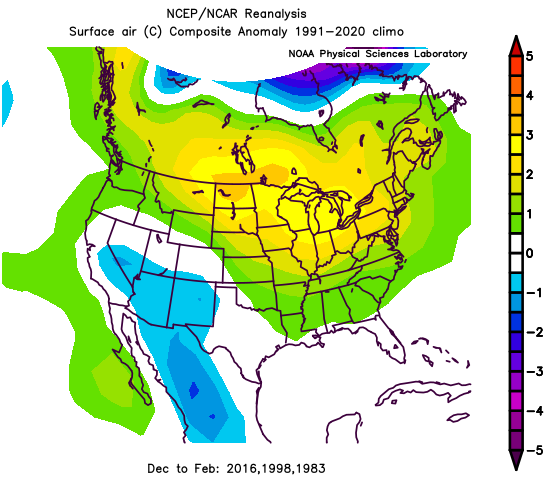
You can clearly see how those were blowtorch winters for much of the country, especially in December of each year. All 3 did give us a big winter storm later in winter, but that was about it for snowfall.
If we look ahead with the latest seasonal models, we find them all in agreement that this winter would deviate from the other supers. Here’s the latest CFS temp anomaly forecast for December through February…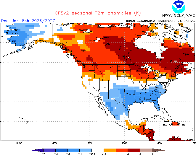
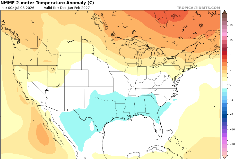
The same time period from the NMME looks similar…
As does the latest EURO Seasonal…
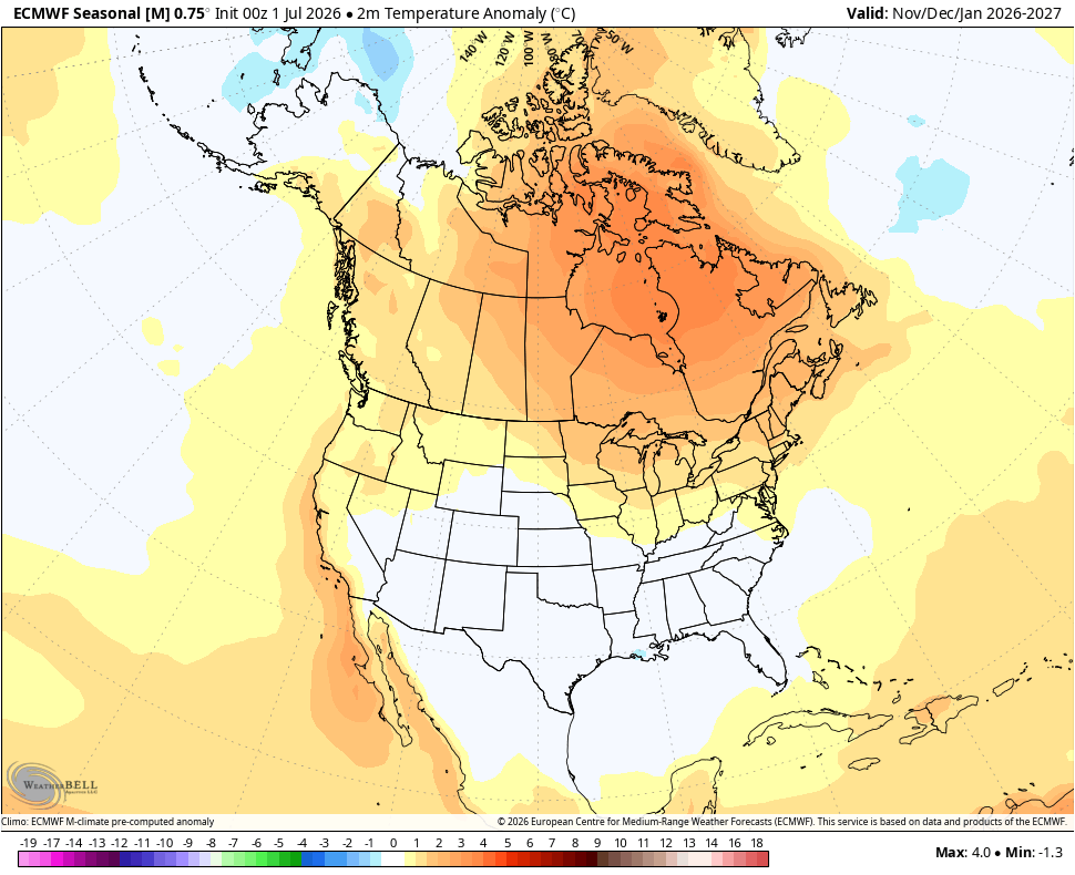
Those 3 all push the warmest air farther north into Canada when compared to the average of the past 3 Supers with below normal temps underneath across the country.
The latest CanSips has an overall colder look for much of the country…
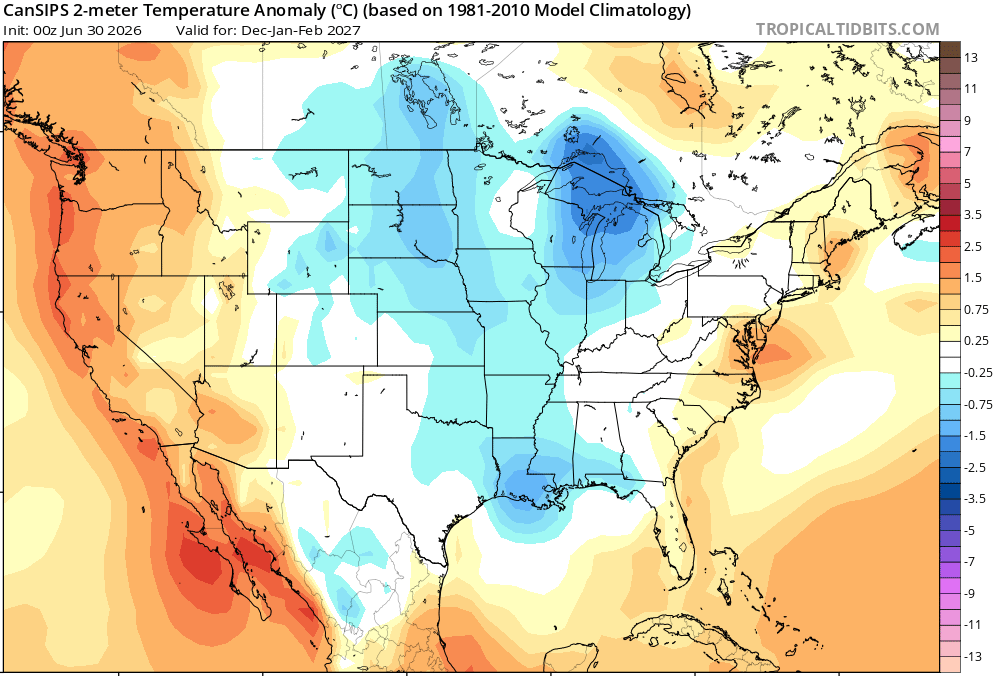
None of this is to endorse any of the above seasonal models, because they should all be taken with a grain of salt from this time period. That doesn’t mean we can’t find some use out of them, though.
The bottom line is that this developing Super El Nino is not delivering the typical response across the United States and the seasonal models are continuing that trend into the upcoming winter. I have no idea if either of those will continue, but the current base state of the planet is not the same as any of the prior Super El Nino’s and that result of that may already be showing up.
As always, I leave you with your daily storm tracking toys…




Current watches

Possible Watch Areas

Make it a great Sunday and take care.

Wrote a long paragraph… It didn’t go through. Not bothering again.
Mark, I don’t Know why that happen. On this blog if you have one word like P*A*S*S, It will not accept the post. Try again.
I hear you Mark, I can’t begin to figure how many posts simply didn’t go through, despite the fact that other comments on that blog used even more words than mine. I know that the problem is blog’s anti-spam application Akismet is to blame, possibly if it sees a word or two which, when taken out of context, matches up with a word in its database. I’ve even seen had a comment rejected, and then accepted if I change a punctuation.
All I know is that it would be very helpful if that application could tell the “offender” what they did to incurr Akismet’s wrath!
I’m sure not going to trust the computer models from this far out about what the coming winter is going to be like. Really, it’s anyone’s guess.
Leaving today for a six-day vacation to Las Vegas, where the temperature is predicted to be 111 degrees today and tomorrow. Definitely looking forward to lots of time swimming at the hotel wave pool 🙂
Viva Las Vegas! Enjoy your trip Mike.
Thanks Chris. Could turn out to be a very interesting Fall and Winter.
I hope it’s all a blowtorch.
I hope it’s our normal mild Winter, with maybe a couple of Snowy weeks.
If I’m correct the 1976 super El Nino holds the record as the strongest, if this upcoming one is slated to break that record.you better get your long johns out the winters were very brutal afterwards in 1977,78 and 79. But who knows what mother nature has up to its sleeve
That’s for sure. That up in Indiana the Winter 1976 -77 was a nurseryman’s worse nightmare. Temperatures down to -15 to -20 below, with record Snowfall. The kind of Snow that drifted.