Good Tuesday, everybody. Strong to severe storms rumbled across Kentucky last night and we have a few more to go through out there today. This is ahead of a cold front, bringing a much better brand of air, albeit smoky, into the region for the next few days.
Winds gusting to better than 60mph showed up with the thunderstorm complexes impacting central Kentucky Monday evening. That produced wind damage and power outages.
The chance for a few more strong to severe storms is with us through the first half of today across parts of central and eastern Kentucky. The greatest threat for severe weather today is across the east and southeast. This is the area being highlighted by the Storm Prediction Center…

A cold front moves in from northwest to southeast today, bringing much better air behind it for the next few days.
Skies will look a little smoky and hazy with highs in the upper 70s and low 80s Wednesday and Thursday with a little warmer air in the west.
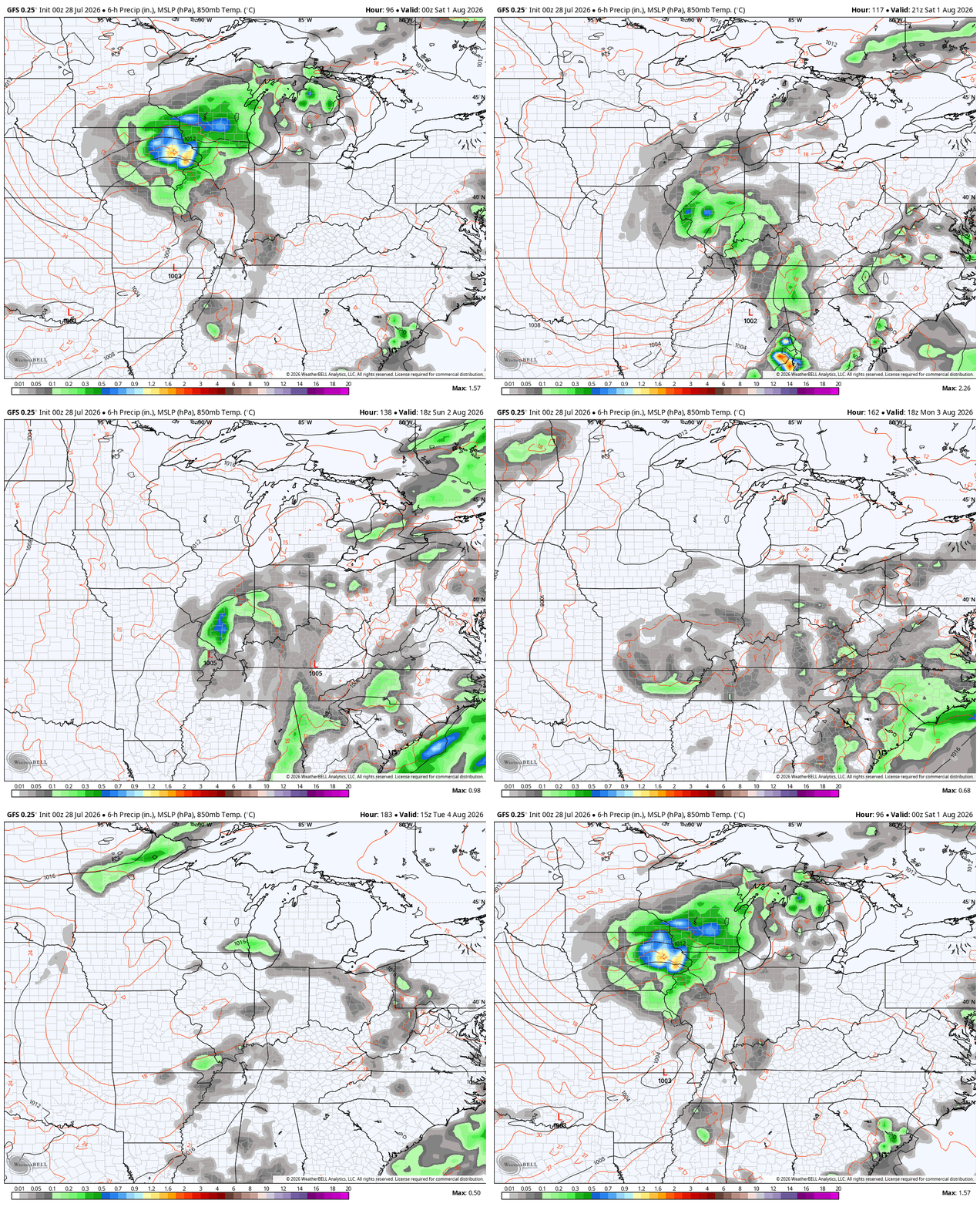
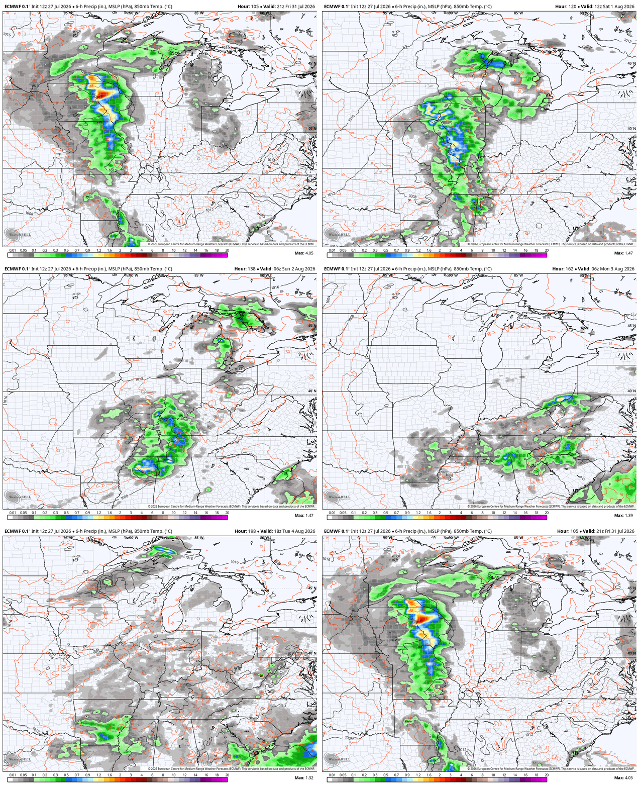
The next system moves in here later Friday into the weekend as a slow-moving upper-level system moves across the region to start the month of August…
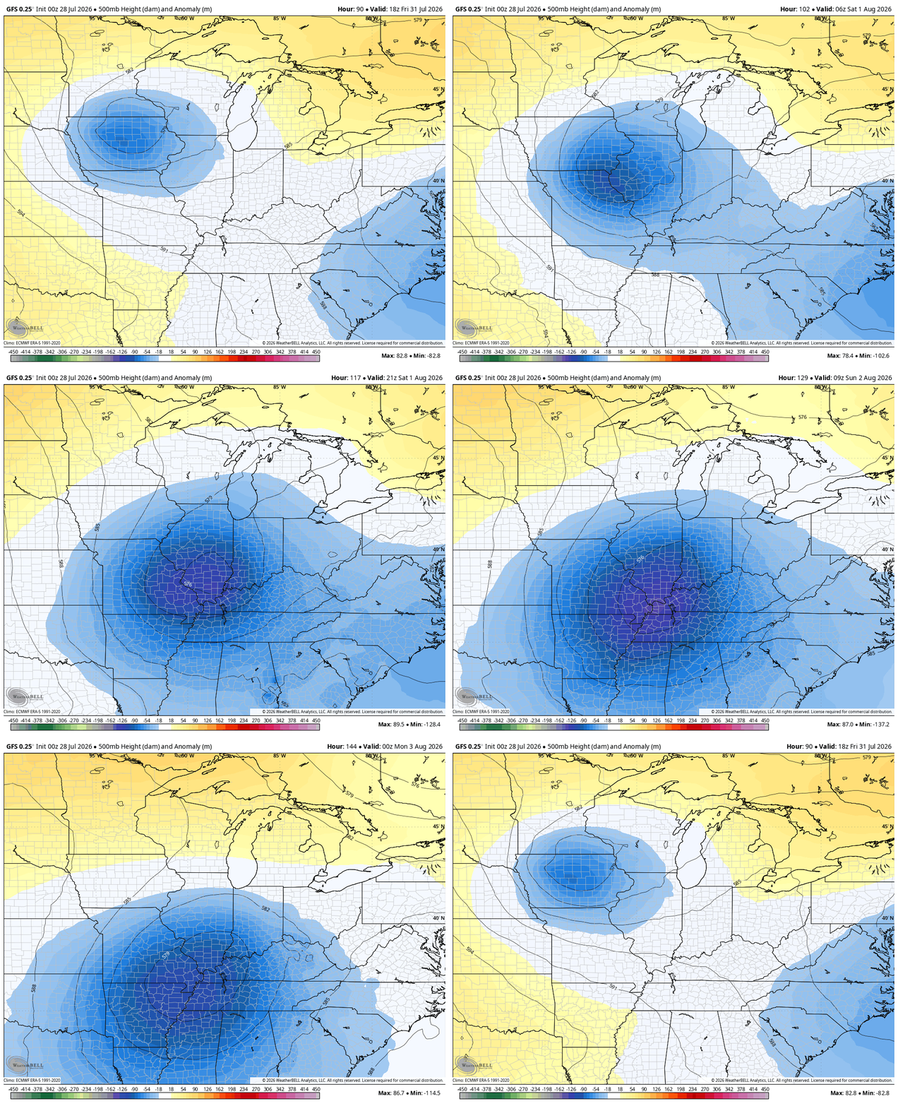
Spiraling bands of showers and storms look likely into early next week…
GFS
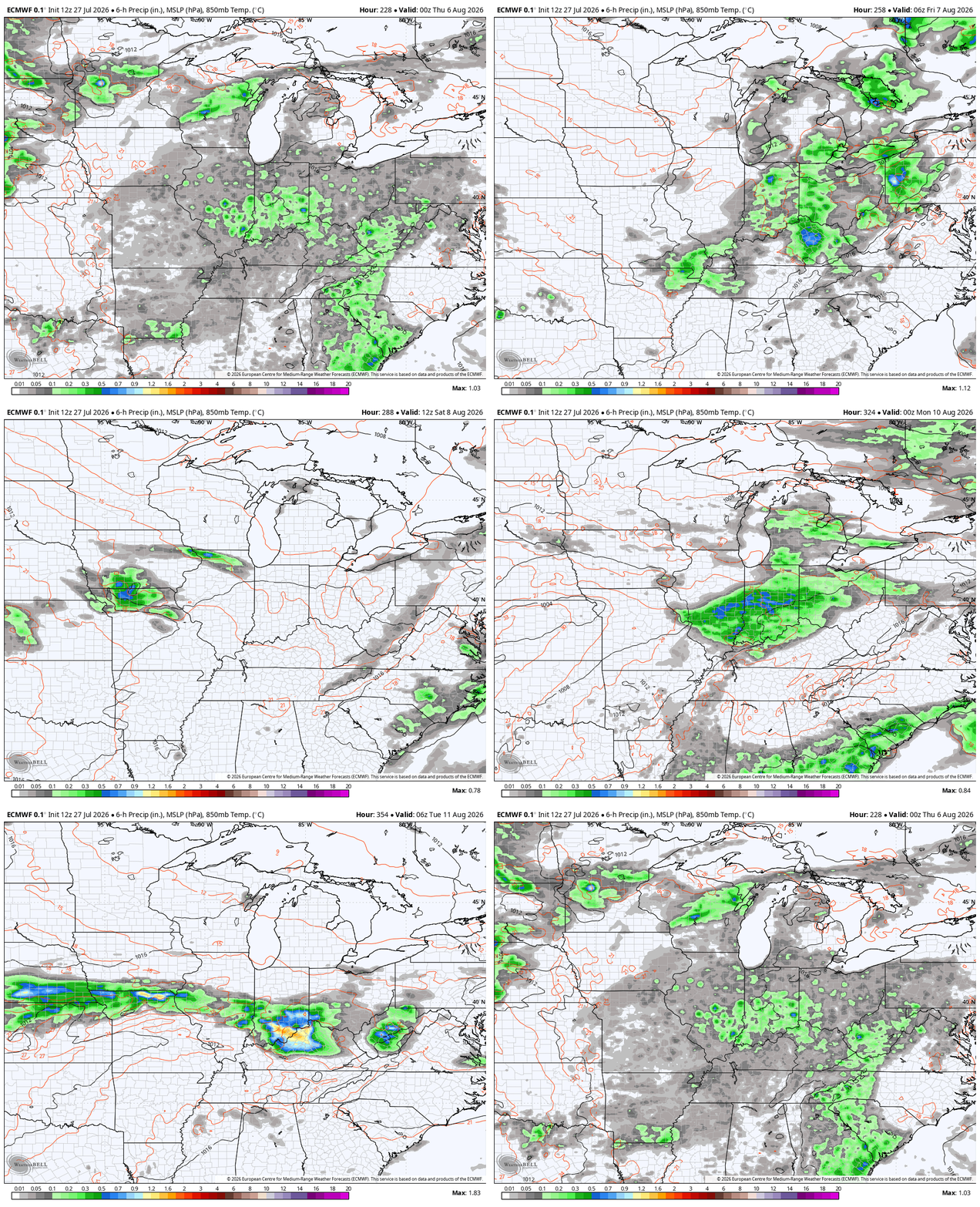
EURO
Temps under that will be held way down and may not get out of the low and mid 70s for any day that’s overcast and rainy.
As that system departs, the pattern looks busy with several cold fronts dropping in from the northwest later next week into the following week. Each system will bring the potential for showers and storms…
As always, I leave you with your daily storm tracking toys…




Current watches

Possible Watch Areas

Make it a terrific Tuesday and take care.

Doesn’t look like were going have a tap shut off this summer. We had it back in the spring.
I think we will.
I would be glad if the timely rains continue, but we will need a drying period later in the Summer for the crops. This sure has not been our usual Summer weather temperature wise.
Bring on the incoming heat dome. You know it’s coming.
Jeff, If the huge high pressure in the Western Plains merges with the Bermuda high to the east, then you will have your HEATWAVE big time, and there is still plenty of Summer left for that to happen. I hope it doesn’t happen. Ready for the cooler days of Autumn.
We’ve seen near 100 in late September, so anything can happen.
After going three weeks without any measurable rain in the Chicago Metro Area, severe weather blasted through the region yesterday, with numerous reports of wind damage, large hail, flooding, and even a tornado or two. Reports of nearly two to three inches of rain in less than an hour were common.
Meantime, here in Las Vegas where I’m on vacation, it’s going to be 111 degrees later today under sunny skies. Perfect for the hotel large pool area and swimming 🙂
Enjoy your vacation Mike ! Lots of fun out there.