Good Monday, everyone. We have more in the way of showers and storms rolling across the Commonwealth today, but this marks the end of this prolonged period of severe storms and flooding rains. We do get a day and a half of drying ahead of another stormy setup later this week. That one unlocks some much better air.
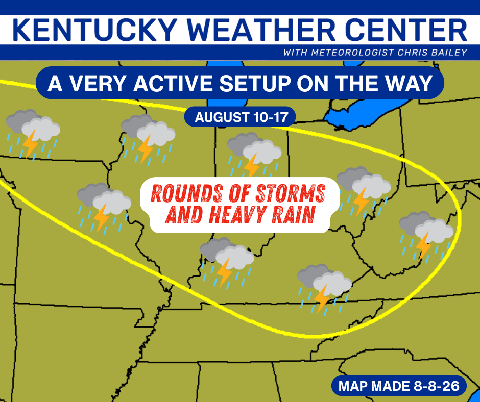
The past week of weather has been among the worst you will ever find for areas of the Ohio Valley and Appalachian Mountains… especially for August. Today marks the end of this 8 day stretch we had been highlighting for some nasty weather…
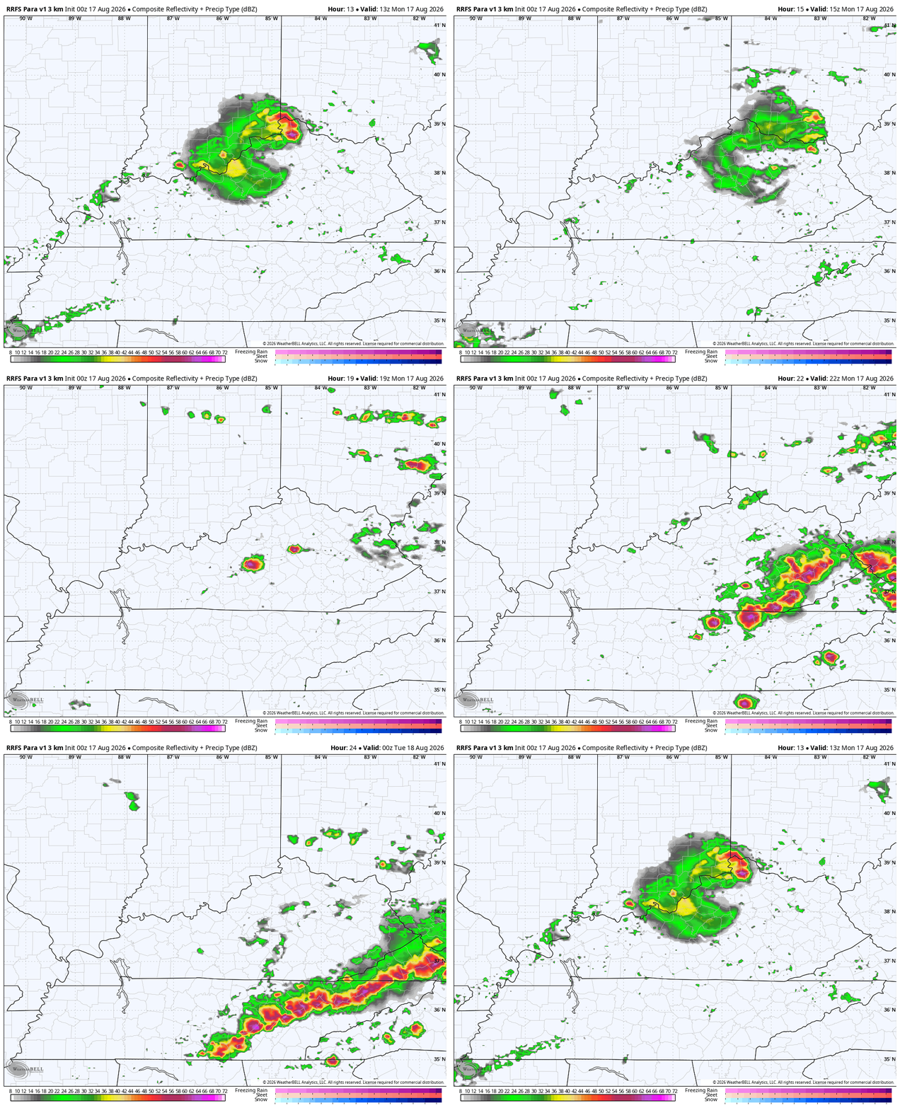
Deadly flash floods and severe weather have blasted the outlined area and we have one final day of some nasty stuff. A complex of storms may be noted early today across the northern half of the state with scattered strong to severe storms going up this afternoon with the greatest concentration across the southeast. You can see all that on the future radar…
Those storms going up this afternoon may have a kick to them with damaging winds and large hail possible. The Storm Prediction Center has been trying to push this too far south too quickly in recent days. Here’s a look at today’s Severe Weather Outlook…

Tuesday’s weather looks and feels much better. Enjoy it, because more storms blow back in Wednesday through, at least, the start of the upcoming weekend. Sigh.
It’s a much different setup, but can still deliver some healthy rains with showers and storms rolling through Wednesday and Thursday with cooler showers possible this weekend. This is a system dropping in from the northwest through the weekend…
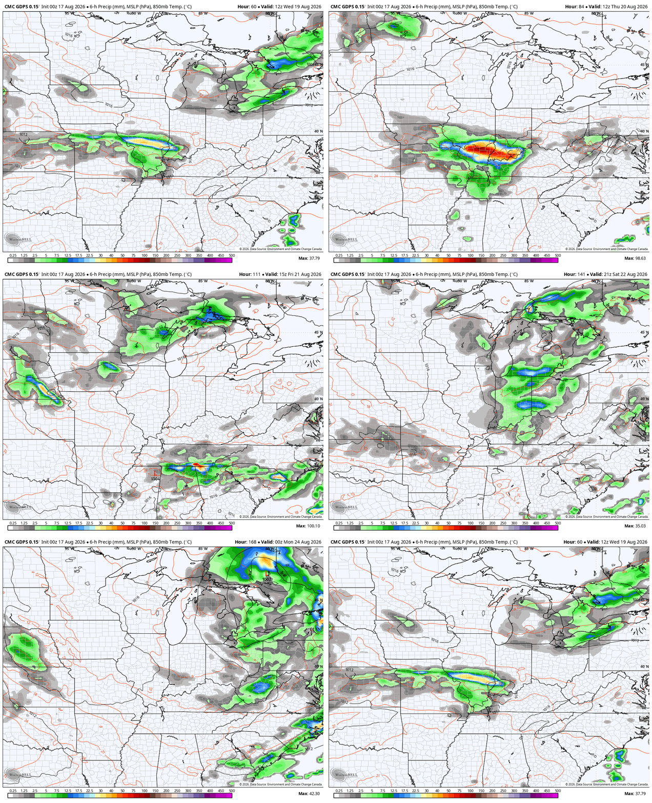
We will need to watch for a few strong storms and heavy rains late Wednesday and Thursday.
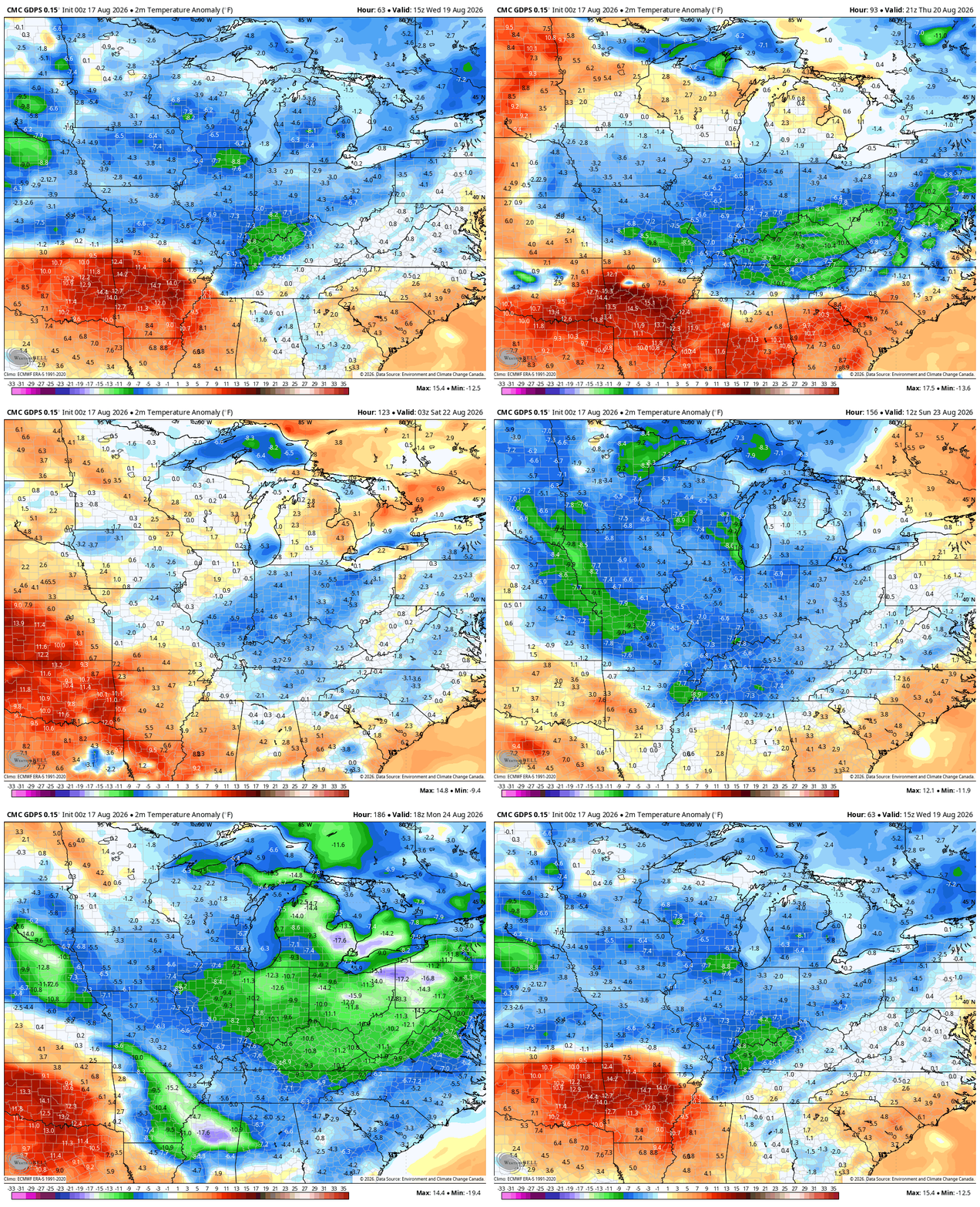
Temps will be MUCH different with a surge of much below normal numbers settling in. This animation runs from Wednesday and goes all the way into early next week…
As always, I leave you with your daily storm tracking toys…







It’s not going to be “much below” normal. Highs are forecasted in the 80s all week.
Maybe so, but the nights and early morning temperatures in the 60’s will happen.
That’s still not very below normal if at all.
It’s better than it is now !
Thanks Chris. Here in Taylor County, we could use a couple of inches. The good rains have miss Taylor County most of this Summer. Hopefully, we will receive the amount we need this week or even today.
For the entire month of August, my immediate area of Warren County has picked up 1.19 inches of rain, and most of that fell on the first day of the month. The average rainfall for August in BG is 3.65 inches so we remain in a serious deficit, especially considering the prolonged heat. Yesterday, my PWS recorded a high temperature of 102.4° F, dewpoint of 74.6°F and a heat index of 115.0°F. Yeah, I’ve just about had it with the heat, but somehow we tend to balance out over the course of the year, so winter ’26, ’27 could be one for the books!
We haven’t had that much rain here either Joe. We had a thundershower this morning. Just a few hundreds of an inch. I’m watching the high pressure over Greenland, the pressure is 30.10 inHg at the present. If it happens to get to 30.30 inHg in December, and the teleconnections are a strong negative ( AO and NAO ) and the PNA is positive, we could have a Winter comparable to 1977 – 78 Fall and Winter.
” To every action there is an opposite and equal reaction “
Looks like the good rains past our central counties again. Well maybe later on ? Got to remember this is the driest months August and September. No I’m wrong again, October is our driest month.