Good Sunday, everyone. It’s another active weather day taking shape across the Commonwealth (stop me if you’ve heard that one before), as showers and storms rumble through. Some of these storms may be severe and put down enough rain to cause more flash flooding issues.
The tropical heat and humidity are out there again today with heat index numbers topping 100 degrees for much of the state.
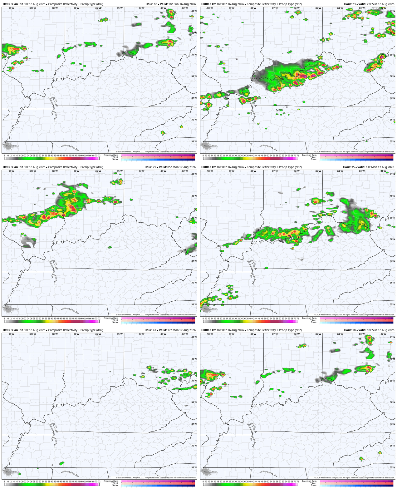
Scattered strong to severe storms develop this afternoon with the potential for a line or two of strong to severe storms to go up later this afternoon into the evening. The future radar from the HRRR shows it all very well in this animation from this afternoon through early Monday afternoon…
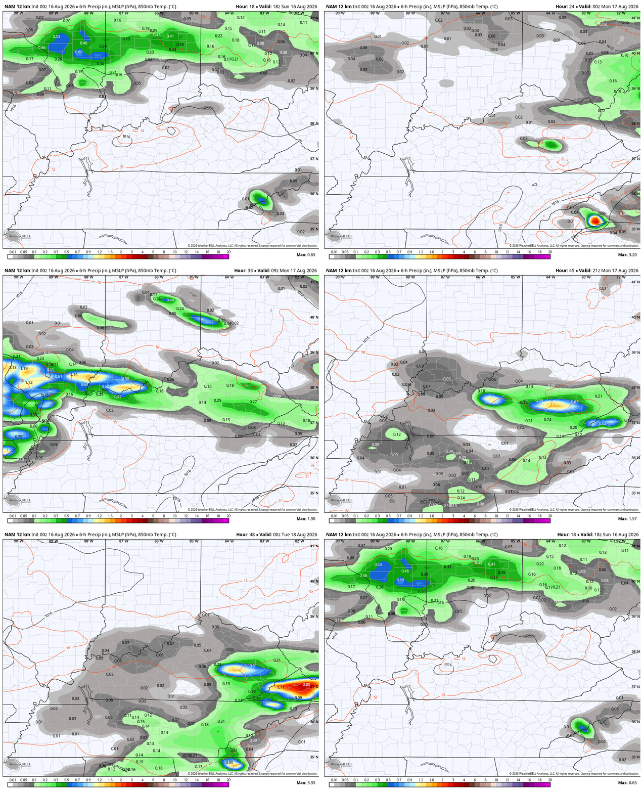
The model may very well be a little too fast in getting rid of the showers and storms on Monday. The NAM shows some pretty decent action hanging around through the early evening on Monday…
The Storm Prediction Center is blanketing our region in Today’s Severe Weather Outlook…

Damaging wind and large hail are the main players with today’s storms with a very low tornado risk.
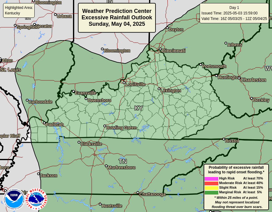
We’ve had areas of flash flooding each day since Tuesday and today is likely to bring more of the same. The Weather Prediction Center has that risk outlined…
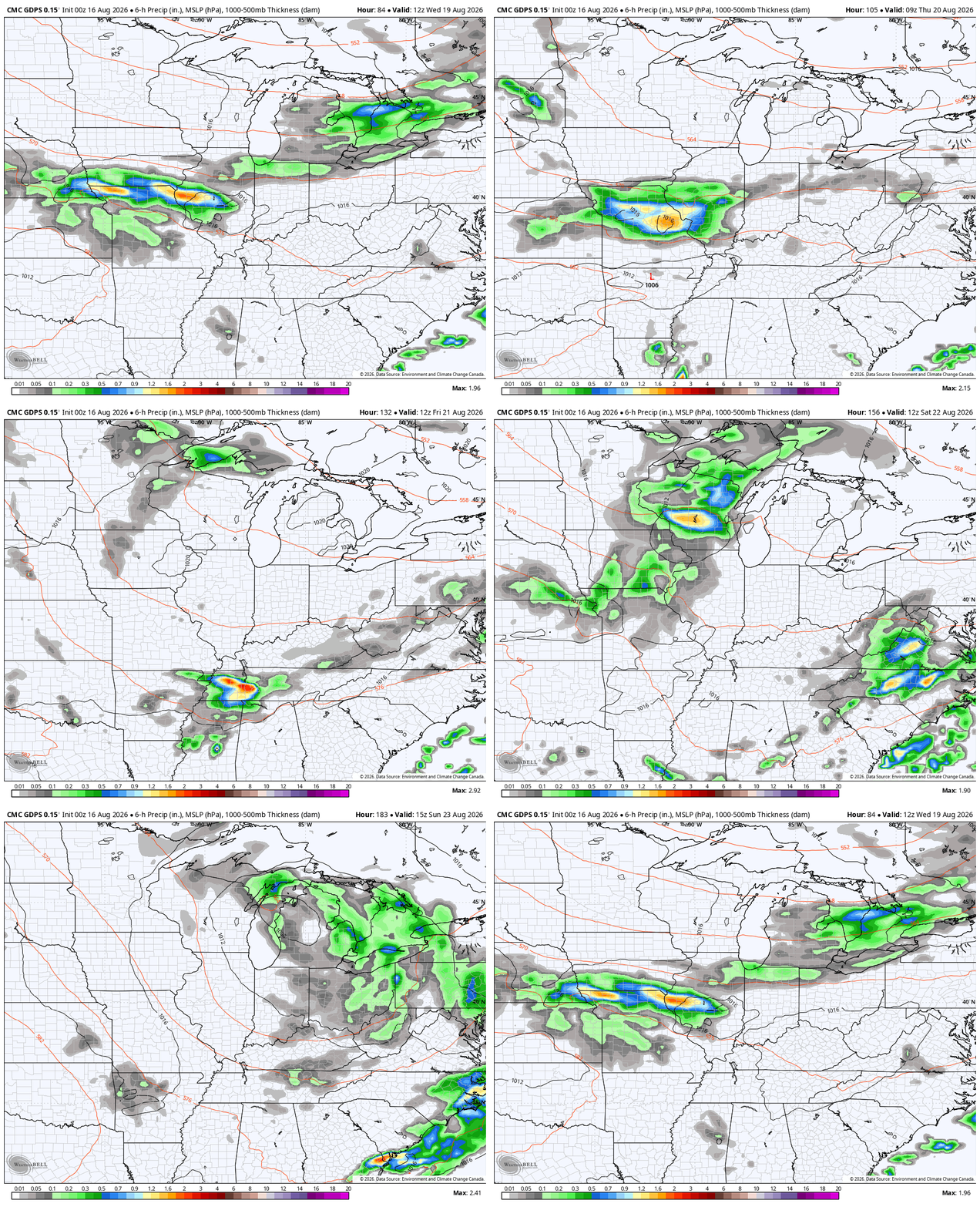
Temps and humidity levels come down behind this departing system on Monday with better feeling air into the middle of the week. That will be followed by more in the way of showers and storms as a system slowly moves through the region later next week into the weekend.
The Canadian and Euro are similar…
CANADIAN
EURO
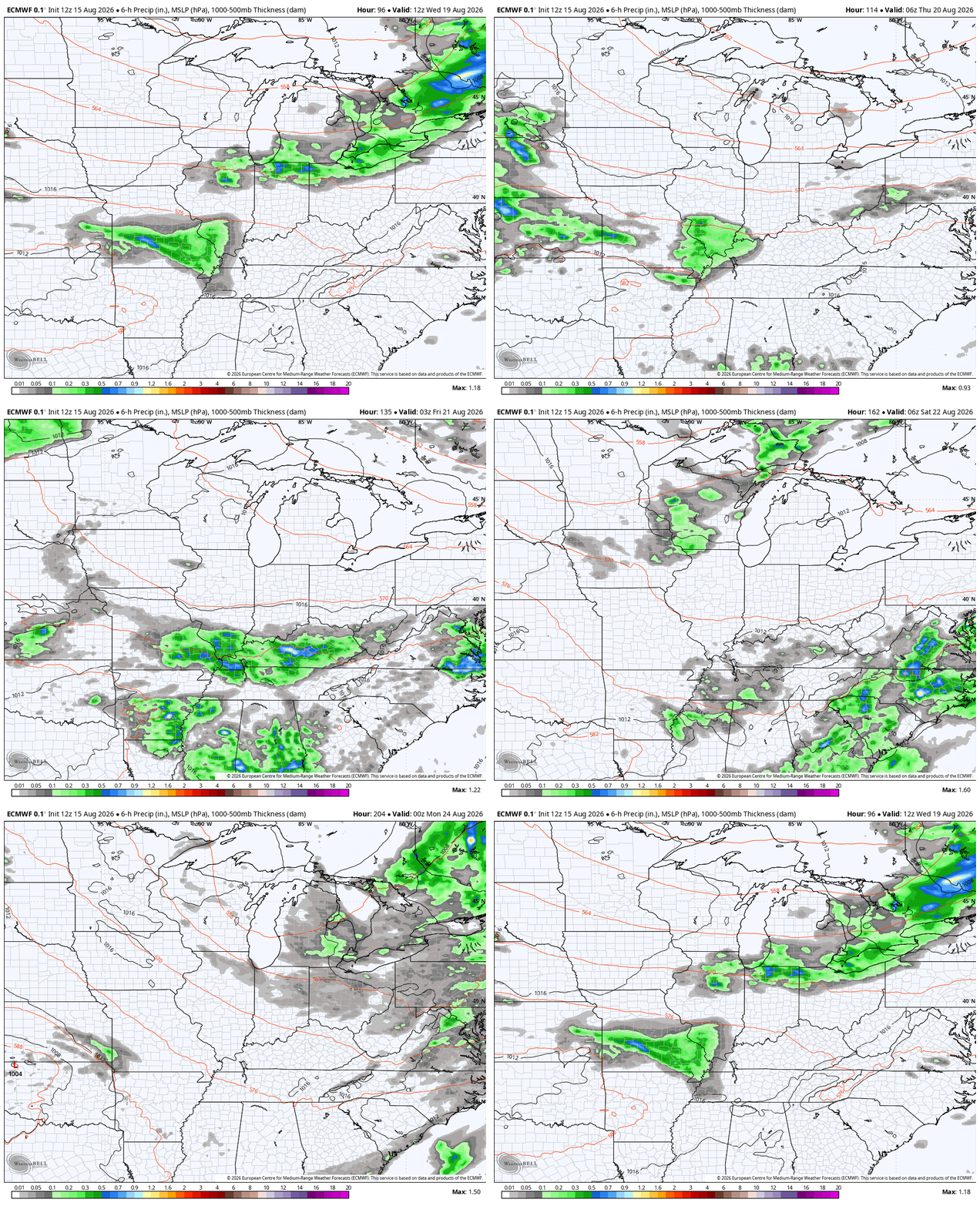
Cooler temps accompany that setup.
Let’s look even farther down the road toward the winter months. We have a raging El Nino that is currently developing and it may very well become the strongest El Nino ever recorded and it may be by a good margain.
Lately, I’ve talked about how this current Super El Nino is already deviating from the handful of past Supers with the summer pattern across the lower 48 and here in Kentucky. It’s very interesting to watch how every single seasonal model looks similar with regard to their respective forecasts.
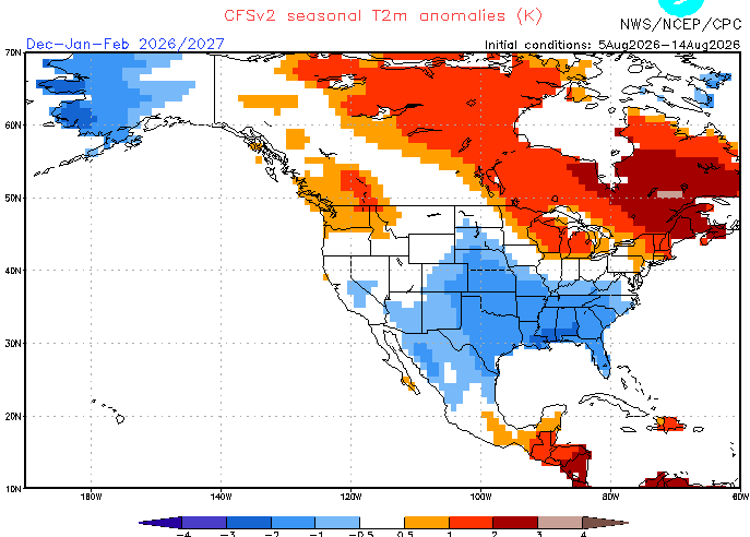
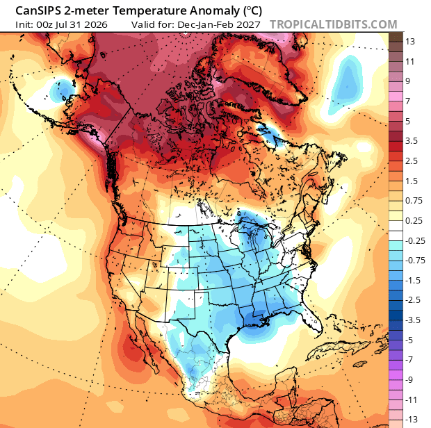
All have a much colder look than what we would normally expect during a Super El Nino, which can be blazing for much of the country.
Here’s the CFS forecast for December-February…
The CanSips is a little more widespread with the cold…
The JAMSTEC only gives us a global view, so I’ve circled the US to show the cold look it also has…
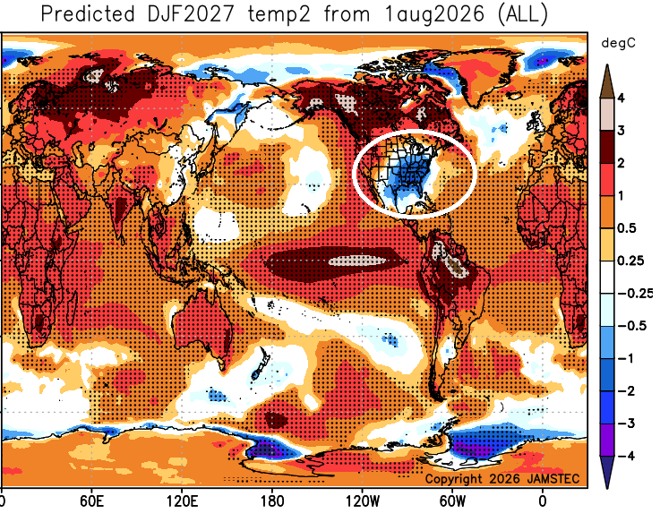
That’s wild to see so much of the world with well above normal temps with the bullseye of cold right on top of our little corner of the globe.
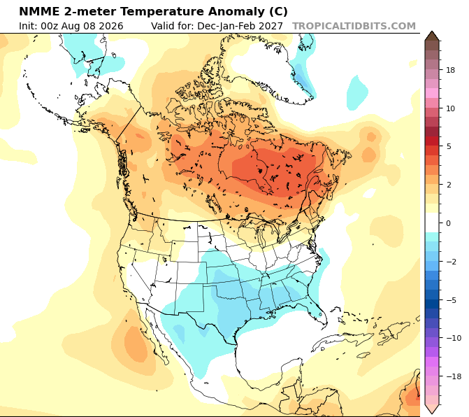
The NMME is usually pretty warm biased, but it has a similar colder look…
As does the EURO Seasonal…
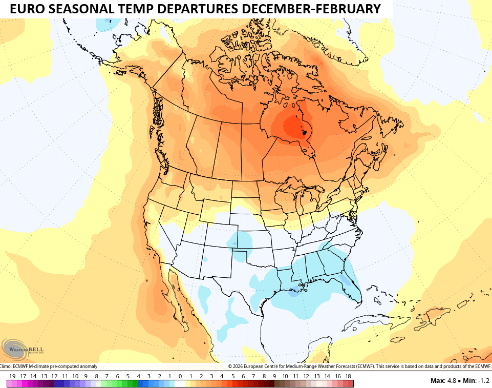
What’s interesting is they all grow colder as we get deeper into Winter, extending that into early Spring.
Look at the January-March cold from the CFS…
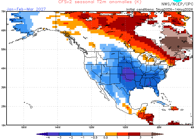
That’s same signal is showing up on all the seasonal models.
It’s still way early in the winter forecasting game, but it’s wild to see every single model showing something similar, something you don’t expect during a Super El Nino. But this summer’s weather is showing the actual weather isn’t following the Super script up to this point.
As always, I leave you with your daily storm tracking toys…







Thanks Chris. Great Blog this morning, on a look ahead into Winter. Sounds like I will have to dust off my Snow shovel. Reminds me of the Winter forecast back in the year 1969 – 70. A very Cold and Snowy El Nino Winter.
Sounds like we need to get some wood cut and split. Not gonna do it with this heat index though.
August ENSO update:
https://www.cpc.ncep.noaa.gov/products/analysis_monitoring/enso_advisory/ensodisc.shtml
Thanks Joe, for the latest on El Nino. I’m concerned the impact may be a disaster for the West Coast ?
Not buying the model hype.
Jeff, if you’re talking about the ENSO update, I actually think that it’s too conservative, based on how rapidly water temperatures are rising in the Pacific.
Jeff, the models are just making us aware of what may happen. It’s not hype.
Jeff, it’s a shame you wasn’t around the late 70’s winters. You be miserable Lol
Incorrect take