Good Tuesday, everyone. It’s a MUCH better weather day across the Commonwealth as cooler and drier air presses in from the northwest. This begins a pattern that’s overall calmer, but will still throw a few shower and storm chances at us.
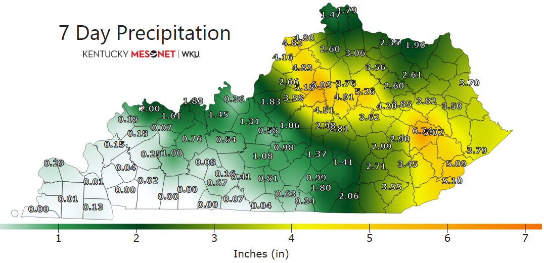
The past week has been nothing short of ugly in terms of severe storms and flooding rains. Central and eastern Kentucky experienced the brunt of the bad weather with some areas picking up more than a half foot of rain.
Look at the rainfall totals from the Kentucky Mesonet over the last week…
Torday starts with some low clouds and fog across the east with that drying wind kicking in from the northwest. Highs today are generally 80-85 with a mix of sun and clouds and that awesome feeling air.
A system drops toward Kentucky from the northwest on Wednesday, bringing an increase in showers and storms across the west. This spreads eastward late Wednesday through Thursday night, bringing more in the way of booming showers and storms. The NAM is showing some pretty good rains during this time…
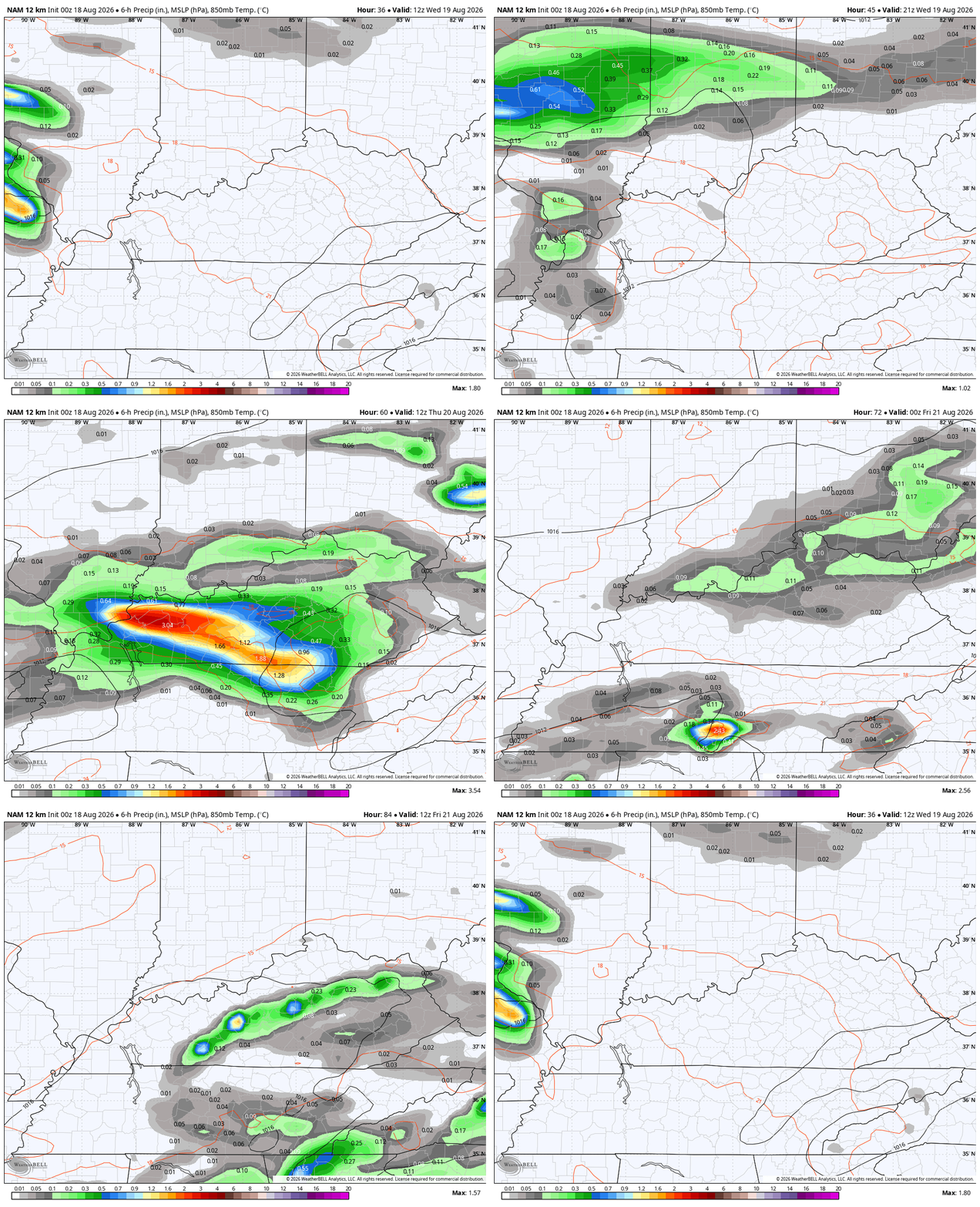
Some of the storms on Wednesday could be strong or severe in the west…
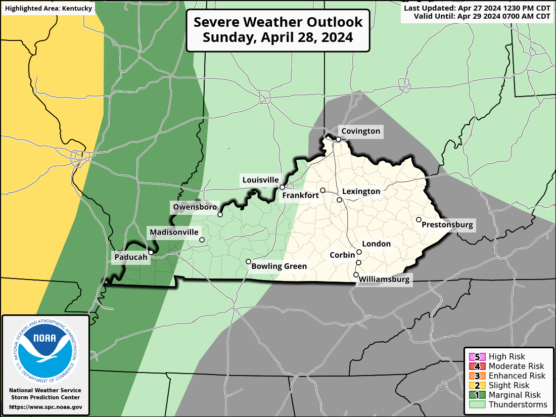
The low-end severe risk spread farther east for Thursday…

Highs on Thursday may not get out of the 70s in several areas.
Lingering showers and storms take us into early Friday but much of that looks to end before we the kickoff to the High School Football season, but it may be a close call in the south and southeast.
The pattern this weekend through next week will feature several systems dropping in from the northwest, bringing below normal temps and more chances for scattered showers and storms…
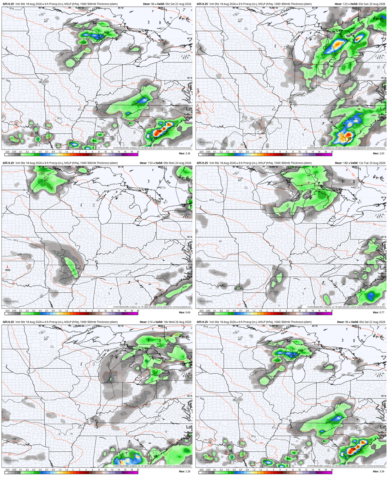
These are some fairly deep troughs diving into the eastern half of the country through the start of September…
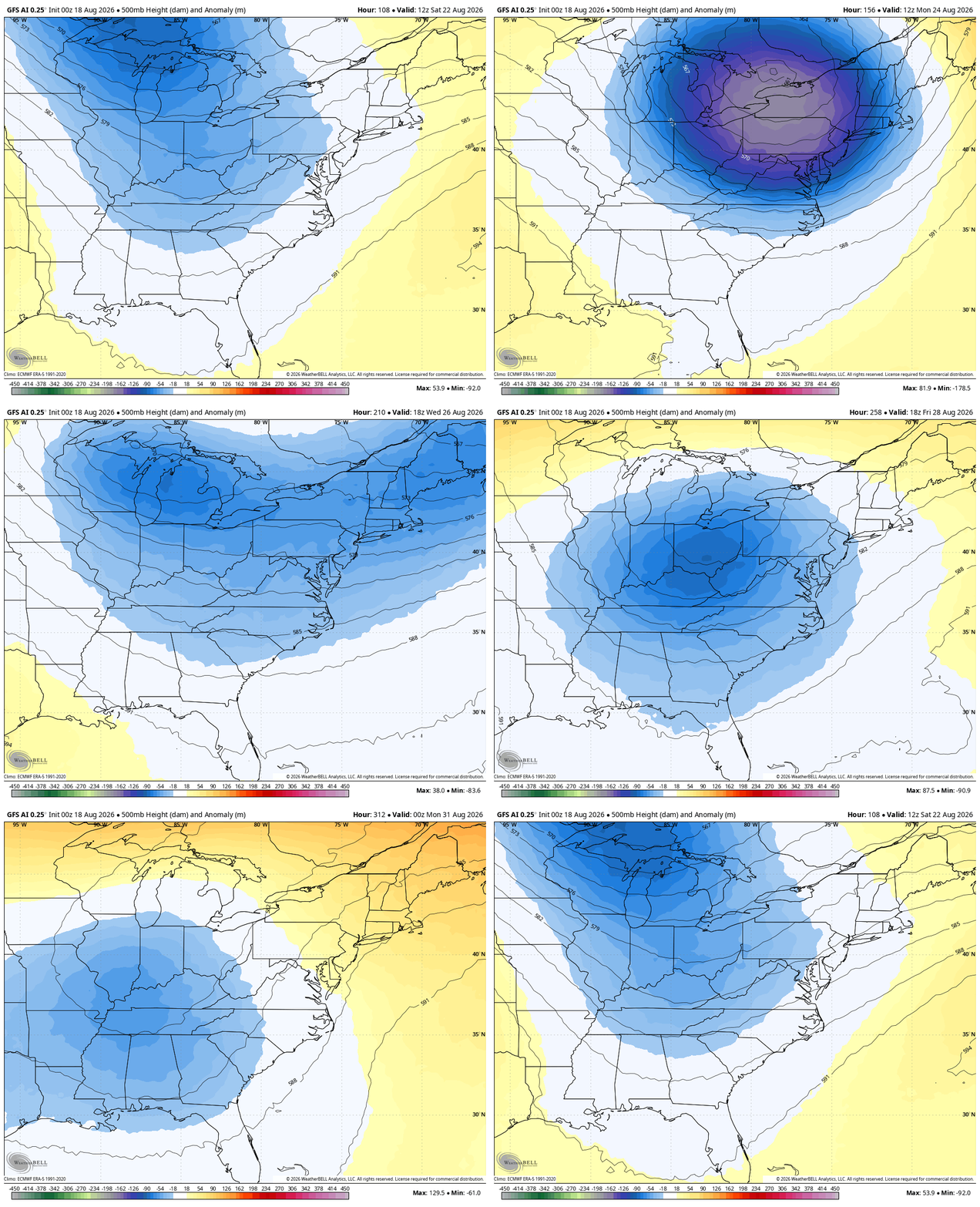
As always, I leave you with your daily storm tracking toys…







I’ve always felt that August was the most boring weather month… but not this year. Several instances of LOUD thunder and CRAZY lightning.. Lots of ppl on reddit were without power again and complaining as they had just previously lost power earlier in the week or something. Since 1996, let’s see, I’ve lived in 5 places in Lexington (all on the south side except where I live now -since 2004) The worst place for losing power was Chinoe Creek Apartments. I feel like you could blink and the power would go out there. And that’s where I lived during the 2003 horrible ice storm. I think that area was the last place to get power restored. Total nightmare. But here in northwest Lexington, all power is underground. I think I’ve lost power only a handful of times since 2004 and none of them were long duration. One of the power outages was early morning, like 6 am, and it was like -15 F outside during a wicked cold wave and it was out for like 3 hours or something.
Exactly Mark, All electrical lines should be buried, and the transformers a box on the ground. Get rid of those ugly utility poles of the early 20th century.
Mark, I lived in the Liberty Road/Henry Clay area and I think my house was about to get power restored. I was out for just shy of a month.
Dotte, was that back in the January, 2009 Ice Storm ? We didn’t have power for over a month and nearly froze to death. I had to call my Lawyer. Power came back on within an hour. They always service the most populated areas first, that’s understandable, and the very rural areas last. Cleanup after the Storm was very hard and expensive. If there is a Tornado that destroys my home, or an expensive Ice Storm occurring again, I’m moving to the Snow Belt in Michigan. Lee Shores of Lake Michigan have one of the most stable Climates in the US. Long cold ( not frigid Winters ) but lots of Snow that stays on the ground most of the Winter, and the roads are plowed very well. Severe weather in the Spring is rare, but can occur. Summers are cool and pleasant without flooding rains. Falls gradually turn colder ( no ups and downs on temperature ) Snows start early, sometimes in early November. I might add a good growing climate for Rhododendron Nurseries.
No Schroeder, Mark was referring to the 2003 ice storm. That one was worse for me. 2009 wasn’t any fun either!
Thanks Chris. An early taste of Autumn weather. I’ll take it ! Some of the trees are beginning to show the signs of change. Not temperature, but the declining day length, and lack of good soaking rains are causing this action.
I’m hoping the very strong Southeast Ridge weakens, and brings rain from all the troughs ( fronts ) that are forecast in the next several days. My area has been in this sinking air for weeks now due a very strong Southeast Ridge caused by the ongoing negative Pacific Decadal Oscillation.
Summer still has a month to go, but enjoy false fall I guess. LOL
Bring on the boring, dry heat.
Jeff, Nothing wrong with liking the hot, humid, dry weather. I’m sure we will have more weeks of our usual Summer weather, before Fall weather( kicks in ) in mid October – November. However, our climate here in the Ohio Valley is so strange, we can have Summer weather in the Fall and sometimes Winter and Spring months. Tornadoes, can also occur in any month of the year. I must add, that major Snowstorms are more rare than major Ice storms, because Kentucky is in the temperature transition belt. Too far south, or too far North to predict what the precipitation type will be.