Good Sunday, everyone. We have an absolutely awesome pattern settling in for the next few days as September flexes a little early. This is part of an overall larger pattern shift that will bring several deep troughs into the eastern half of the country to close out the month and being September.
Those big storms showed up on Saturday, especially in the east and south. Some wind damage was reported, but we’ve got to calm the NWS in Jackson down… Every thunderstorm does not need a warning. I say that with love, btw.
Those storms were ahead of the September cold front that’s giving us the awesome air out there today. Highs range from the mid 70s to low 80s across the state with low humidity and a stiff northwest wind.
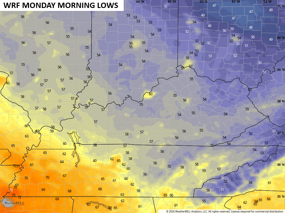
Temps tonight drop deep into the 50s and that’s how we begin the final week of August…
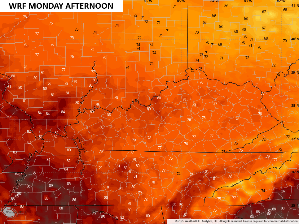
High temps on Monday once gain range from 75-80 for much of central and eastern Kentucky with low 80s west…
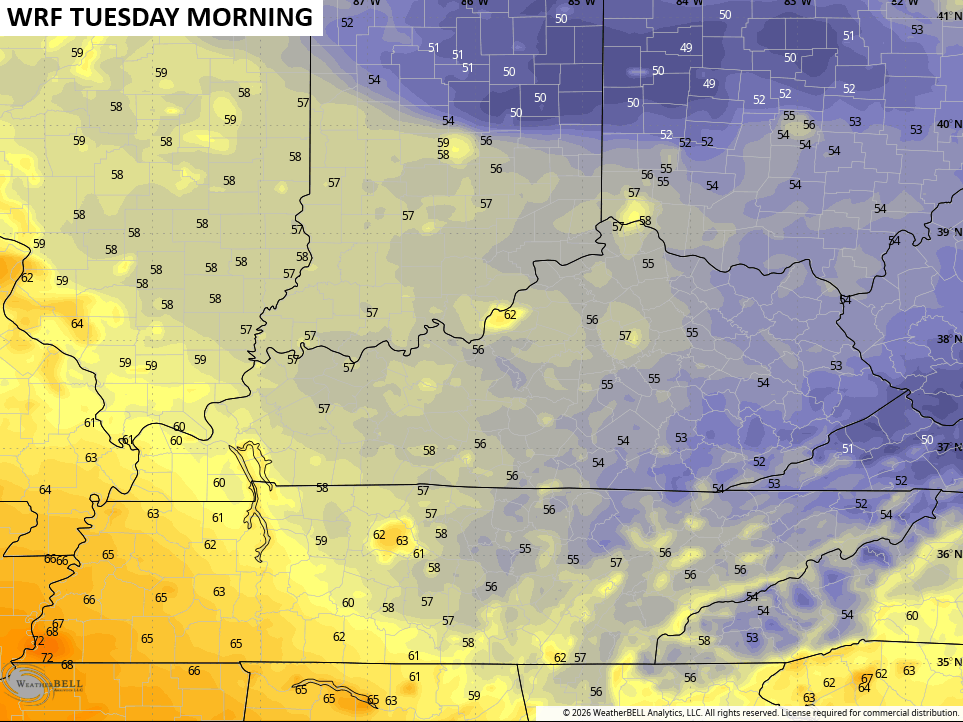
That sets the stage for another cool night with temps back into the 50s to start Tuesday…
As you probably know by now, we have a developing Super El Nino and it may very well be the strongest El Nino ever recorded. We’ve only had 3 of these in the modern era and those summers we all much cooler and drier than the one we are about to wrap up in Kentucky and across much of the country.
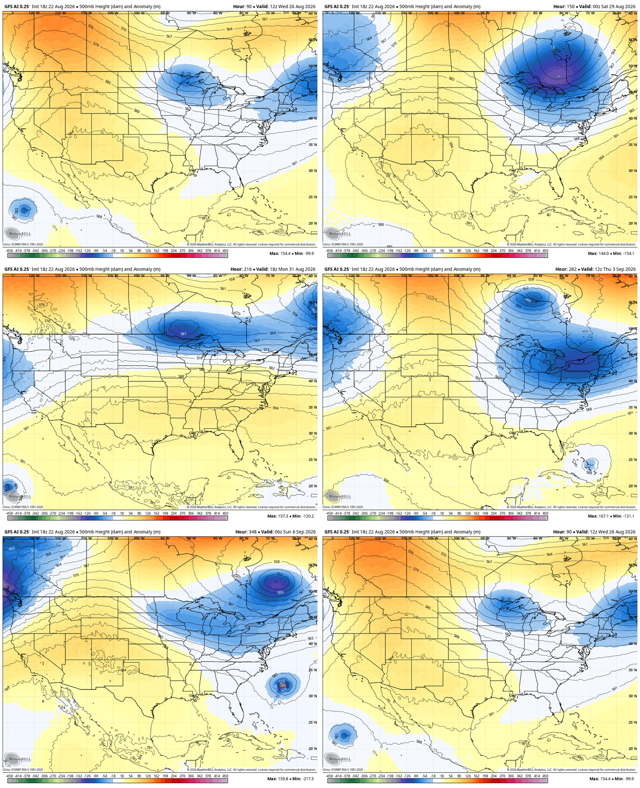
We may be seeing some hints of that changing over the next few weeks as the heat ridges get beaten down with those deepening troughs digging into our region. This animation from the EURO goes through the first week of September…
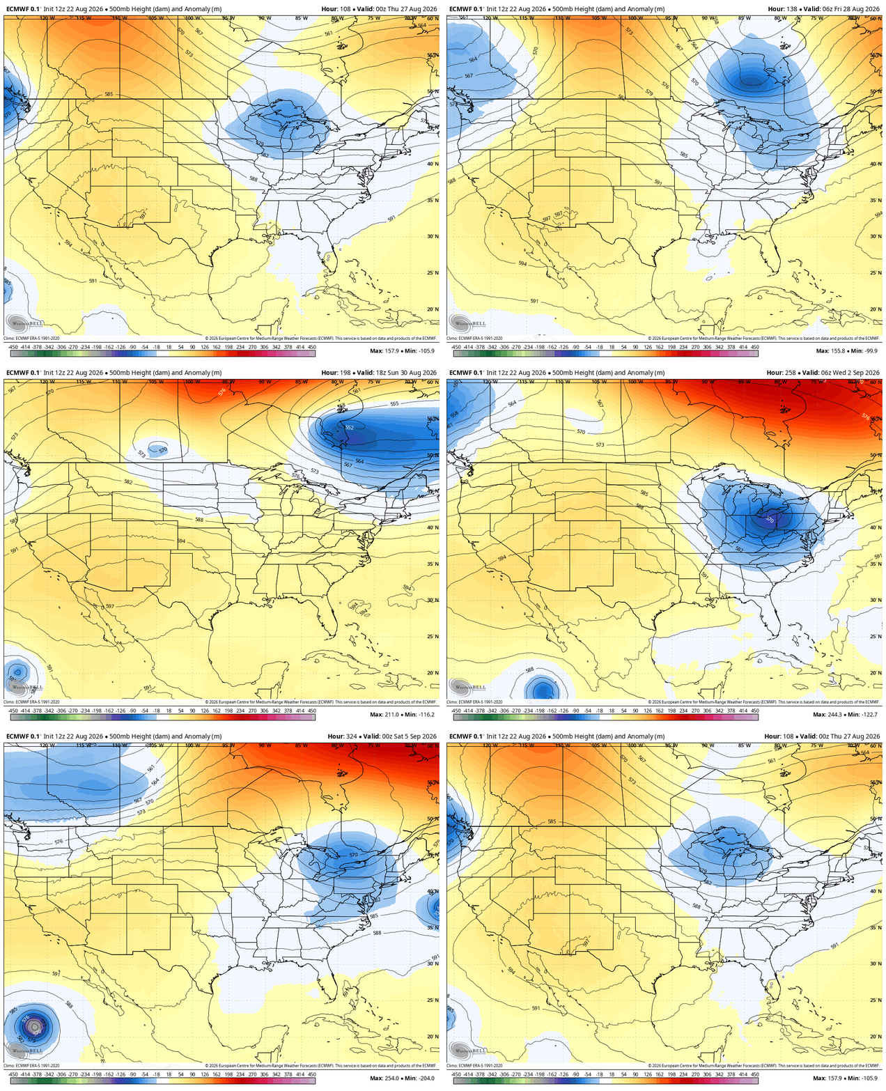
The GFS AI looks pretty similar during that same time…
As always, I leave you with your daily storm tracking toys…







Thanks Chris. Really enjoying the early morning temperatures. I know that it’s not Autumn yet, but it’s pleasant to have a ” taste ” of Autumn this early.
I recall the El Nino Winter 2015 – 16 was very Cold and Snowy for Kentucky. Here in the hills of Taylor County, I measured 15 ” of Snow on the ground at one time. The coming super El Nino event is going to be interesting to track, especially if it couples with the atmosphere.
We are nowhere done with heat. If you think otherwise, you’re delusional.