Good Tuesday, everyone. It’s another awesome weather day taking shape across Kentucky with that sweet September feel rolling on. Once into the second half of the week, we will be tracking a few storms along and ahead of a cold front.
Temps this morning are in the low and middle 50s with the chance of some upper 40s in a few spots. A mix of sun and clouds will be noted with highs reaching the upper 70s to low 80s in most areas with the west being warmer.
Temps are in the 50s will be noted for Wednesday morning. Clouds will increase with just an isolated shower or storm chance later in the day. Temps are in the low to middle 80s.
A cold front drops in here on Thursday, kicking off scattered showers and storms Thursday into Thursday night…
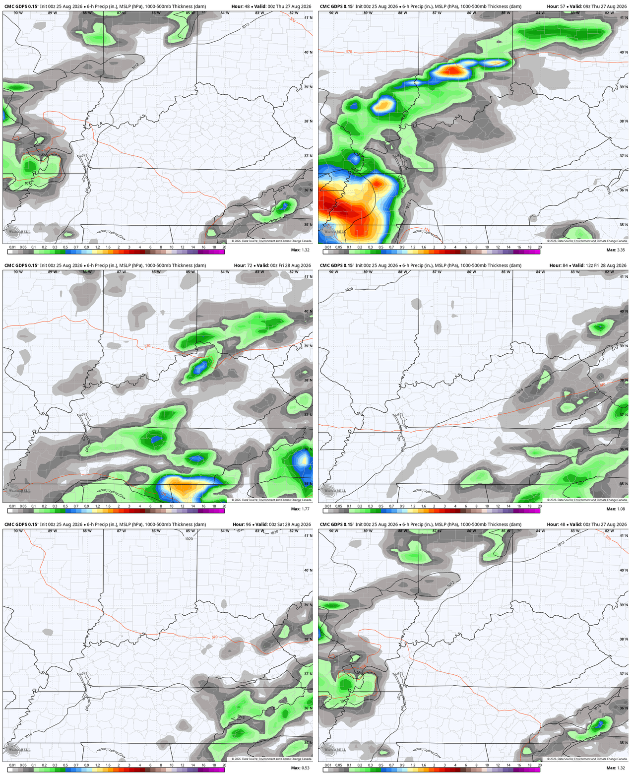
I could see a strong storm or two out of this. I’m not sure if it’s enough for the Storm Prediction Center to include it in the Severe Weather Outlook for Thursday, but here it is…

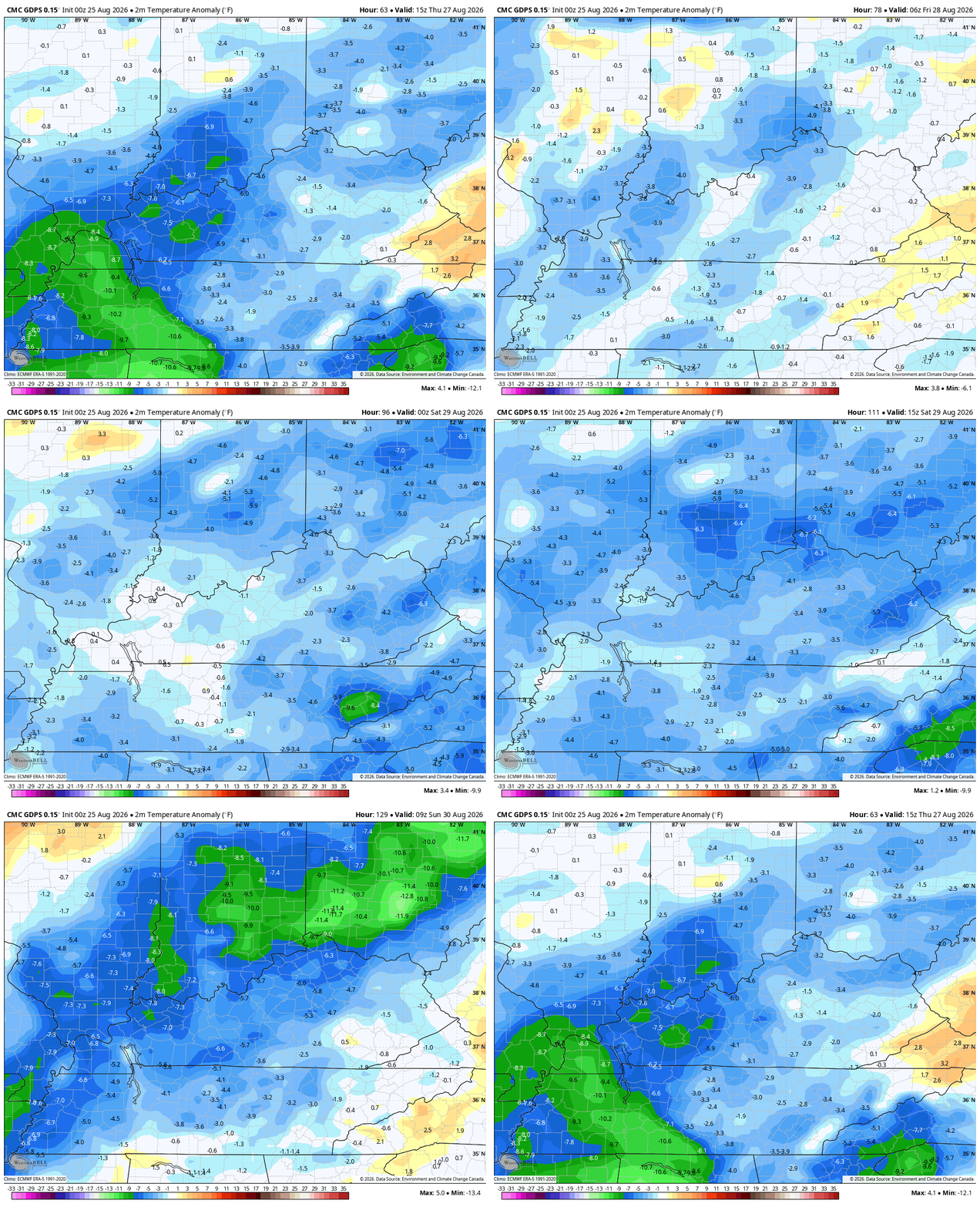
The air coming in behind this boundary isn’t nearly as cool as the one we have now, but it’s going to bring in temps that are a touch below normal…
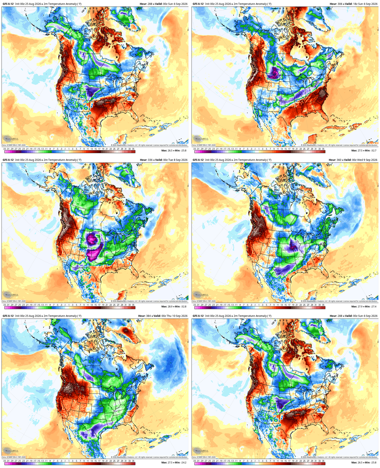
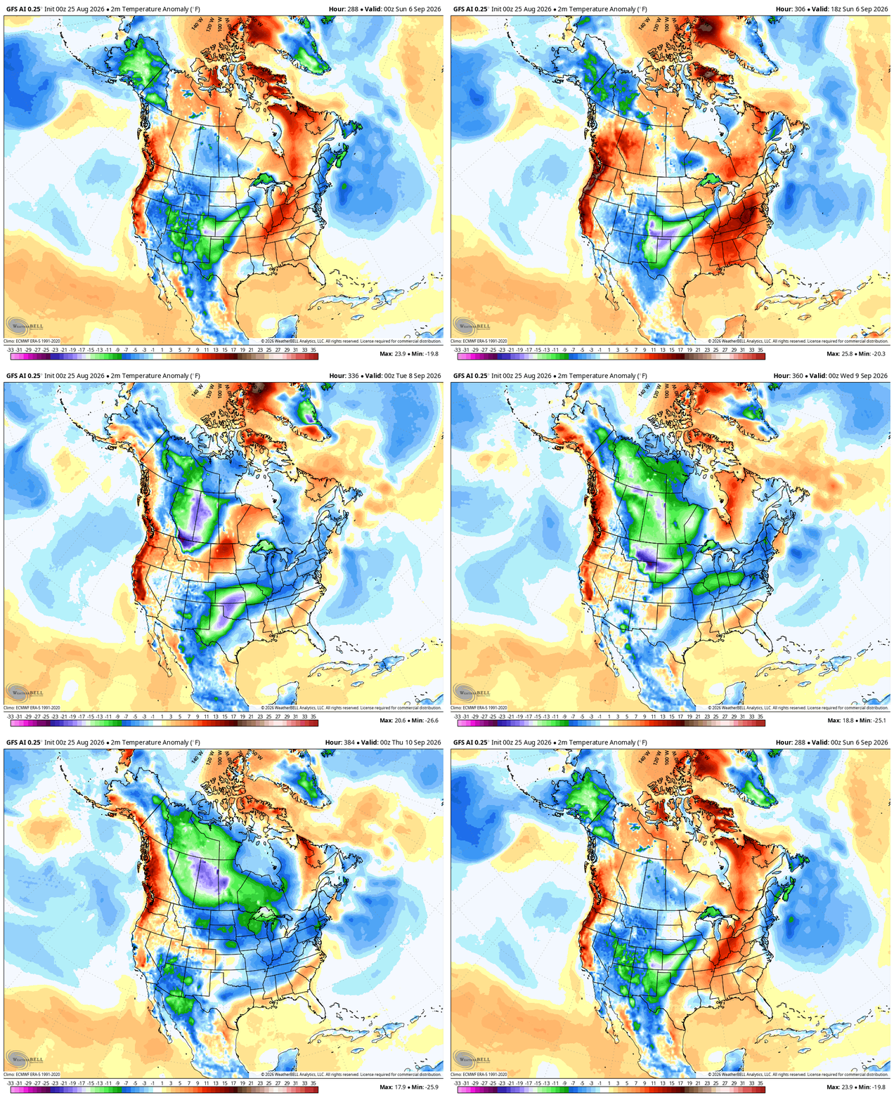
The heat across the southern plains will make a run at us as we flip the calendar to September next week. There are some growing signals for a fairly significant overall pattern change across North America showing up around Labor Day or shortly thereafter. It’s a pattern that can bring some pretty good early season below normal temps…
GFS
GFS AI
As always, I leave you with your daily storm tracking toys…







Thanks Chris. The Labor Day period and the first week of September may therefore be very interesting to watch. It could tell us whether this recent cool spell is just a brief interruption, or the beginning of a more persistent change towards the kind of early Autumn pattern I was hoping for.
I’m keeping a watch on the blocking High Pressure System in Greenland. This morning’s reading was 30.70 in Hg. That’s very strong for this time of the year. It’s causing the NAO to go strongly negative.
I believe this Winter’s weather will have a dependency on what phase the Pacific Decadal Oscillation is in. Snow Lovers would want a strong positive phase with the strong El Nino plus a negative AO ( Arctic Oscillation ) and NAO ( North Atlantic Oscillation ) and a positive PNA ( Pacific North America Oscillation. ) Again we shall see what happens.