Good Tuesday and welcome to September! It’s the start of Meteorological Fall, but Mother Nature didn’t get the memo. It’s a sizzling start to the season as we look ahead toward changes for Labor Day Weekend and beyond.
With Meteorological Summer behind us, let’s take a look at how things turned out. For the country as a whole, this was a very hot summer with Kentucky being one of the few “normal” areas…
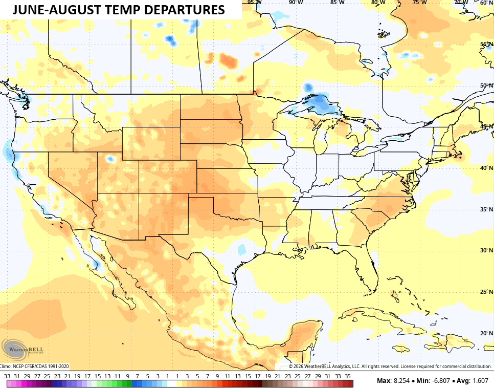
That looks nothing like what any of the prior developing Super El Nino summers had, so that’s certainly noteworthy.
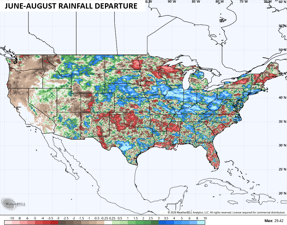
Frequent storms made for one of the wetter summers on record for much of the Ohio Valley, including parts of Kentucky…
Temps today through Thursday generally reach 90-95 in most areas with the numbers coming in a bit above in the west and northwest. Areas of the southeast have been running a little cooler and that trend continues.
Heat Index numbers aren’t off the charts thanks to this airmass not being tropical in nature. Still, it will push 100 at times for central and eastern Kentucky with slightly higher numbers in the west.
There’s also the chance for an isolated shower or thunderstorm going up, with a greater chance on Thursday.
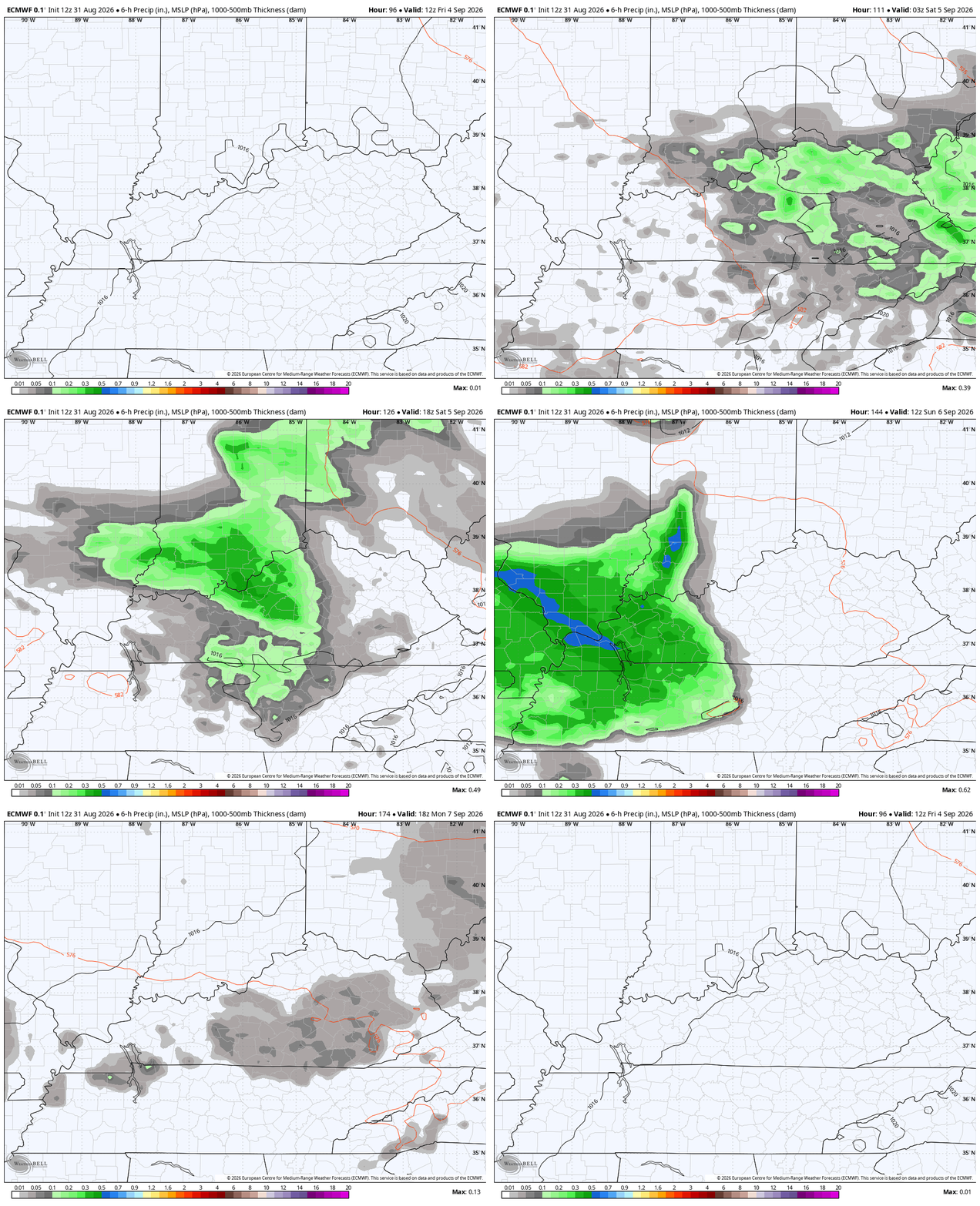
The threat for showers and storms increases Friday into Saturday as a cold front drops in from the north and northeast. This brings the potential for a few booming thunderstorms for the first half of Labor Day Weekend with much more pleasant air coming in behind it for the second half of the big weekend.
Here’s the EURO from Friday morning through Labor Day…
Check out the lightning from that same run of the EURO…
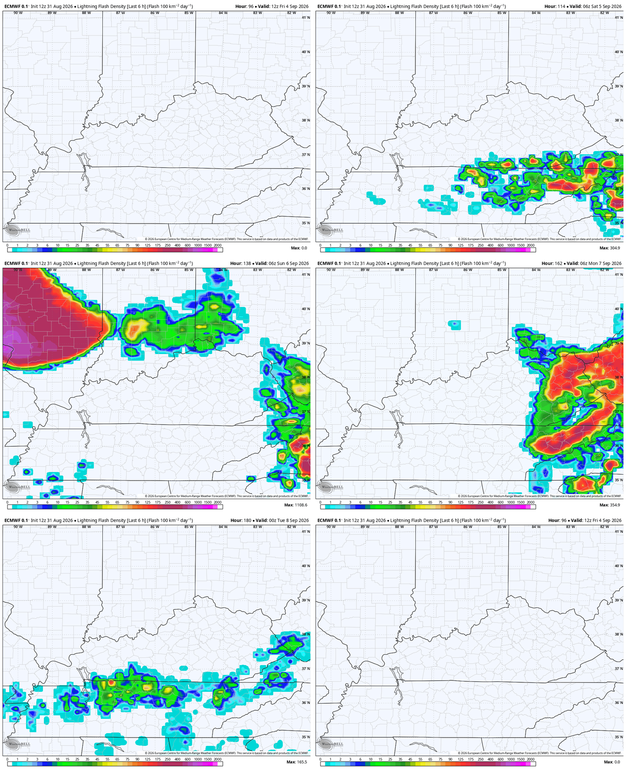
With college football in full swing this weekend, lightning delays can’t be ruled out in our region.
As you know, I’ve been showing some analog years that pointed toward an increase in tropical activity. Since then, we’ve had Tropical Storm Dolly and now Tropical Storm Edouard is spinning along the Gulf Coast…

Edouard will ramp up as it heads toward the Texas/Louisiana border for landfall later today…

As always, I leave you with your daily storm tracking toys…






