Good Monday and Happy Labor Day! Today marks the unofficial end to summer but we still have a little more summer left in the tank. Temps will take off again over the next few days, but a significant pattern change looks to be setting up with a series of fall cold fronts ahead.
Today looks mainly dry with just isolated showers and storms across the southern half of the state. These will be moving against the grain. Temps are still fairly pleasant with 80-85 in the east and upper 80s to near 90 in the west.
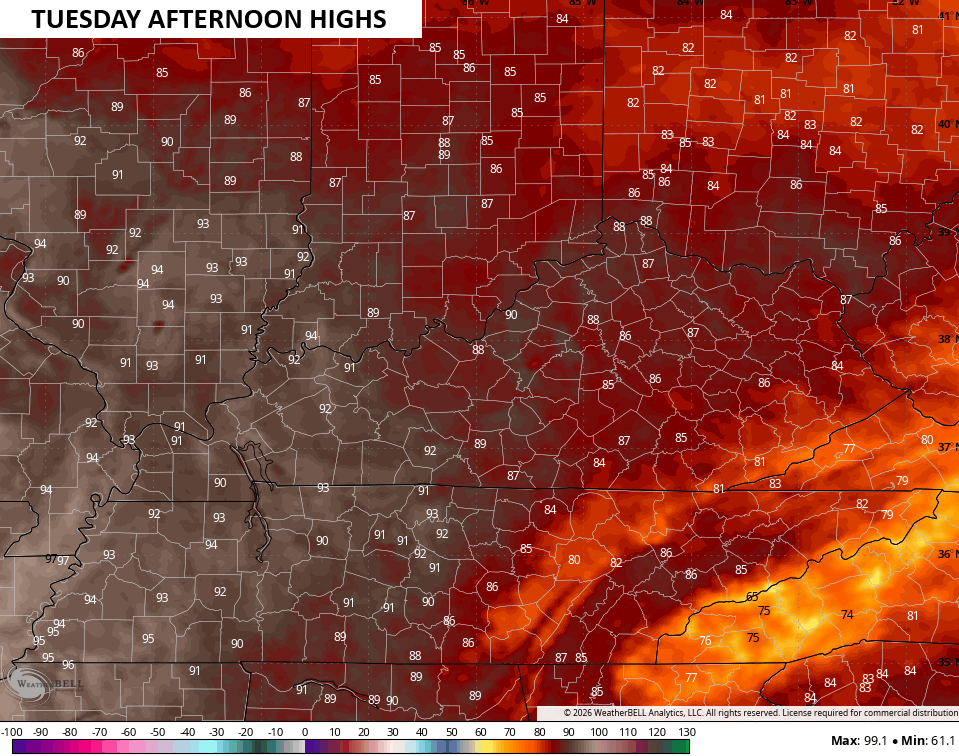
Temps toast up a little more on Tuesday with mid and upper 80s east to low 90s in the west…
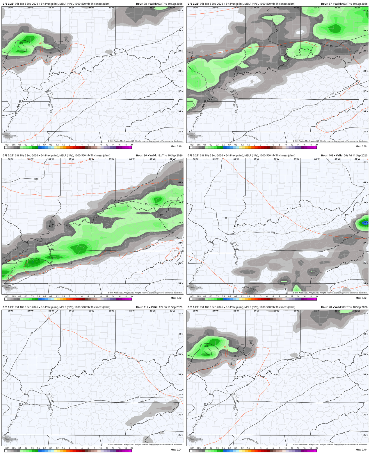
Wednesday finds temps a few degrees above that with gusty southwest winds kicking in. These winds are ahead of a strong cold front moving in with showers and thunderstorms for Thursday. These storms may put down some pretty good rains as they move through here into Thursday night…
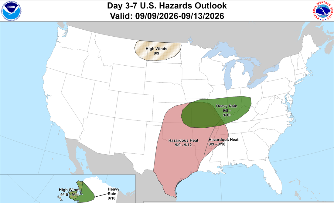
The Weather Prediction Center is highlighting the chance for heavy rains in our region during this time…
Temps on Thursday have a chance to stay in the 70s if the rains get in early enough. Pleasant air then comes in behind this boundary for Friday into the start of the weekend.
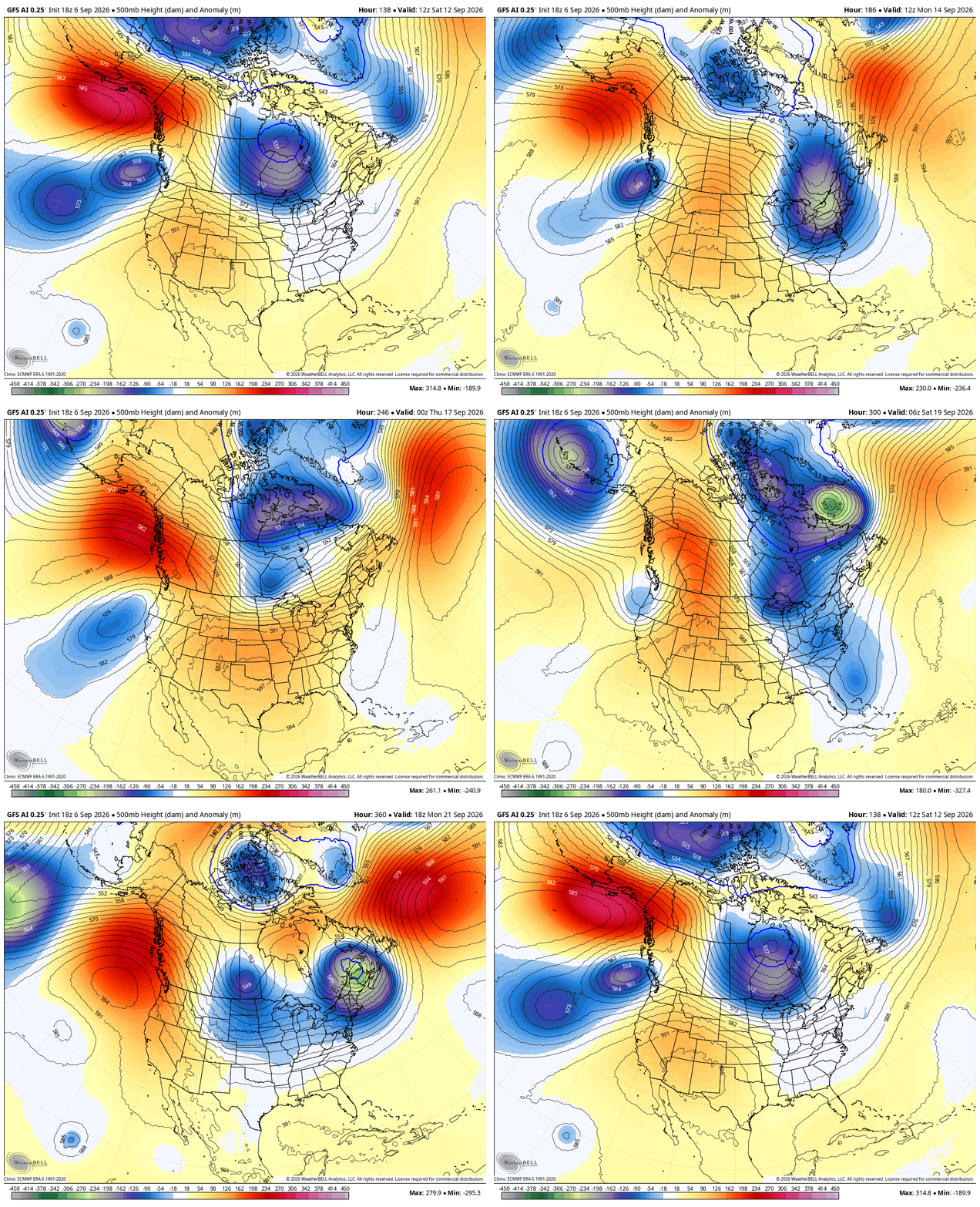
The stage is set for a much bigger buckle in the jet stream behind the next front arriving late this weekend or early next week. Check out the change behind that front and the front coming behind it a few days later…
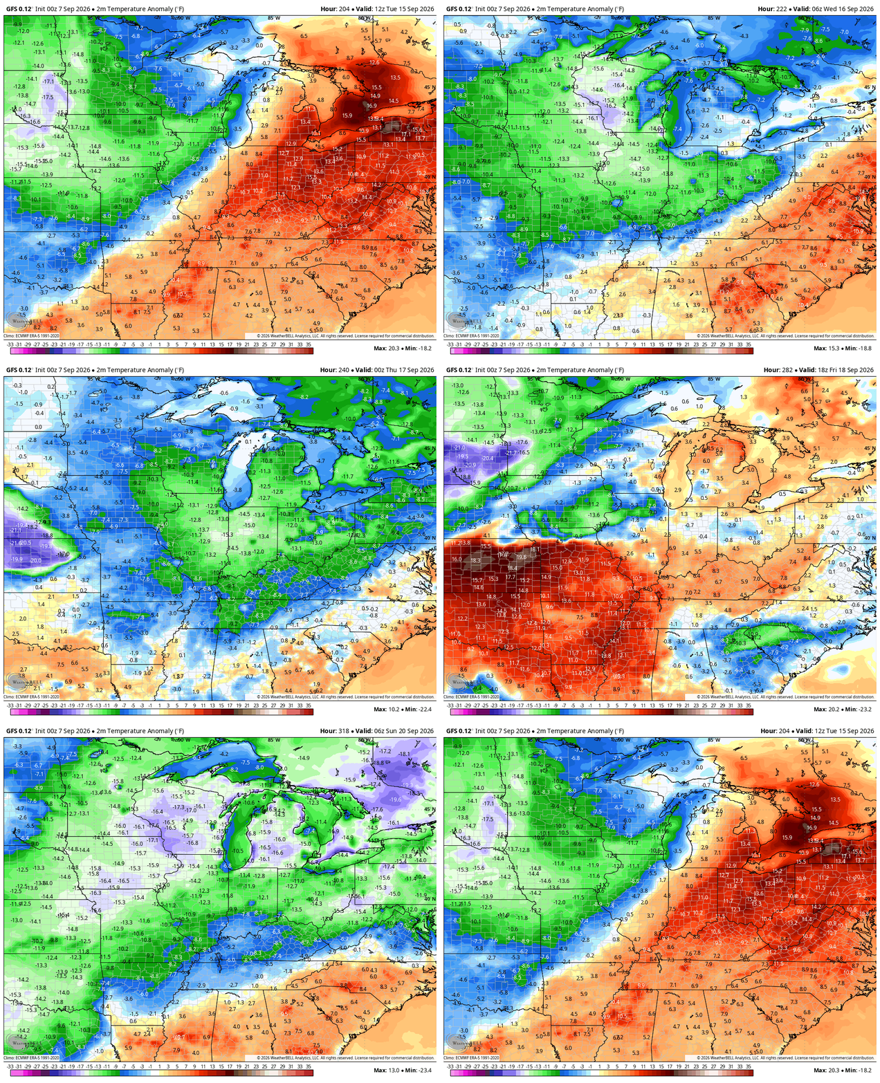
Many of the forecast models are now seeing this starting a setup that look more like it’s from the cold weather season…
As always, I leave you with your daily storm tracking toys…






