Good Sunday to one and all. The remnant low of Isaias is spinning through Kentucky today, sparking more bands of showers and storms. Once this gets outta town, the pattern for the next week has a bit of an interesting look to it.
Isaias took a bit more of an easterly track that the NHC forecasts had been showing, but it’s still spinning across our region today. These spiraling bands of showers and storms will impact central and eastern Kentucky through the evening…
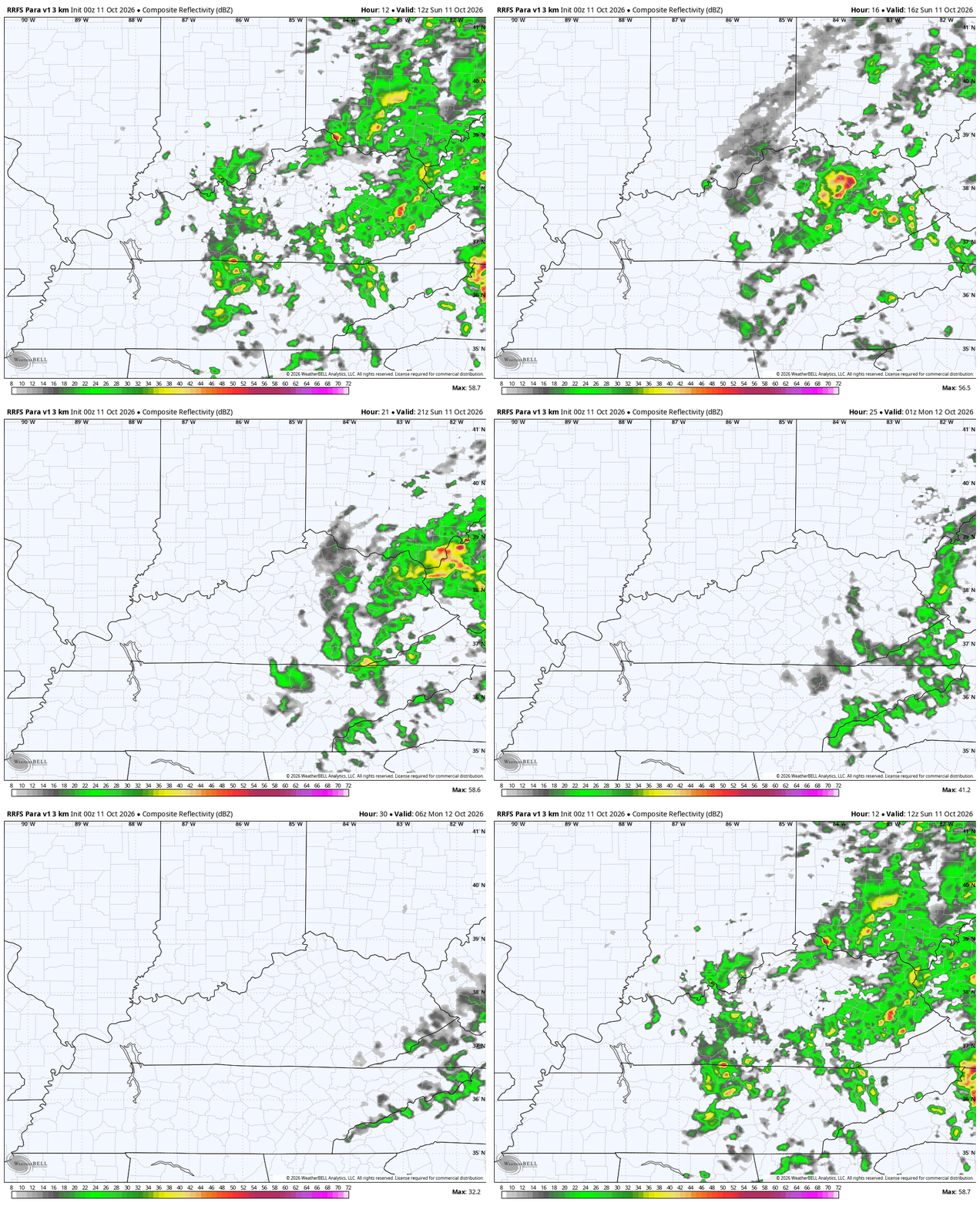
Areas of heavy rain may cause local high water issues, especially across the east. There’s still the low-end risk for a few strong storms…

Temps jump behind this on a strong southwest flow Monday into Tuesday. This is ahead of a boundary that slides in from the north, producing a few waves of showers and storms across the area from Tuesday night through Thursday night…
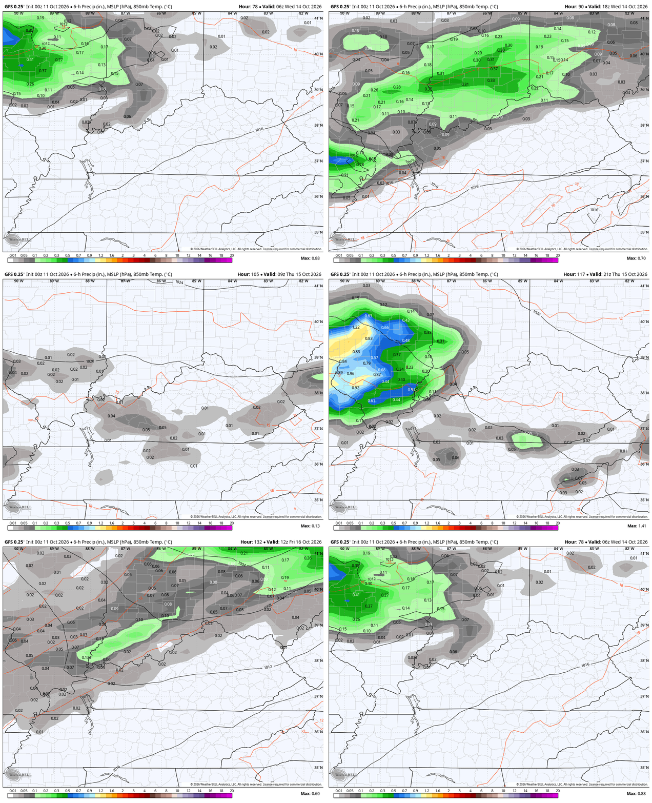
Temps continue to run on the mild side during this time.
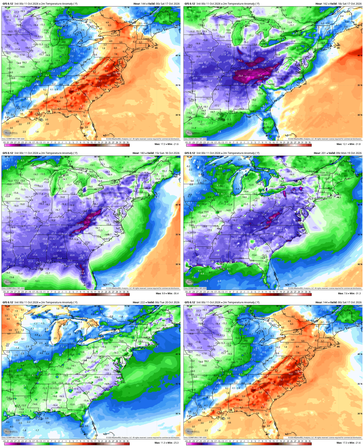
All that changes with a massive trough digging into the eastern half of the country late Friday into the weekend. This front continues to look rather dramatic in temps of the abrupt change it brings to the weather for many.
This is a growing season ending type of air mass coming in behind it with some models continuing to show a bit of a winter look. The GFS has been pretty consistent in showing the first taste of winter across the Great Lakes and northeast with some of that getting into the Appalachian Mountains. Several runs of the GFS have also been showing some Ohio Valley flake action.
This animation starts Friday and ends Sunday afternoon…
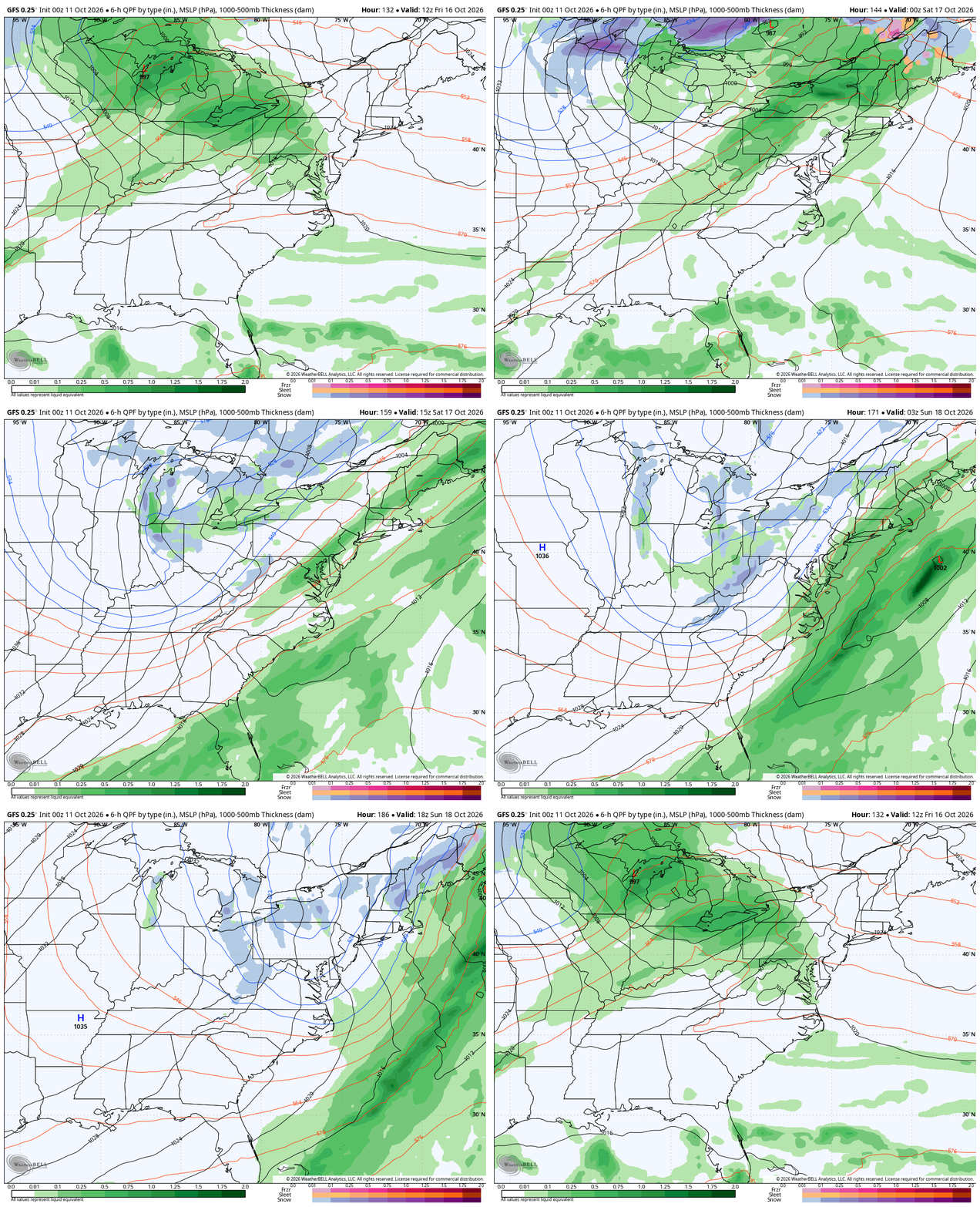
That’s pretty wild to see this early in the season, but it’s happened before so it can’t totally be discounted. That said, it’s still several days away so we are just having a little fun with the potential right now.
The GFS snow map for next weekend looks like something out of the heart of winter…
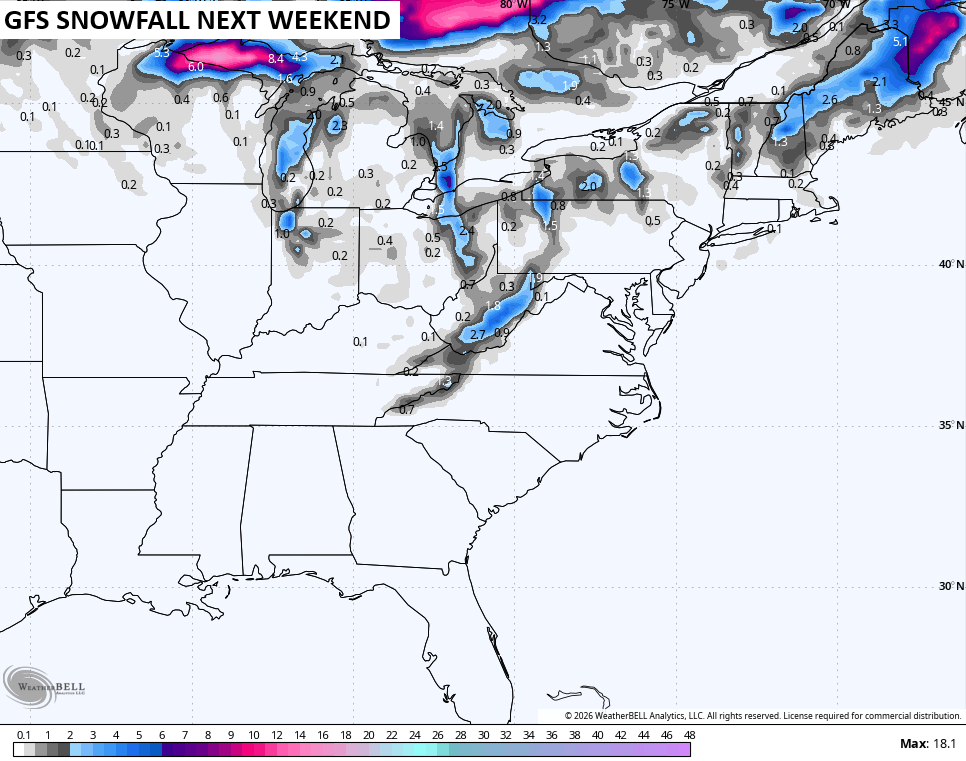
Here’s a closer look at our area…
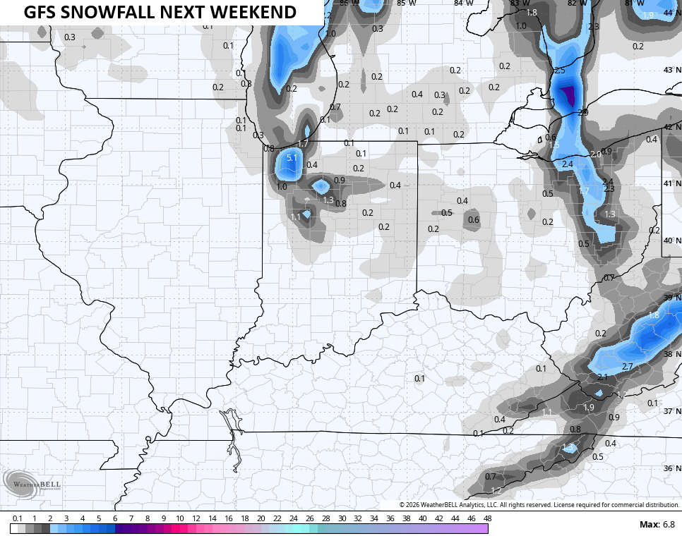
Again, that’s fun to look at but I wouldn’t get too juiced up by that just yet. If we still have a flake signal showing up a few days from now, then we can get a little more excited.
The cold is pure Barney as temps go well below normal…
As always, I leave you with your daily storm tracking toys…




Current watches

Possible Watch Areas

Make it a great Sunday and take care.

I won’t get excited. 🙂
How? How can we have tropical remnants move through here and get such a SMALL amount of rain… 0.20 inches??
It simply moved further east than expected.
We had around a half inch late last night. I can’t recall the year, but it wasn’t too long ago we had 5 inches of rain from a remnant.