Good Sunday to one and all. Most of the region is waking up to frost and freezing conditions, putting an end to the growing season. If you’re a fan of amazing fall weather, you’ve come to the right place because we have it for the next week or so.
Temps this morning range from the upper 20s to middle 30s. Lots of sun will be with us today as temps reach 60-65 awesome degrees.
This sets the stage for another frosty night tonight into Monday morning with lows back in the 30s. The rest of the forecast is just flat out awesome. Highs for the week ahead range from the upper 60s to low 70s with lots of sun-filled skies. Overnight lows range from the middle 30s to low 40s.
The fall colors will be absolutely brilliant!
One of the reasons our weather will be so nice is the slow-moving system now coming together off the eastern seaboard…

The National Hurricane Area now has this area highlighted as something to monitor…

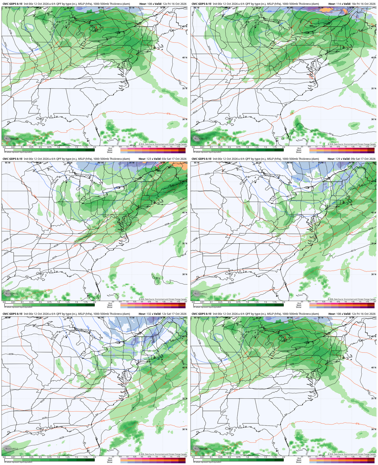
This system, whatever it is, will spin for the next several days before finally getting pushed away from the east coast late in the week. That allows the weather to start moving again, bringing a likely cold front in here at some point next weekend. Here’s the GFS…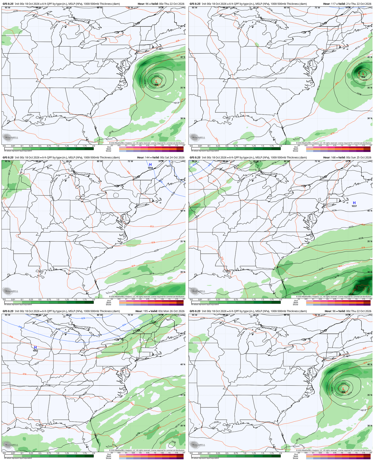
The Canadian…
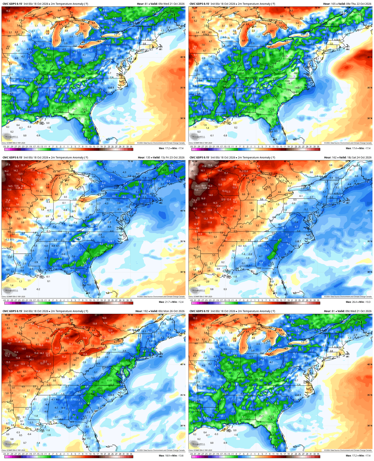
With that system spinning off the east coast, the flow around here in generally from the northeast and that keeps pleasant temps going. Here’s a look at the temp deviation from normal from Wednesday through next weekend…
I keep looking ahead to November as it does have some early season potential. We know this pattern has been drier than normal so far this fall, but the EURO Weeklies are advertising a very active setup with above normal precipitation for November…
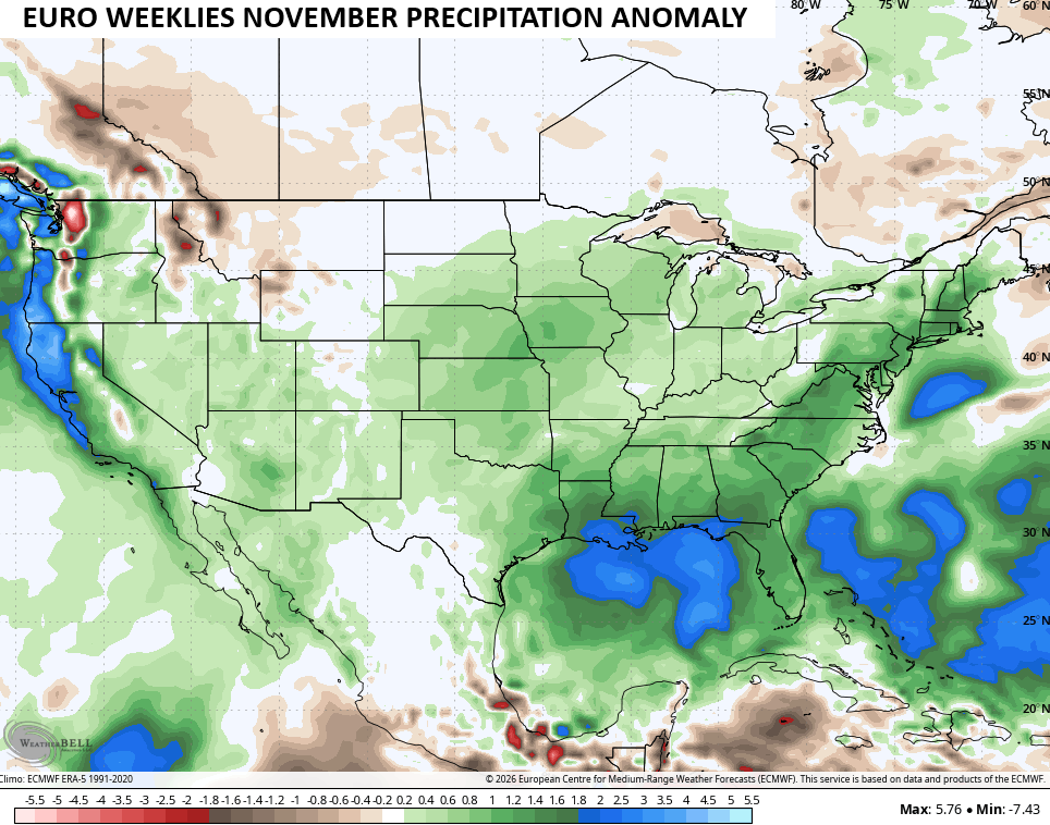
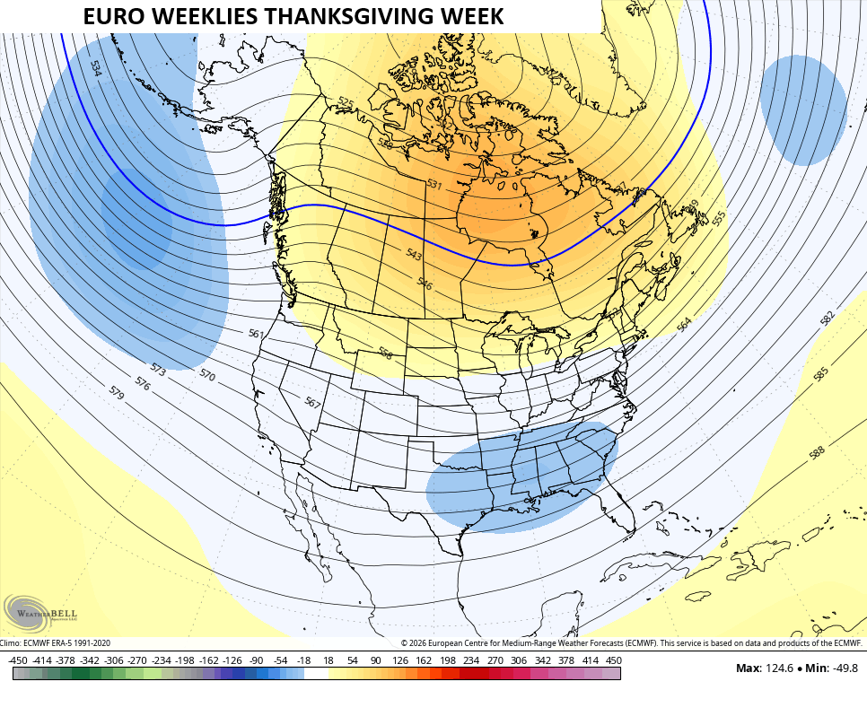
I wouldn’t be surprised if this November gave us severe weather and a snowfall. We continue to see the highest height anomalies getting pushed farther north into Canada as the month progresses with troughing developing underneath. That gives us a Thanksgiving Week that looks like this on the latest run of the Euro Weeklies…
Have a happy Sunday and take care.
