Good Saturday evening. I continue to point toward shots of cold air blowing back into the bluegrass state as we go into next week. These will grow colder with each blast and they may have some snow associated with them.
We get a cold front to arrive on Monday as a storm system rides to our south and east. This will have a small cool down behind it. Another blast will follow that up on Tuesday and that’s a system that may have some light snow associated with it. The models are trying to wrap this thing up into Tuesday night and Wednesday morning…
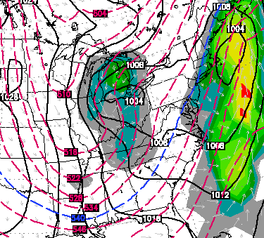
That brings 20s for highs and low and mid teens for lows for the middle of the week.
The next blast of arctic air comes Thursday night into Friday and may also produce some snow as it sweeps in. The air behind this one looks much colder. Look how far below normal the European numbers are…
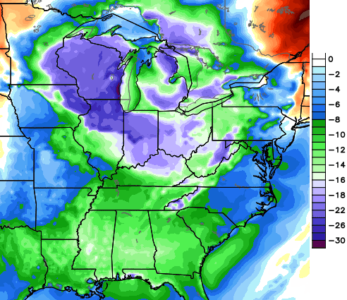 It’s showing the possibility of single digit lows by Saturday morning. Brr!
I will talk more about all this and the potential return of the polar vortex with my overnight update. Enjoy the rest of your evening and take care.

Talk to me about snow, that polar vortex was a litlle to chilly for my liking. 😉
Thanks Chris. Have a good evening.
Crazy weather today. At about 3:30 here in cross lanes we had a bright flash of lightning followed by about 5 minutes of hail.
gotta love Ky weather.
I never thought I’d say this, but give me single digits. No more polar vortex. There are limits, Mother Nature.
It could be worse. I had a low of -7 at my house. I’ve seen -26 here (1994).
Go cats!,,
Sorry but what I read was “light snow & some snow”. I hope this can be a lot of snow