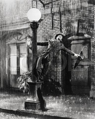
Good Wednesday everyone. Given how dry things have been for the past few months… many of you may be tempted to run outside and do a little dance in the rain. If that’s what you plan to do… make sure to snap a pic and send it to me and I will show you off here on the blog. 
Quite a few areas got in on some much needed rains Tuesday. This stuff wasn’t as widespread as many would like and the rains that fall today into tonight will try to get everybody in on the act before all is said and done. Since we are talking about showers and storms… totals will vary from place to place. The models continue to suggest the eastern areas will get in on the highest totals into Thursday…

For the first time in a long time… we give you the full array of radars to track the showers and storms…


The best time for showers and storms will be later this afternoon into the overnight hours as a front passes through here. This front will team up with low pressure cranking up to our south and east to give us out best chance at rain in a while. That low will head up the east coast toward New England later Thursday into Friday. This will usher in some windy and chilly weather that will last into the start of the weekend. Here is the European Model…

That is a pretty good shot of chill. Highs Thursday and Friday will likely range from the upper 50s and low 60s in the east to the middle 60s out west. There is still the threat for a weak system diving in here Friday and this can bring an increase in some clouds and a spotty shower… especially east.
Clearing skies will settle in for the weekend and this should set us up for a couple of mornings in the 30s meaning frost will be a distinct possibility Saturday and Sunday. Both days look spectacular in terms of the overall weather as sunny skies will be with us. Highs Saturday will be in the low and mid 60s with readings around 70 for Sunday.
Early next week will see temps return to the 70s for a couple of days before another cold front sweeps in late Tuesday into Wednesday. The models are hinting this may have some decent wet weather with it so keep your fingers crossed. Chilly air would likely try to invade the region again for the end of the week.
The longer range outlook remains the same as what I have been talking about for several days now as things continue to line up for a big change to cold toward the end of the month into early November.
That’s all I have for you right now… have a great Wednesday and happy rain dancing. 
Take care.

In just a few weeks, the first post will be a coveted spot!
We aren’t getting rain… Never. We are going to be a part of a new geographical location in the United States. The Central American or East Central or Midwestern Desert. The rain has been like the snow. A week out it looks like we may get rain and have a good chance at it. Then the day before all hope goes out the door.
That coverage of rain on radar is impressive-it’s nice and sunny here in Georgetown. The roads were wet around Somerset early this morning while I was working though, so we must have missed it again.
Looks like the storm next week is already starting to weaken out. Here we go again…:(
I am getting more than a little worried that this pattern might persist through winter.
Looks like that rain in Indiana means business.
Jake
I know how you feel. But in the past ten years, the annual rainfall here has been Above normal except for one year. I remember in 1999 I went to Waldorf, MD to visit and they were having an extreme drought, much much worse than we are having. There were water restrictions out the wazoo. It will rain here again, and A LOT……we just have to WAIT for it to cycle back around I suppose
Chris, I actually DID go out and dance in the rain for a few minutes yesterday afternoon. I went out and it took ne a few miutes to figure out what that stuff was that was falling from the sky!
We didn’t get much, but what we got was appreciated!
Nice to know that the weather looks good for football on Saturday evening…no, I will not be at the UK game, but at the Lindsey Wilson game. But I will still be following my CATS!
Hope the weather pans out for some more rain next week…we really need ithere, and I know the folks ou tin western KY need it even worse than we do! Have a GREAT day everyone!
testing 1-2-3!!! this is the ROLO WINTER WEATHER test post for the 10-11 season.
hello all, hope u had a great summer. its time to lock and load for OLD SCHOOL WINTER STORM this year!!
been wonderful weather this summer IMO.
R.IP. BILL G.
There is a very strange thing showing up on the good ol’ 88D out of Louisville. I googled it, and apparently they call it a “squall line”. Gosh.. we haven’t seen one of those in months.
Hey, Rolo! Good to see you back!
crazy isn’t it
I see the Marshall game has been delayed due to lightening and it is pouring over there. Why did central Ky miss out on the good, heavy rain?? I getting ticked at the weather. It may be time to move because the middle of ky is a dead spot wx wise. Im serious someone needs to do a paper on this phenomenon. It’s bizarre.
PS…the radar looks impressive; however, i bet we haven’t gotten enough rain to fill a thimble. Guess we wait another 2 weeks till the next wx maker 🙁
Folks, i dont want to burst any winter bubbles but if the data holds out, looks like we are in for a not so memorable winter. SE Ridge looks to dominate for the second half of winter. Who knows though, this is noit a typical la nina winter. There is early snowcover in siberia and massive arctic buildup in canada. So who knows. Fingers crossed.
Not much, but I’ll take it!
At the risk of asking a stupid question, why is everyone saying “we need rain”? At this point in the year it won’t help the farmers and I definitely DO NOT miss mowing my yard. So why the anxiousness? I’ll hang up and listen…