Good Sunday, friends and neighbors. Our first day of Daylight Saving Time is shaping up to be a pretty good one for most of the region and this will carry over into the first few days of the new week. It’s a week that starts with spring and ends with a touch of winter.
Highs on this Sunday will hit the upper 40s and low 50s under a mostly sunny sky. We could start the day with some clouds and a light shower… especially in the south and east.
The 60s are coming for Monday as mostly sunny skies continue. Tuesday has a shot at seeing thermometers hit 70 as gusty southwesterly winds increase. This is ahead of a storm system that rolls right on top of the region by Wednesday.
This continues to look like a gusty rain to snow scenario…
 We will have to wait and see if it’s just a few flakes or something a little more white than that. Regardless, the temperature changes is impressive…
That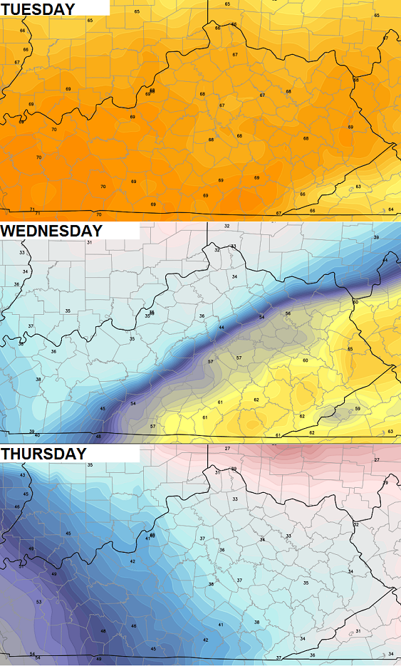 That shot of cold should be progressive with a quick warm up to follow into the start of next weekend…
That should go away fairly quickly as another cold shot moves in later in the weekend. That could introduce another wintry system or two for the following week.
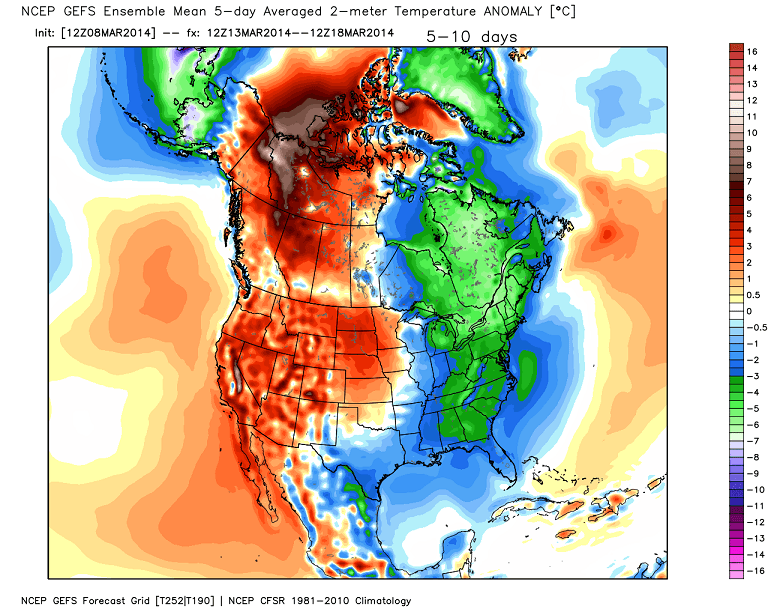
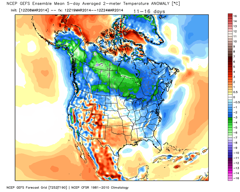
The GFS Ensembles continue to show a colder than normal pattern in the coming weeks, but are not as cold as they were before…
 Have a great Sunday and take care.

This is a very interesting article I found. It talks about how the US models lag way behind the European model and other ones. It explains why no upgrades recently, etc. etc. etc. It’s a bit long, but worth the read. (If your interested) http://tinyurl.com/k5dz3c5
Good read and I like this blog. Thanks!
I’d love to see weather modeling be put out in a form accessible to the PC gaming community. Other scientific areas which have done this have experienced helpful results.
Off-topic but since it still hasn’t been mentioned here, keep an eye out for 3-21 to 3-23. Should be interesting.
…what is that….those dates
Certainly think this will end up being a white situation for many folks in SEKY.
Thanks Chris. Going to enjoy what we have. Everyone have a great Sunday and GO UKHOOPS! Beat Tennessee!!!
Go Cats!
The men Cats though had better win on Friday, or they will be home watching them, plus the Colonels and Cards in the NCAA.
BTW, if the Cats were to play EKU like they did in 2007, I would place my bet on EKU, since they play as a team. That probably will not be a match-up, since the Cats will be too low a seed to be matched with EKU. Cats would need to be a 4 or higher to play EKU.
Probably will (not will) since depends on how many at-large bids get taken from pool. EKU as example just took one.
That was 2005 they played a Tubby team.
You stay on top of it Chris.
Sounds like it’s march.
I wonder when these 8 foot tall snow piles are going to melt? Even the piles from early February are still hanging around! Its been about a month and a half.
Sounds like a slighty below average temperature forcast to near normal. Sounds a lot better than last year. I’ll take it. Thanks CB for all you do.