Good evening, folks. Right on cue… it’s back to winter here in the bluegrass state. Snow showers, gusty winds and very cold temps are taking center stage right now. While we do have a bit of a roller coaster ride ahead… I’m tracking another possible winter weather maker for late in the coming weekend.
Let’s start with the weather out there this evening. Snow showers and squalls are working across the area and these can put down light accumulations. That’s especially the case as temps drop into the upper 20s this evening.
Make regional radar for BFF…

Skies will slowly clear tonight allowing temps to hit the teens by morning. Gusty winds will make it feel much colder than that.
30s will be with us Tomorrow with a nice rebound close to 60 for Friday. That’s when we start to go the other way. A cold front sweeps in late Saturday with a shower chance and temps in the 50s. This front pushes through on Sunday as low pressure develops across the deep south and works toward the Carolinas…
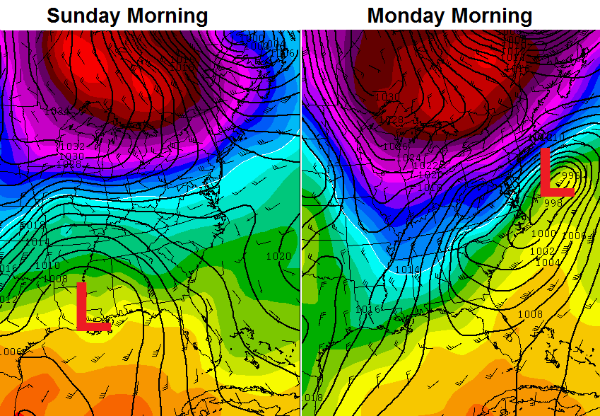 Rain and snow will be possible Sunday into Monday. This is one for us to keep a close eye on.
Enjoy the evening and take care.

Thanks Chris. I really hope you get your four day weekend. I am pulling for you! Thanks for all you do. Stay safe and warm everyone.
Euro showing anywhere between 3-5 inches for Eastern ky Monday..We have received some big snow’s in March before so you never know..
This hopefully will not happen. I love some snow but ready for some warm weather and fishing.
Snow is really coming down in Clay County. Ground is already white and it is pouring. May get more than expected.
Mehh
Can we please have some sort of spring outlook? All this winter talk makes me want to choke myself