Good evening, gang. We’re putting the wraps on a cold day in the bluegrass state. Temps couldn’t get out of the 30s for much of the region, but a milder day is on the way for Friday. That mild up won’t last long as a developing storm system takes aim at the state to end the weekend.
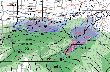
This storm will likely bring rain and snow to the region from Sunday afternoon into Monday morning. The NAM only goes out to Sunday evening, but it shows the system well…
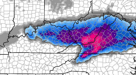
 Here’s the snowfall map from the NAM through Sunday night…
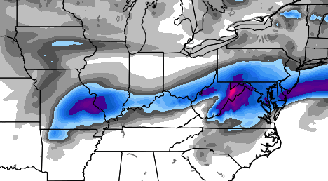
 That rain and snow line matches up pretty well with what the European Model is showing with this system. Here’s where the latest run shows the best chance for snow…
 Keep on enjoying this fine Kentucky spring! 😉
Take care.

omg will it ever end?
I get nervous when I see the freeze line draped across central KY. Is the atmosphere expected to cool quickly enough for this to be a rain/snow event or is this low going to pull in enough warm air aloft to turn it into a potential ice event?
Most other mets are calling for just cold rain Sunday, so their must be different models showing warmer solutions than Chris is seeing!
Will not Surprize me if another accumulating snow happens! Spring is asleep at the wheel!