Good Tuesday, everyone. Rounds of heavy rain producing showers and thunderstorms zipped across the bluegrass state Monday into last night. These storms didn’t produce widespread damage, but some wind damage was reported in a few areas.
After a break in the action today, the severe weather threat returns later this afternoon into the evening. That’s when another round of thunderstorms develops and works across the region. Damaging winds, large hail and isolated tornadoes will be possible.
We will also have to keep a close eye on the potential for additional heavy rainfall. Much of the state has picked up 1″-3″, so it won’t take a lot to cause some high water problems.
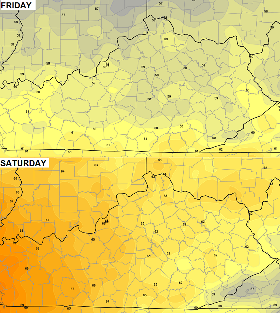
The severe weather and heavy rain threat will diminish Wednesday as much cooler air swings in for the rest of the week. That means some cooler than normal weather for Oaks and Derby days…
 The chance for a light shower or two will also be noted.
Let’s get back to today’s severe weather potential. Your tracking tools…
Today’s Risk Area

Current Watches

Possible Watch Areas 

Rainfall Since Midnight

Current temperatures

Winds

WKYT Studio Lexington

I-75 @ Winchester Road Lexington

I-75 @ Iron Works Pike Lexington

I-75 @ Clays Ferry Bridge South Between Lexington and Richmond

US 60 @ US 127 Frankfort

US 127 @ Frankfort Frankfort
View of Downtown Cynthiana
I-75 at MP 36 London

I-71/I-75 at Buttermilk Pike Near Covington

I-71/I-75 at Mt. Zion Rd. Near Covington

I-64 @ 3rd St. Exit Louisville

Downtown Louisville @ 2nd & Broadway Louisville

I-65 @ 234 Near Bowling Green

I-24 MP 7 @ US 62 Paducah

I will have updates as needed. I will be also be using twitter to send out quick thoughts, warnings and storm reports. Make sure to follow @kentuckyweather .

It seems that yesterday we didn’t get a lot of sunlight to destabilize the atmosphere, thus not much damage.
Looking at the cameras and the radar, this sun is already out for most of the state. Does that mean more destabilization for today’s rounds of storms?
Yup as i said yesterday at least for SE KY no severe weather today would be worse with clearing skies approaching.
Unlike yesterday we will have alot more sunshine region wide so the possibilty is there for severe weather later today. However its not going to be a widespread severe weather event. Isolated to scattered warnings look resonable maybe a severe thunderstorm watch issued for parts of KY. Main threat large hail and wind, the best chances for a major severe outbreak will be in the southern states. Thats where the best wind shear high dewpoints and instabilty will be. Not so much here in KY isolated to scattered here at best.
Let’s all pray it does not come here!!
Joyce, what the southern states have been experiencing the last two days were not going to see that at all.
Thank you ! 🙂
Being that said cant rule damaging wind or large hail with the strongest of the storms but nothing widespread.
There will certainly be more instability today. Hi res NAM shows some interesting “lone cells” ahead of the main action in eastern Kentucky later this evening.
I think flooding will be the story for extreme SE Ky tonight as training is very likely to occur with the SW to NE movement of these storms.
Yeah but the main show of widespread severe weather looks to be well south of KY. It can be sunny all day but if we dont have all the key ingredients for widespread severe weather (and we dont) its just not going to happen. Isolated scattered yes widespread nope.
And for tornadoes at least, it can be tough for twisters to form in the higher elevations of KY (and TN, VA, WV, NC, etc), even if conditions at high altitude are ideal [click here for past discussion of this subject on a previous KWC thread].
The outbreak of March 2 2012 – which of course included the West Liberty and Salyersville tornadoes – had several areas of strong rotation/well defined hook echos over southeast KY, yet even they apparently failed to touchdown or if so only briefly.
This said, storms infrequently beat the odds and produce tornadoes. When they do, mountains are no real barrier. An F3 tornado hit downtown Middlesboro KY in 1988, then traversed the ridge east of town. In 1933, an F4 barely missed Jellico TN but then wiped out Pruden TN (both towns next to the KY state line) before crossing into KY and lifting just shy of Middlesboro. This twister crossed multiple ridges along its path.
Frankfort is always the last area to clear out in ky, mostly clouds here with a stubborn cloud layer hanging in! Should clear up hopefully soon for a nice afternoon! 3 day rain totals here about 1.7 inches, nothing major yet!
Thanks Chris. I feel for those who got the severe weather in our states yesterday, and even more for the folks to our south who really have been hammered. I am glad that the weather seemed to calm down a bit over night and this morning has been beautiful. I am hoping that doesn’t ramp up the severe threat even more. While I feel like we may be very lucky again, there is always that chance that it pops up right over the top of you. We have had close to 2 inches of rain here at my house. I know other places have had more and less. Just hope we can keep from having a lot of flooding issues.
Everyone have a great Tuesday, and stay safe! Thanks Chris for all you do, and for keeping us up dated on the developing weather situations.
I am so thankful it hasn’t gotten bad in Ky.I feel extreme sadness for all the people to the south of us that is dealing with so much death and destruction.Such a helpless feeling I am sure.
It is sitting on 80 degrees here at the moment even though there isn’t a lot of sun now.Heard a little rumble of thunder and a few sprinkles of rain in the last half hour but that seems to have gone on past.
I hate situations like this and especially during night time hours.It is so much more concerning when you can’t see what is happening.
Really hoping this heating doesn’t cause us big problems later tonight.
Thanks to everyone that details the weather conditions on here.I learn a lot just from reading posts.Thanks to Chris for the daily layout as to what to expect.
Wind is blowing strong from the northwest in frankfort and temps have dropped to 60 from a high of 77, didn’t read about this in the forecast today???
We have dropped from 80 that I posted earlier to 66 right now.Can hear a tiny bit of thunder way in the distance but no rain.Hoping this cooling down will help us out as far as storms tonight.
Guessing what I am hearing way in the distance is the storm that is near Somerset about now.
Another wimpy storm day in our area. Wonder how long our luck will hold out, considering other areas have gotten smacked down real bad.
In this case, wimpy is good.