Good Saturday, everyone. Here’s hoping this update finds you having a wonderful start to the weekend. The weather is absolutely gorgeous out there today and that continues into Sunday. Soak it up before another big storm system impacts our weather early next week. That looks to be a catalyst for a major pattern change leading us into much more of a winter look.
That storm slowly works across the plains states and lifts to the north from Monday through Wednesday.
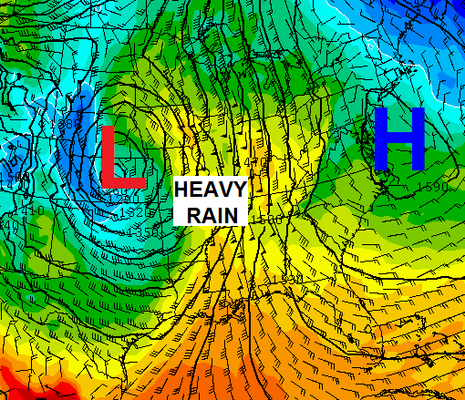
The flow will initially bring scattered showers and storms in here later Monday and Tuesday. The bulk of the action comes late Tuesday into Wednesday. That’s when a wall of slow moving rain and storms works eastward through the state. Heavy rains appear likely with local high water concerns possible in the west.
That system pulls away as chillier air sweeps in here Thursday and Friday. A colder shot of air arrives over the weekend. The question is… will it have some kind of storm system with it. I suspect that depends a lot on how the midweek storm plays out exactly.
The GFS Ensembles are hinting at a deeper system late next week into early Thanksgiving week…
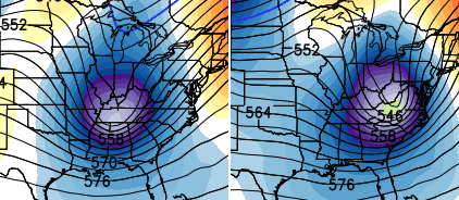
That particular run actually develops a storm that runs from the Gulf up the east coast…
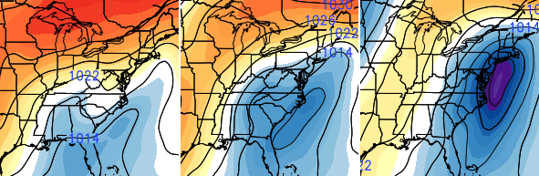
That map shows the pressure anomalies. The blue shows lower pressure with the orange and reds showing the higher pressures.
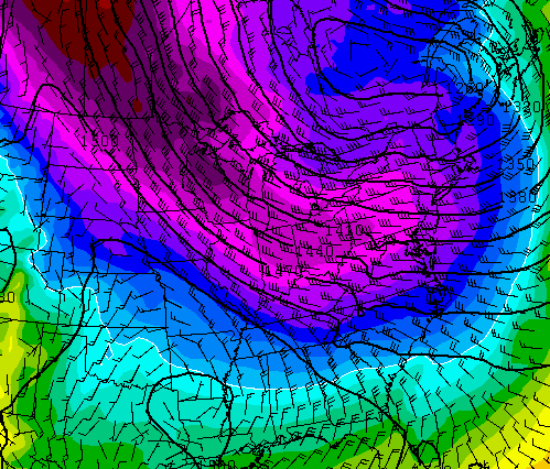
Once into Thanksgiving week, we really start to see some blocking taking over. This goes for the eastern Pacific and into the North Atlantic. Once that happens, we will really have to watch these kinds of systems much more closely.
A much colder than normal pattern, at least, appears to be in the making…
I will shoot you another update later today. Enjoy the day and take care.

Lord, please give me summer back. If you can’t do that, at least let winter be a very mild one.
Thanks Chris. We are gonna have to take whatever Mother Nature throws at us anyway, so at least we have the best meteorologist in the country to get us ready for it and keep us informed! Going to enjoy today and the gorgeous weather we have! Have a great Saturday and make the day count! GO CATS!!!
Thanks! !
As much as I like snow, this pattern of not too cold and lots of sun during the day to warm the house is a great money saver. Looks like I’ll have to break out the heat soon. Oh well.
Great day in Richmond, I do say! 🙂
My begonias finally succumbed to the cold as we were below freezing for several hours at my house…low of 27 in Valley Station.
My rosemary is still hanging in there as it is the only thing in my garden that I have not dug up.
Hey Chris! Rodger getting ready to settle in for another winter season of fun and frolicking! He’s hoping for snow on Thanksgiving and at least 20″ this season. Dat be nice!
I’m expecting my power bill to be ridiculously low, as I have yet to turn the heat on so far nor have I had to run AC for the past month except very briefly..
Hi MarkLex! We have used our central heat a few times this season (including last evening when Nashville dropped to 31 degrees).
Kind of a reversal of things compared to when we chatted about the start of the cooling season last May. 😉 😛
https://kyweathercenter.com/?p=14430#comment-163236