Good Wednesday to one and all. The weather is going in reverse today as scattered showers and storms spin in from the east. Get used to me saying the word “scattered” because that’s the theme of the forecast through the upcoming weekend, at least.
Today’s scattered showers and storms will be spiraling across central and eastern Kentucky. Pockets of heavy rain may show up from time to time, but plenty of dry hours will also be showing up.
Scattered storms will also be around on Thursday with a bit of an increase in coverage and intensity Friday and Saturday as a cold front inches closer to us from the northwest.
These storms won’t be constant, but will be on guard for some locally heavy rains from time to time. The various forecast models are spitting the heaviest totals across central and eastern parts of Kentucky through Sunday…
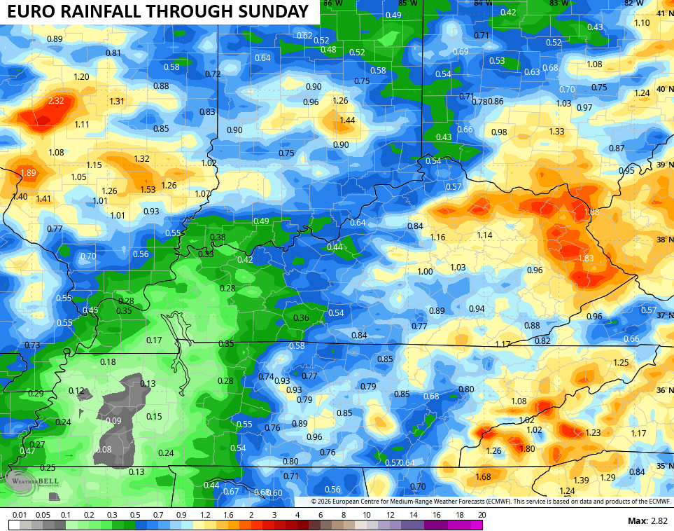
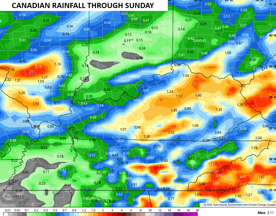
The local high water threat is there, but it’s relatively low in the overall scheme of things. Here’s what The Weather Prediction Center is focusing on Thursday through Saturday…
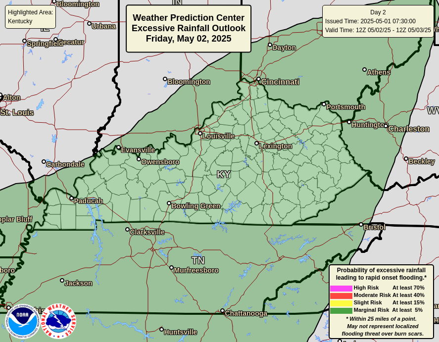
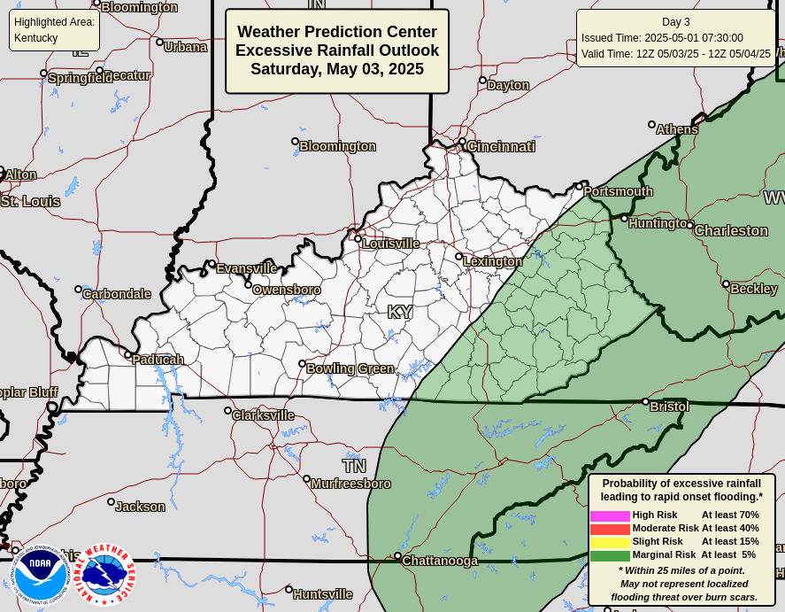

The pattern next week features some bigger dips in the jet stream across the eastern half of the country. The AI models have been indicating a stormier than normal setup accompanying that pattern and now we are seeing some of the operational model runs showing something similar.
This animation from the GFS starts Monday night and runs through August 19th…
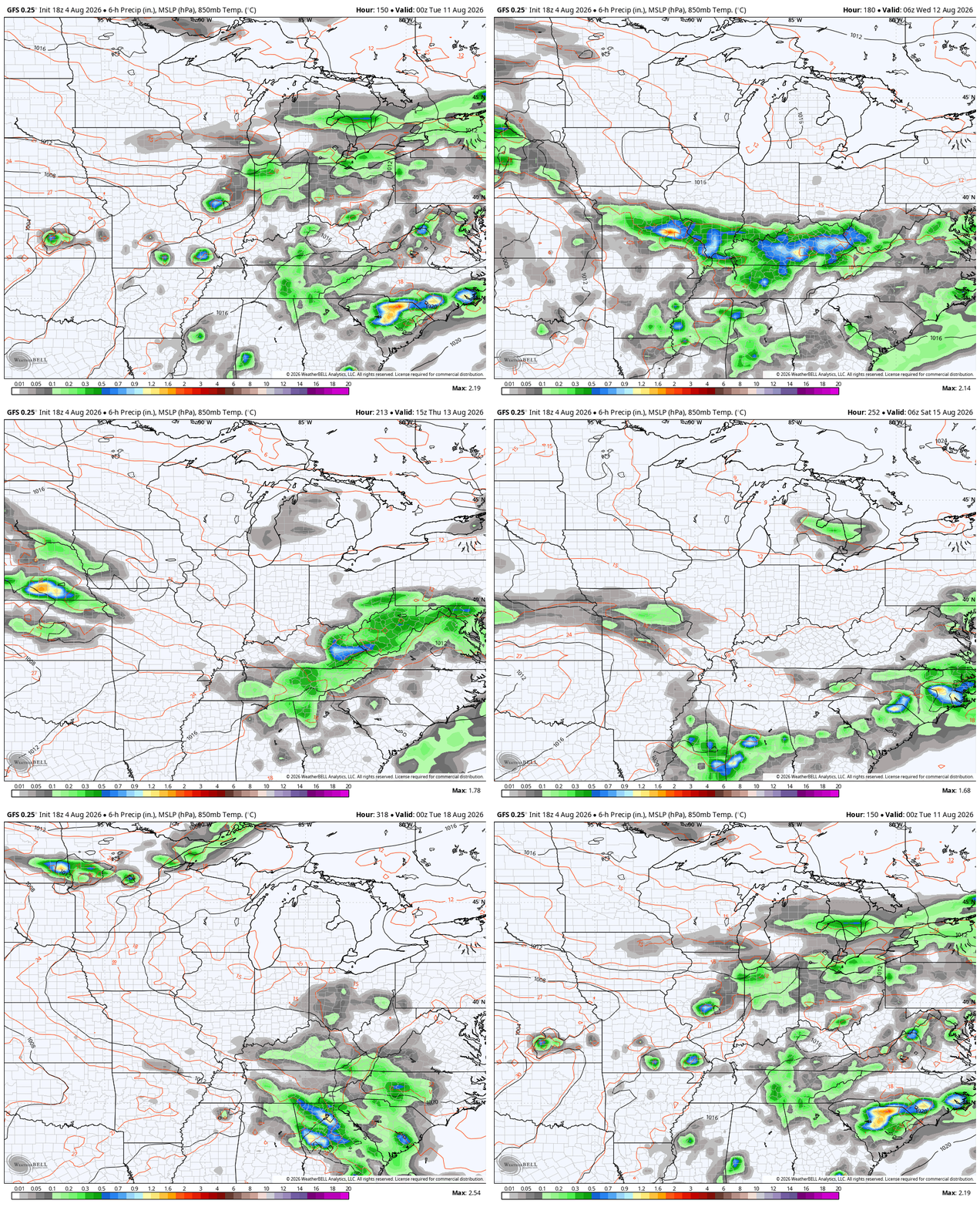
As always, I leave you with your daily storm tracking toys…







Thanks Chris. Hoping one or two of those scattered showers happens over the northern sections of Taylor County. It’s not completely dry yet, but we are gaining.
Really fascinating watching the strongest super El Niño in history taking shape..Going to break records..Never seen nothing like this before this early..
An 81% chance that during October to December 2026 a very strong El Nino event will occur. This would be in the same league as the major El Nino events of 1982 – 83, 1997 -98, and 2015 – 16. In the 2015-16 El Nino event we had 15 inches of Snow on the ground here in Maple for a week or so. Yes, my brother and I were Snowbound until our Neighbor plowed our drive out. If we still have the Greenland high pressure block plus a strong negative Arctic Oscillation and North Atlantic Oscillation, and the El Nino jet stream along the Southern states, This El Nino could be Snowy.
The PDO ( Pacific Decadal Oscillation ) is beginning to respond to the coming El Nino event by making a slow move towards neutral. If it gets into the positive, we will feel the full effects of El Nino. Hoping for Snow, and not severe weather like Tornadoes in December.