Good Thursday, everyone. Scattered showers and storms caused pockets of problems on Wednesday and may very well do the same over the next few days. The pattern as we head into the middle of August continues to look fairly active with ample storm chances.
Scattered showers and storms blow back up today, especially during the afternoon and evening. These storms may produce local wind damage and put down enough rains to cause flash flooding.
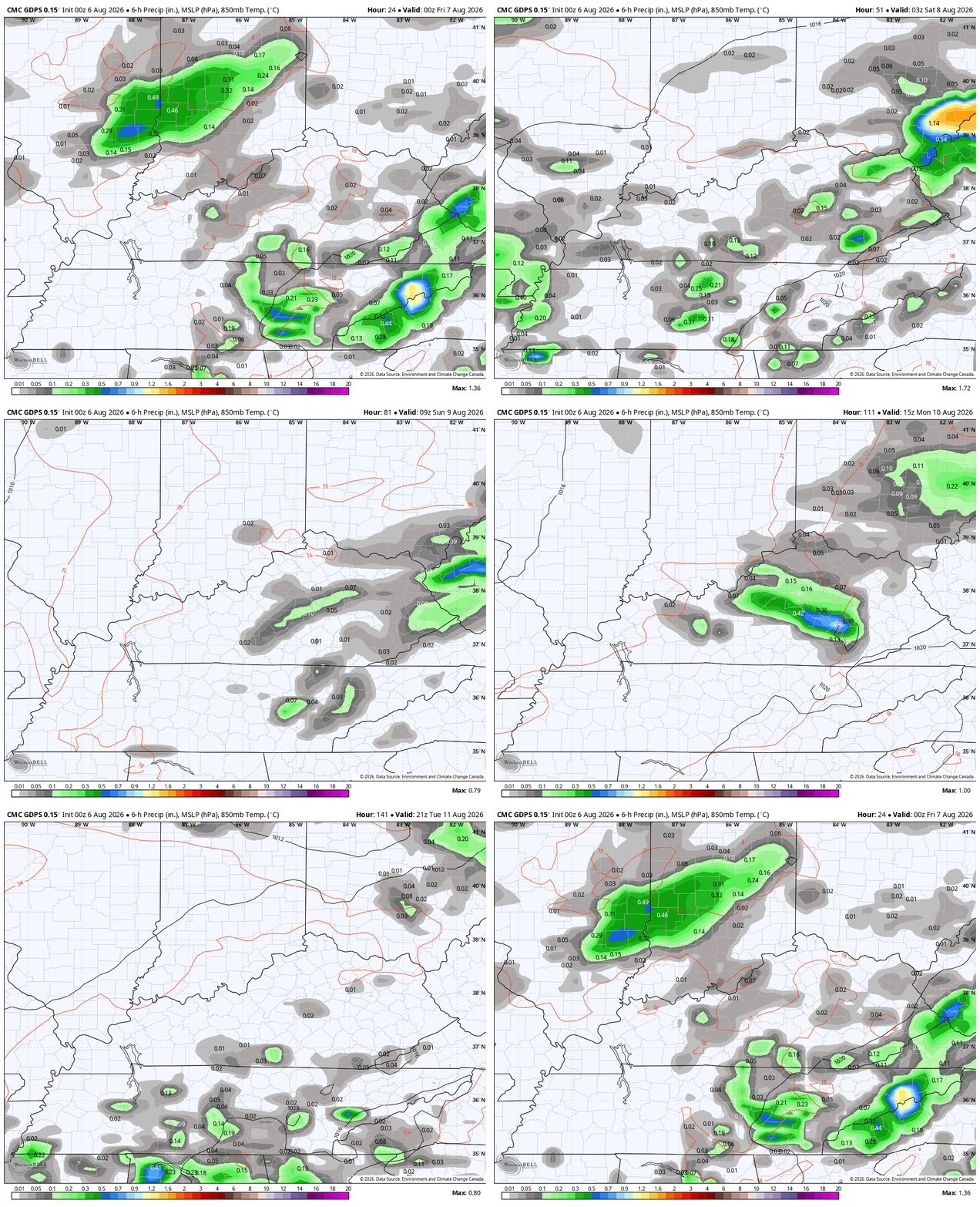
The storms will be a little more prominent as we roll into Friday and Saturday as a cold front makes a run at us before tapping out just to our northwest. This animation shows the storms going up from later Today through Saturday…
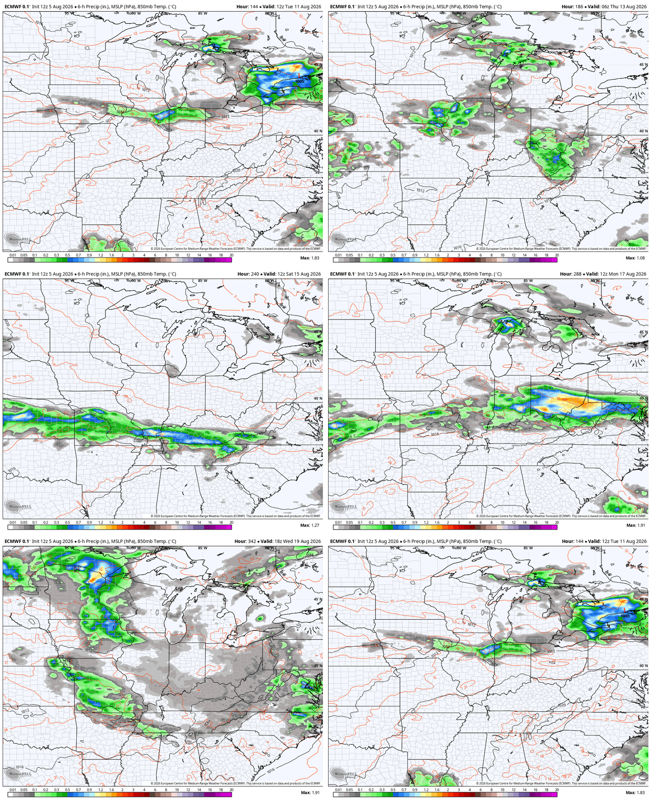
From there, we see deep troughs diving into the eastern half of the country next week into the following week. This means a very active pattern may unfold, bringing the potential for some big thunderstorms and heavy rains.
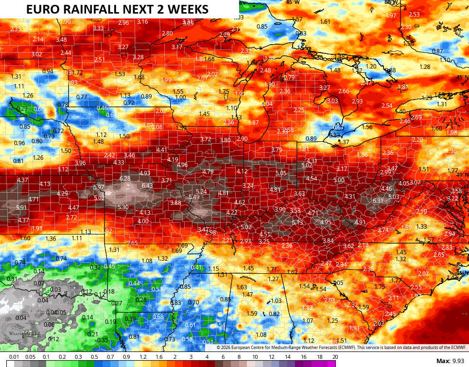
I started posting some of the AI models several days back because they seemed to be grasping the directing I thought the pattern was heading. Now the operational models are jumping aboard. Here’s the Euro from Monday through August 20th…
Check out the rain numbers from this particular run…
The new run of the Euro Seasonal Forecast Model is out and it continues to show the strongest El Nino in history and it’s not even close.
This is also the first run of the Euro Seasonal that goes through the winter months, and it has bit of a colder look compared to what we normally expect in a Super El Nino.
If we look a the 500mb anomalies, we see lower heights showing up for October…
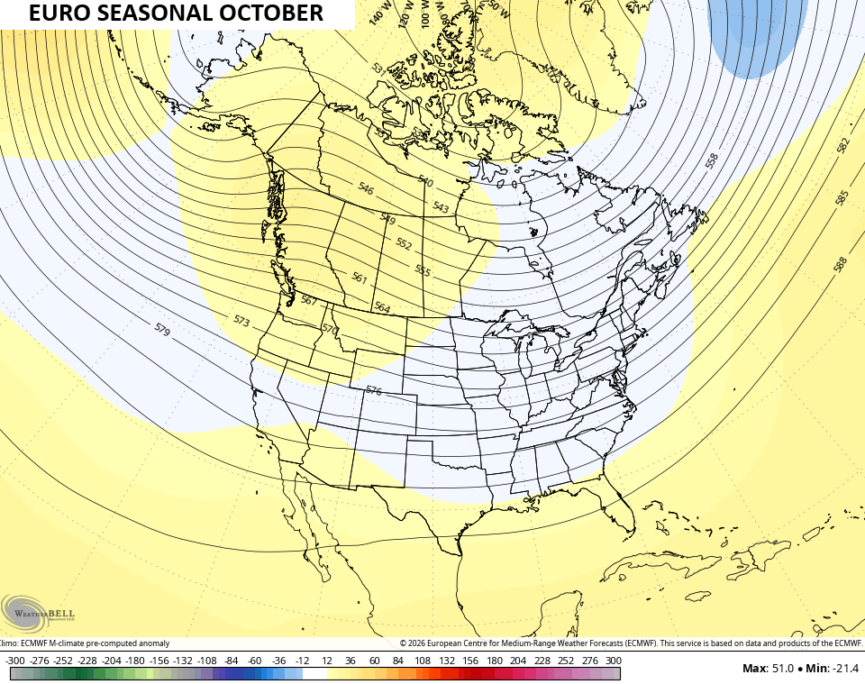
From there, we can see how the troughing starts to show up across the southern and southeastern US for November…
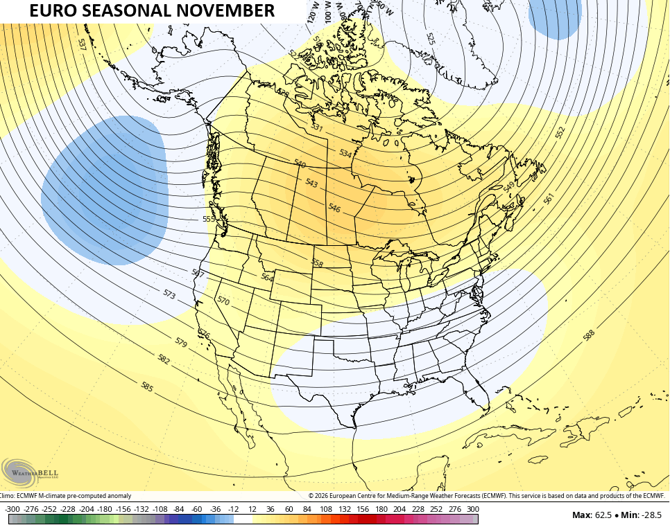
That trough shows up more and more as we go through the winter months…
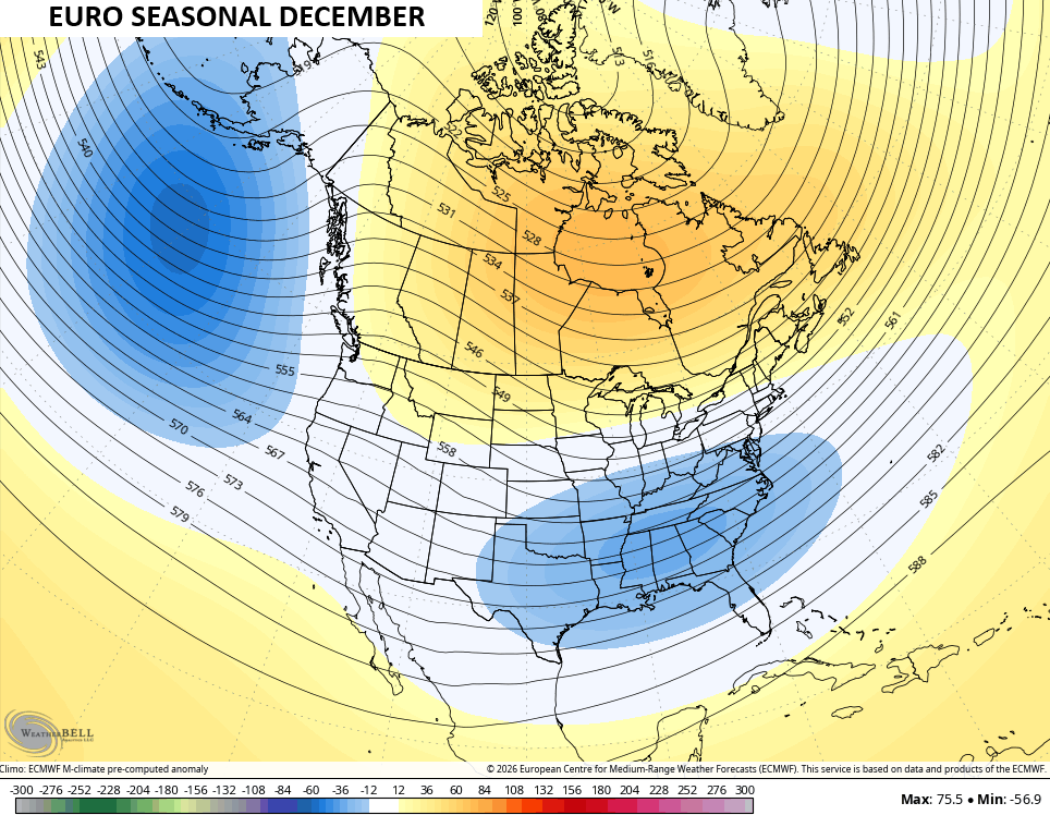
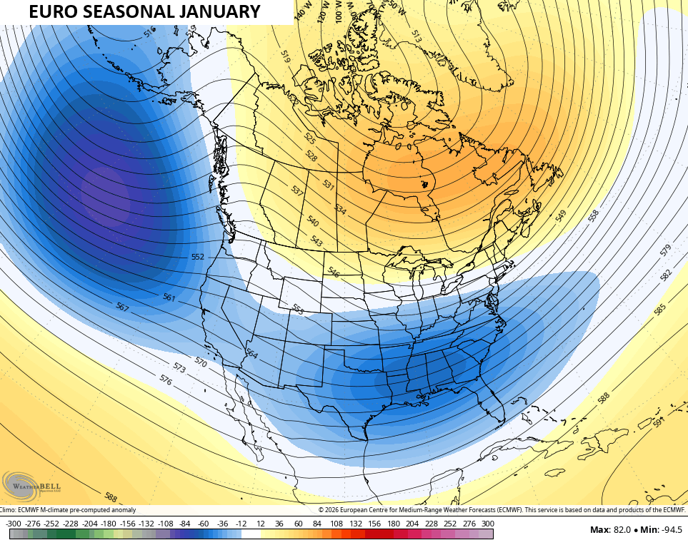
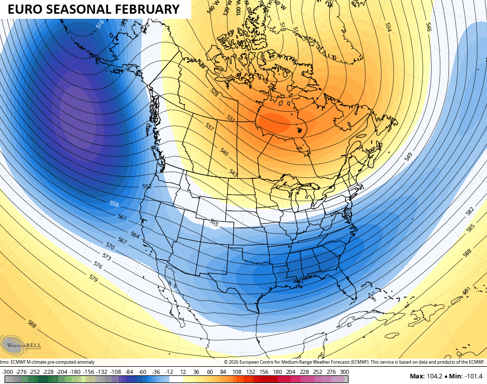
That type of a pattern floods Canada and the northern tier of the country in milder air with cooler than normal across the southern half of the country. This is the 3 month temp anomaly forecast from December through February…
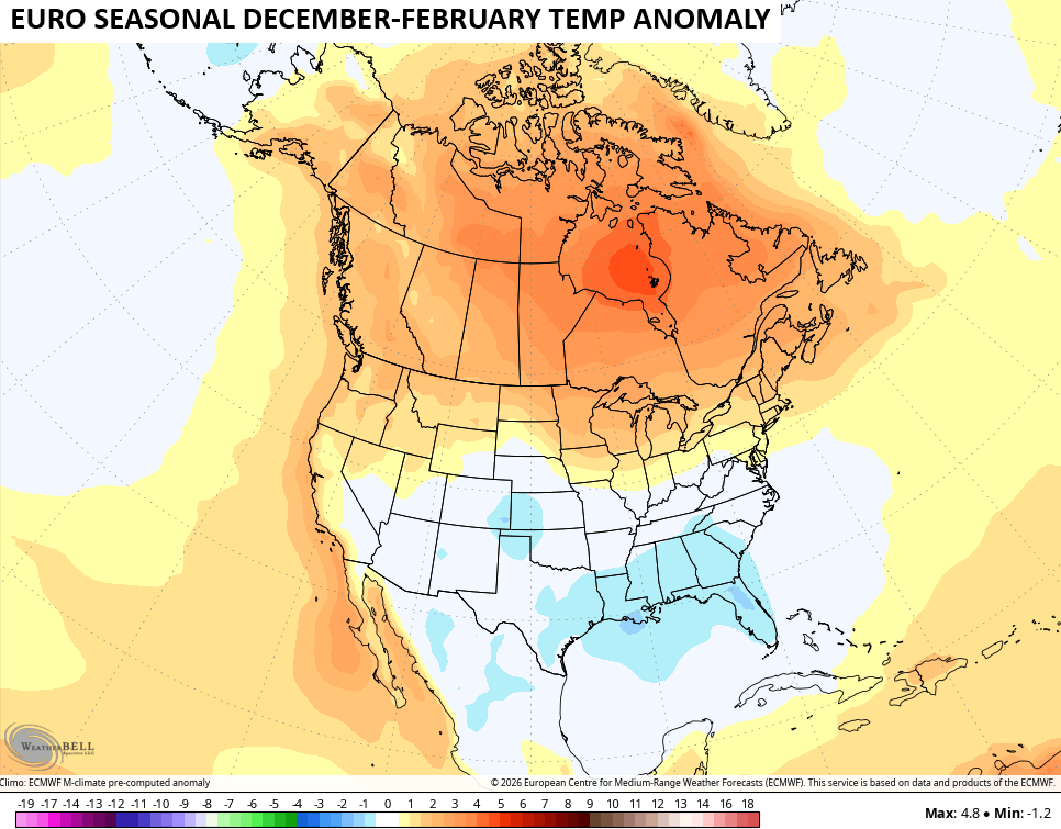
Take all that with a grain of salt, obviously, but those maps match up well with other seasonal models that are out right now.
As always, I leave you with your daily storm tracking toys…







Thanks Chris. As we head into our Autumn Months, we will get a better picture as to how our Autumn and Winter will turn out. El Nino will definitely be a major factor. One analog year stands out 2009 – 10.
Other analog years : ) 2002 – 03, 1986 – 87, 1969 – 70. Note that the global ocean pattern was quite different back in 1969 – 70. I remember up in South Central Indiana where I was a Senior in High School we were out of school many days due to very heavy snowfalls during January and February.
The year 2009 was the year of the worst Ice Storm in Kentucky’s history. Hope this doesn’t happen again.
Going forward, the troughs are going to be the norm instead of the exception, as this El Nino continues to press towards record territory. Part of this is will be caused by the amplifying effect of strengthening high pressure over the northern pacific, due to that area of very warm water south of the Aleutians. This factor is one reason why the strength of this Super El Nino will be unprecedented, since it will cause the polar jet to push further to the north. Another factor is how the warming of the east and central equatorial Pacific is not just occurring at the surface, but is showing up at depths greater than 20 feet below the surface. The presence of this very strong El Nino, combined with significant atmospheric warming across the globe will also make analog years a much less effective tool for predicting seasonal activity than in prioryears.
https://www.ospo.noaa.gov/products/ocean/sst/anomaly/
Very true Joe. I totally agree. Very different than in the years we grew up. 1950’s and 60’s.
I’m not buying the long range model hype because that’s all it is. Summer is not over at all.
Summer ends September 22, but Summer weather may hang on. That’s the way it is now days.
This El Niño is also looking like it will be the most East base also on record..Going to be a hyper STJ if this occurs..If we can get some cold air intrusion’ look out..Uncharted territory..Interesting times..
A strong Greenland blocking plus, El Nino’s jet stream to our South plus, a weakening PDO plus, a strong negative AO and NAO. would have to happen to promote a cold and snowy winter here in Kentucky. What are the chances of this happening ? Too early to tell.
I think chances are good that we’ll see several cold air intrusions this winter, especially if that overperforming northern Pacific high maintains its position and continues to push the polar leg of the split jet stream into the arctic, above Alaska. With a trough in place, the jet will pull polar air in the midwest and mid south, and if the southern leg pulls a decent amount of moisture, it could get very interesting.
Very possible Joe.