Good Friday to one and all. Stop me if you’ve heard this one before… Scattered showers and storms will be with us today and may cause pockets of problems. This pattern is stuck in neutral with very little change through the weekend. A September style cold front will bring some change by the second half of next week, though.
Let me begin by talking about the cooler than normal temps we’ve been seeing to start August. Here’s a look at the country’s temp anomalies over the past week…
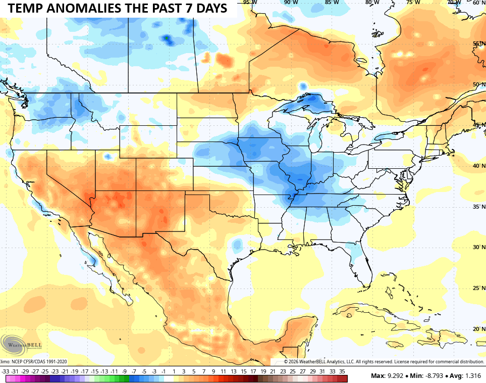
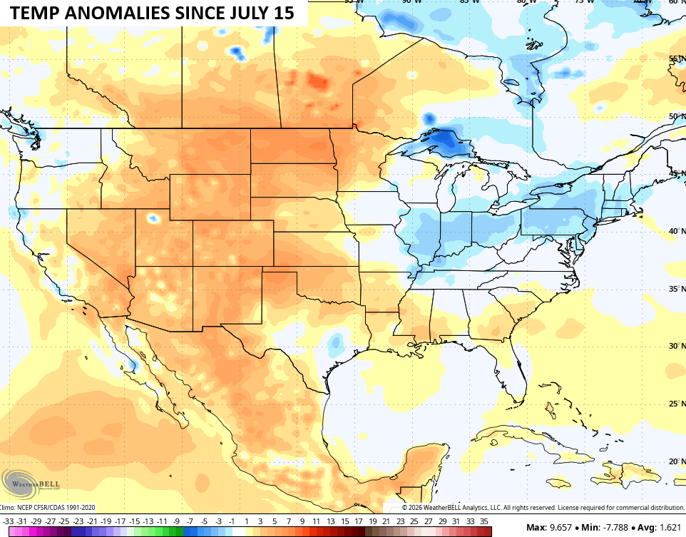
Notice how our region is in the below normal category and we’ve actually been there since the pattern started to change around the middle of July…
Clusters of showers and storms fire up again out there today as a boundary nears from the northwest. This boundary won’t make it through here, but it’s close enough to give the atmosphere an added kick in the pants to get the air to rise, creating some hefty boomers.
This same setup continues through Saturday and may lead to some strong storms that put down enough rain to cause more flash flooding. Check out the NAM from this morning through Sunday morning…
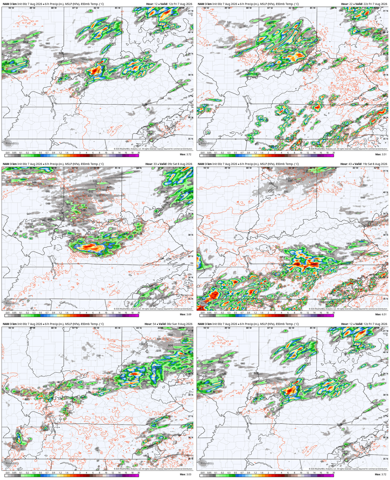
Scattered storms will still be noted on Sunday and Monday as temps surge. Highs Monday may very well surge into the 90s for most areas as we get set for the first in a series of strong cold fronts to drop in from the northwest.
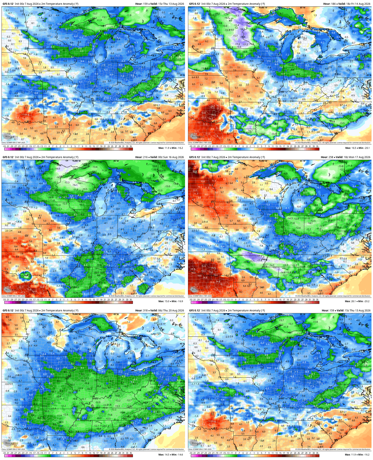
This front arrives with the chance for strong storms late Tuesday through Thursday with another boundary arriving a few days later…
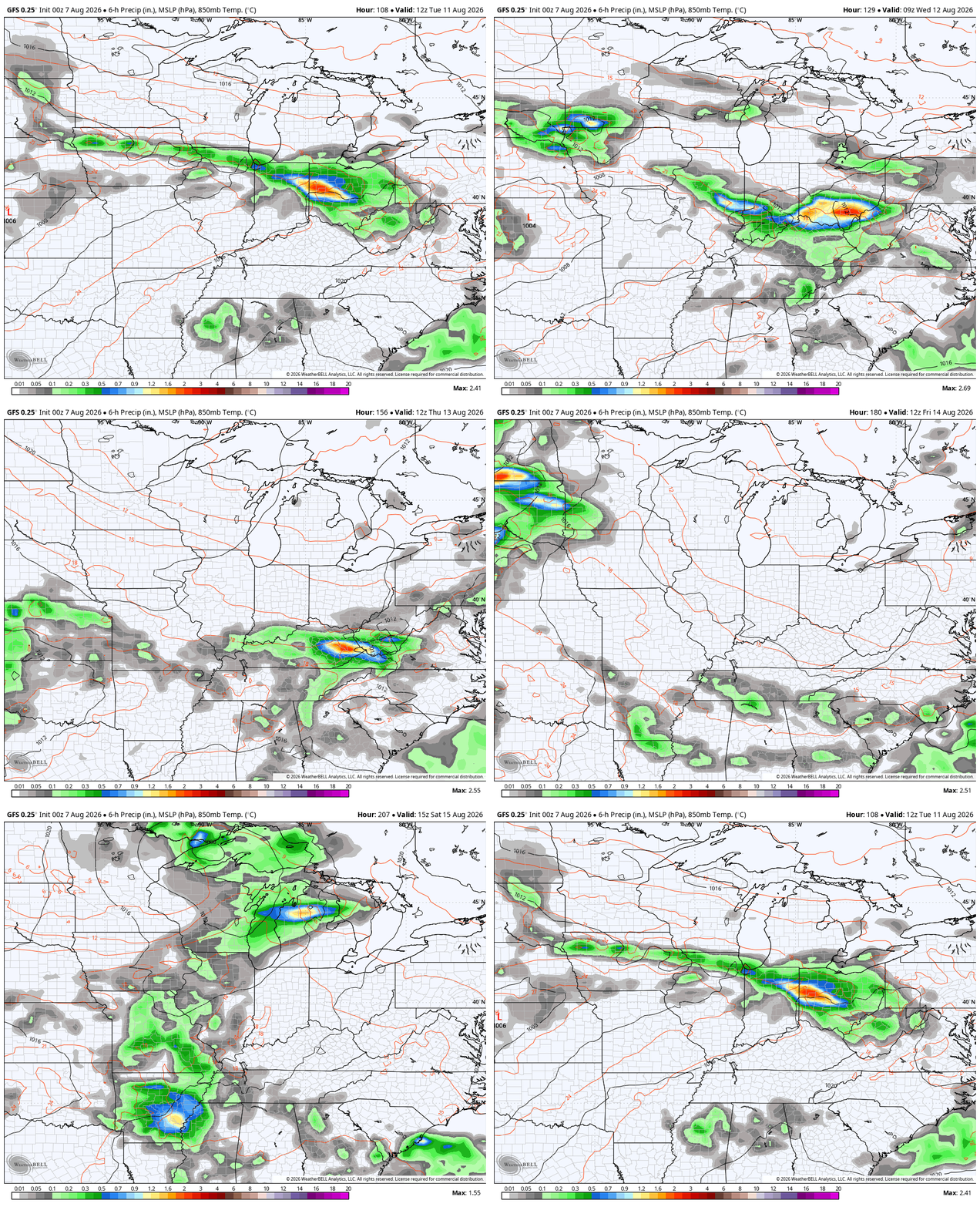
These dips in the jet stream may really bring some comfy, below normal temps in here…
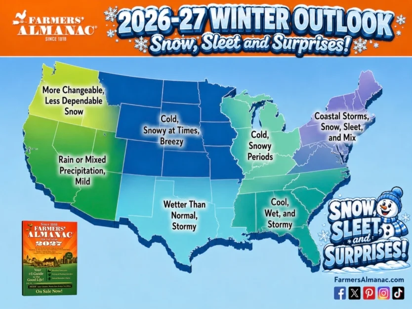
As we continue to look ahead toward winter, the Farmers’ Almanac is out with their Winter Forecast and it’s calling for a cold and snowy winter yet again…
The strongest El Nino ever recorded might have something to say about that.
As always, I leave you with your daily storm tracking toys…







Thanks Chris. Here’s a link to NOAA’s three month forecast : )
https://www.cpc.ncep.noaa.gov/products/predictions/long_range/seasonal.php?lead=1
Actually the Farmer’s Almanac is for entertainment purposes, as is the Old Farmer’s Almanac not scientific based, however their traditional average rate is 80% accuracy.
Scattered showers continue to miss Taylor county, and it’s beginning to get quite dry. Had to water my plants yesterday morning. Besides that, we have had nice Summer weather so far.
Latest on the Super El Nino event. Here’s the link : )
https://stormbag.co/blogs/stormbag-flood-protection-blog/super-el-nino-2026-27-what-noaas-off-the-charts-forecast-means-for-the-year-ahead
The Farmers Almanac is folklore rubbish, just like long range models. If anyone thinks Summer heat is over, you’re delusional.
You may be right Jeff. Warmer days are ahead, and may spoil our Autumn season. I sure hope not.
I don’t think anyone said summer heat is over Jeff, But if these troughs keep coming that’s in forecast i would said the stretch of hot humid days will be limited
Looks like now that the coming El Nino may bring us a cold, snowy Winter. We shall see.
Forecast models have become increasingly inaccurate over the past several years, especially over longer time frames, and one reason may involve changes that have taken place in Earth’s atmosphere between the time when the program was first written in the early 1980 ‘s, and today. During that time, we’ve seen the atmosphere and the upper levels of the oceans warm significantly, particularly over the past five years, and that warming is accompanied by higher humidity and dewpoint levels, from evaporation. Because heat drives weather systems, the model programs are having difficulty handling the increases that we are seeing today; it’s not crashing the programs, but the data that they are currently processing is delivering forecasts with a much lower degree of accuracy. It’s also why it will be much more difficult to predict future weather patterns using analog years.
Thanks Joe, I’m inclined to agree. Low confidence in every forecast these days. Analog years anymore are a useless tool to making long ranged weather forecast. Weather around the globe has really changed.