Good Thursday, everyone. A super soaker of a summer continues across Kentucky with additional waves of showers and storms rolling through the region. Just like the past few days, some of the storms may be severe and produce areas of flash flooding.
Historic rains feel across parts of central Kentucky on Wednesday. Lexington was the bullseye for another wet weather record…
Record setting rain today in Lexington with 2.59″ (so far). This breaks the August 12th rainfall record of 1.63″ set back in 1993.
Today will also go down as the 9th wettest August day in Lexington history.
Since 5pm Tuesday, we’ve officially picked up 3.99″ of rain. #kywx pic.twitter.com/r3kNAmZR7K
— Chris Bailey (@Kentuckyweather) August 13, 2026
This is also now a Top 10 wettest summer for Lexington and we still have more than 2 weeks left before the start of Meteorological Fall on September 1.
More rain is a given out there today and Friday as a few more rounds of showers and storms target the region from northwest to southeast and that continues into Friday.
The forecast models have been absolutely terrible and continue to be for the most part. Regardless of models, you guys know I do my own forecasting as I’m forecasting the actual weather instead of regurgitating specific models.
That said, a few of the models have the general idea of what I think happens in the coming days. “General” being the key word here.
The GFS hangs on to the boundary into the upcoming weekend with some additional storms dropping from the northwest to the southeast across central and eastern Kentucky. I like the overall idea of this and that’s why I’m showing the GFS rainfall forecast through Sunday…
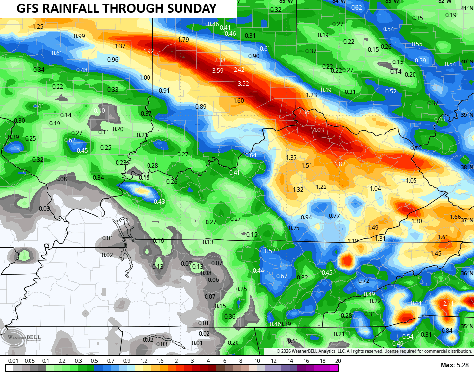
Again, that’s not to endorse the specific rain totals, but to illustrate where to expect the best coverage of showers and storms.
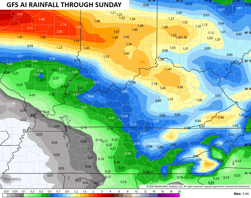
The GFS AI has a similar orientation of the storm tracks…
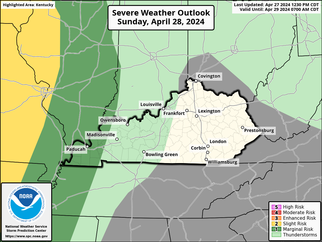
The overall severe storms threat isn’t quite as high as what we’ve seen recently, but some areas of wind damage will again be possible. Here’s today’s Severe Weather Outlook from the Storm Prediction Center…

The damaging wind risk…

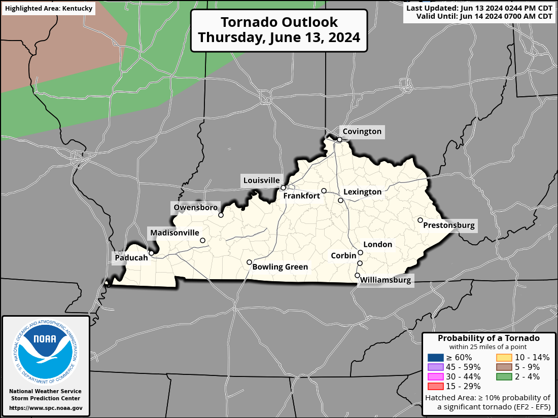
The very low, if any, tornado risk…
The low-end severe storms risk continues across parts of the region again on Friday…
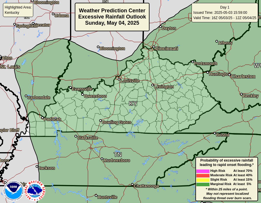
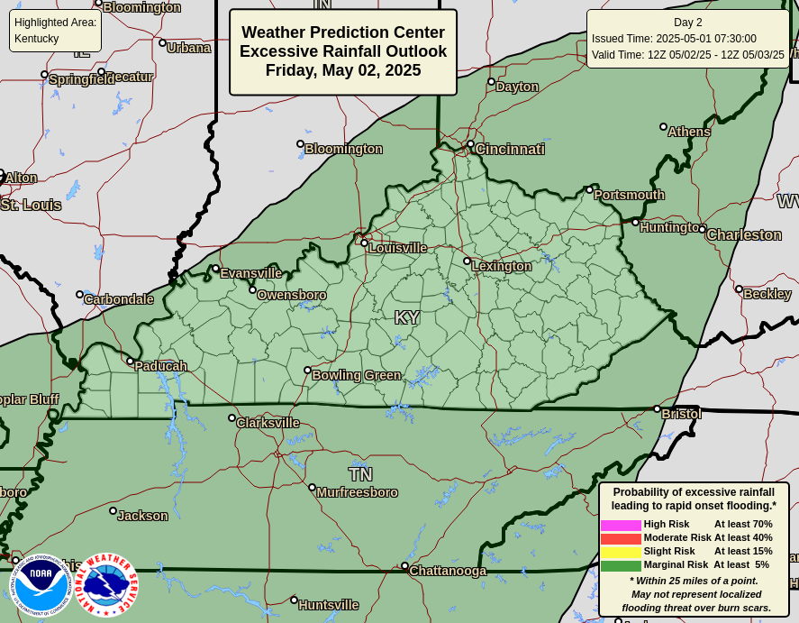
The flash flood risk continues to show up during over the next few days…
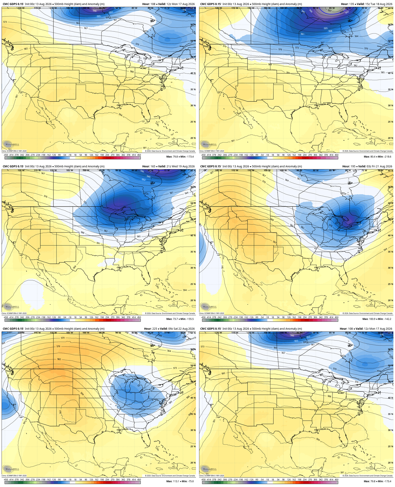
Temps this weekend will be steamy outside of any storm action with that tropical feel lasting into early next week. That’s when another front makes a run at us, opening the door for a bigger dip in the jet stream with a potential cutoff low later next week…
As always, I leave you with your daily storm tracking toys…







Thanks Chris. Enjoy your Blog. Keep up the great work !
I’m manifesting a dry spell of 1-2 weeks and a few more days in the 90s, then Fall can come.
Most years it is this way. I found some weather records I made back from the 1960’s, and there hasn’t been any change in the overall climate to this date.
Jeff, I was in your neck of woods yesterday on the job there was so much different contrast weather from your hometown to mine hometown. We have not had any rain in 2 or 3 weeks plus we have been baking temps in the 90’s. This weekend it supposed to be closer the century mark temp wise If you want heat come to western ky we got it. Lol
This Summer we barely achieved 90 degrees, but starting Sunday ” the heat is on. ” Were good on moisture, and the crops look great.